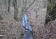
Bieselheide
The Bieselheide is a forest area that extends in the north of Berlin between the Brandenburg towns of Bergfelde and Glienicke / Nordbahn . The eastern border is formed by the Biesel river , the western border roughly corresponds to the course of the Berlin Northern Railway .
Surname
The name Biesel (= small piping) is probably similar to the city as Biesenthal from the Altmark river piping has been transferred, in turn, from the Germanic word bisa for, bison can be 'derived.
geography
The Bieselheide consists mainly of sand , which near the Bieselfließ by fen is detached. The highest point with 62.8 meters above sea level is in the Lorelei Mountains, the lowest near the mouth of the Biesel river below 40 meters above sea level. The Bieselheide originally covered around 600 hectares , half of which still exist today as forest. On current maps, however, only about 100 hectares of the Brandenburg part are referred to as Bieselheide. The Biesel river, originally fed by seepage water from the Hohen Neuendorfer Rotpfuhle area and flowing through the Herthasee mountain fields , flows into the Tegeler river at Glienicke as the Kindel river . The Rotpfuhle and Herthasee have now dried up and the Biesel river only absorbs surface water.
history
The Bieselfließ originally represented the border between the estate districts of Stolpe and Schönfließ . The only significant path through the forest was the connecting path between the two villages. In the 18th and 19th centuries, a little rich clay deposit was mined, for which a brickworks was built near the forester's house Bieselhaus.
In 1907 the western part of the Bieselheide was sold to the "Berlin Terrain Centrale" of the Upper Silesian Prince von Donnersmarck . A villa suburb of the garden city of Frohnau was to be created, which could have been reached from the Stolpe station of the northern railway . However, since the project of the northern garden city was not carried out due to the following events of the First World War and the inflationary period , the forest recaptured the streets that were already paved and partly laid out with sidewalks. The area within the Berlin city limits is today the reference area of the Berlin Forest Administration for the Berlin forests. The forest area was used as a local recreation area by Reinickendorf citizens during the time of the Berlin Wall and still has this function in the 2010s and is also used as a dog run area, with the access on the Hubertusweg to the artist colony, on the Utestraße to the Hubertussee and on the Jägerstieg is possible for 20 meters. In addition, the Berlin Wall Trail (partly on both sides of the city / state border), signposted, leads around the northern area of the part of Berlin previously known as West Berlin.
Today's Hubertussee was created from a silted-up pond for the planned settlement. On “Kiessling's special map of the area around Berlin” (around 1908) there is a river that ends from the west at this point in a forest-free area.
Settlement houses from Glienicke and Schönfließ were built into the forest from the south and east . After the formation of Greater Berlin in 1920, the name Bieselheide was increasingly used only for the eastern part of Brandenburg.
Between 1961 and 1990, the Bieselheide was closed to the GDR because of its proximity to West Berlin and the border area, and general access was denied. A piece of the Biesel river was identical to the border line and - like a strip of forest near the border - had to give way to the expansion of the barriers (today on Brandenburg territory). The western (Berlin) part of the Bieselheide became a local recreation area and a nearby access to nature for citizens, especially from Reinickendorf . Since 1959, the “Frohnau forest area” with 114.17 hectares has been secured as a landscape protection area.
After 1990, the residential park "Frohe Aue" was built in Schönfließ on the former barracks of the GDR Ministry for State Security in the south of Bieselheide. The number of residents in the suburb of Schönfließ increased by 1,600 settlers. The Bieselheide is now a local recreation area between Berlin and Brandenburg and can be crossed on forest paths without hindrance through the intersecting state border or along the old border strip on the "Berlin Wall Trail".
Individual evidence
- ^ Digitized version of: Kiessling's large special map of the area around Berlin. - 1: 75,000. - Berlin: Kiessling. - 1 ct .: multicolored - No edition description ( page no longer available , search in web archives ) Info: The link was automatically marked as defective. Please check the link according to the instructions and then remove this notice. , accessed December 26, 2012. The web link indicates around 1900, but based on the location in Frohnau, more likely 1908/1910
- ↑ Factual data on the LSG-16
Coordinates: 52 ° 39 ′ 2 ″ N , 13 ° 18 ′ 39 ″ E


