
Chelan (Washington)
| Chelan | |||
|---|---|---|---|
Location in Washington
|
|||
| Basic data | |||
| Foundation : | May 7, 1902 ( incorporated , i.e. recognized as a local authority ) | ||
| State : | United States | ||
| State : | Washington | ||
| County : | Chelan County | ||
| Coordinates : | 47 ° 51 ′ N , 120 ° 1 ′ W | ||
| Time zone : | Pacific ( UTC − 8 / −7 ) | ||
|
Inhabitants : - Metropolitan Area : |
4,060 (as of 2015) Wenatchee - East Wenatchee |
||
| Population density : | 249.2 inhabitants per km 2 | ||
| Area : | 16.45 km 2 (approx. 6 mi 2 ) of which 16.29 km 2 (approx. 6 mi 2 ) is land |
||
| Height : | 344 m | ||
| Postal code : | 98816 | ||
| Area code : | +1 509 | ||
| FIPS : | 53-11615 | ||
| GNIS ID : | [2] 1530831 | ||
| Website : | City of Chelan | ||
 Location of Chelan in Chelan County |
|||

Chelan ( ʃəlæn ) is a city ( City ) in Chelan County in the State of Washington . The population at the 2010 census consisted of 3890 people; According to the Office of Financial Management's estimate , there were 4060 people in 2015. Chelan is located on the southeastern tip of Lake Chelan at the outlet into the Chelan River .
Chelan is part of the Wenatchee - East Wenatchee Metropolitan Statistical Area .
history
The Chelan area was home to the Salish-speaking indigenous people known as the Chelan before white colonization in the late 19th century. Even before the arrival of the white settlers, a new “beast” - the horse - reached the area and with it very quickly smallpox, measles and other deadly infectious diseases. These diseases wiped out an estimated 90 percent of Native Americans before David Thompson , the area's first discoverer, arrived across the Columbia River in 1811. The horse and the culture associated with it, adopted by explorers and settlers, are so familiar to the Plains Indians that it is difficult to learn about the indigenous people and their lives before these monumental changes made their way of life. However, they quickly became a "race of horses," adopting clothing, beadwork, and more from the Plains Indians; further changes occurred with the white settlers.
The Indians of the area were organized into small family groups that made decisions without a single guide. However, after the arrival of the whites, a struggle for power began: in order to maintain control over the land that was once theirs, they needed someone to speak for them. Although not a Chelan himself, Chief Moses (a Shahaptin instead of Salish-speaking man from the Columbia Basin and Okanagan) had already secured a large area of the country for a reservation. With the small number of Indians and the steadily increasing number of prospectors looking for riches in the mountains, however, he had to recognize the impossibility of defending the claimed territory and lost everything.
During a period of unrest between Indians and settlers in the 1870s, Lt. Colonel of the United States Army , Henry Clay Merriam , Camp Chelan on the shore of Lake Chelan to the Indian population of the Moses Columbia Reservation to secure and control. His family was also present in the area for the 1880 census. The lake was largely inaccessible by the bare cliffs, so a makeshift road was built from the fort to the Columbia River , whereupon a courier and mail service to Walla Walla was set up. The fort operated for about a year and was abandoned in October 1880 when troops were transferred to Fort Spokane .
The first European settlers in the area were William Sanders (one of the main streets in Chelan is named after him) and Henry Dumpke, who settled in 1886. After having overcome many cliffs and rivers and after losing their horse, they reached the lake safely and were welcomed by the natives; they encouraged you to stake out claims. The presence of the settlers paved the way into the valley for more. In 1888, LH Woodin from Minneapolis reached the valley and rowed up the lake in a barge. Impressed by the landscape, Wooin built a sawmill on the banks of the lake. Chelan's main street is named after him. At the same time, ranchers discovered that orchards could be planted in the area without irrigation.
The city was parceled out and the land was quickly sold. A post office opened in 1890. A school was built in 1892, followed by the first vacation hotel to take advantage of the beauty of the landscape. Hard times came in the wake of the economic depression of 1893 , but Chelan as a whole was not seriously affected. The first bank was founded in 1893. On May 7, 1902, Chelan was officially recognized as a local authority . The following year, Chelan was connected to electricity and water via nearby Donaldson Springs . A permanent meeting house was built in 1904 but destroyed in a fire in 1927. The city continues to grow as an agricultural center and resort, which has allowed it to thrive to this day.
geography
Chelan is at 47 ° 50'34 "N / 120 ° 1'17" W. According to the United States Census Bureau , the city occupies a total of 16.45 km² with a land area of 16.29 km² and a water area of 0.16 km².
climate
Chelan's climate is typical of eastern Washington . Located in the rain shadow of the Cascade Range , only amounts of rain that are almost typical of the desert reach the area.
| Chelan, Washington | ||||||||||||||||||||||||||||||||||||||||||||||||
|---|---|---|---|---|---|---|---|---|---|---|---|---|---|---|---|---|---|---|---|---|---|---|---|---|---|---|---|---|---|---|---|---|---|---|---|---|---|---|---|---|---|---|---|---|---|---|---|---|
| Climate diagram | ||||||||||||||||||||||||||||||||||||||||||||||||
| ||||||||||||||||||||||||||||||||||||||||||||||||
|
Monthly average temperatures and rainfall for Chelan, Washington
Source:
|
||||||||||||||||||||||||||||||||||||||||||||||||||||||||||||||||||||||||||||||||||||||||||
Demographics
| year | Residents¹ |
|---|---|
| 1910 | 682 |
| 1920 | 896 |
| 1930 | 1,403 |
| 1940 | 1,738 |
| 1950 | 2.157 |
| 1960 | 2,402 |
| 1970 | 2,837 |
| 1980 | 2,802 |
| 1990 | 2,969 |
| 2000 | 3,522 |
| 2010 | 3,890 |
| 2016 | 4,108 |
¹ 1910-2010:
2016 Census Results: United States Census Bureau estimate

2010 Census
As of the 2010 census , Chelan had 3890 residents, 1602 households and 1031 families. The population density was 238.8 per km ². There were 2516 housing units at a mean density of 154.4 per km². The population consisted of 80.1% white , 0.4% African-American , 1.4% Indian , 0.9% Asian , 0.1% Pacific islander , 14.1% from other "races" and 3.1% from two or more "races" . Hispanics or Latinos of "any race" made up 24.2% of the population.
Of the 1602 households, 29.2% had children under the age of 18, 49.1% were run by married couples living together , 10.6% by single mothers and 4.7% by single fathers; 35.6% were non-families. 28.8% of the households were singles and 13.1% were single persons over 65 years of age. The average household size was 2.39 and the average family size was 2.91.
The median age in the city was 44.1 years. 22.4% of the population were under 18, 7.6% between 18 and 24, 20.9% between 25 and 44, 30.2% between 45 and 64 and 18.9 65 years or older. 49.9% of the population were men and 50.1% women.
Census 2000
As of the 2010 census , Chelan had 3,522 residents, 1,471 households, and 939 families. The population density was 360.7 per km ². There were 2058 housing units at a mean density of 210.8 per km². The population consisted of 85.69% white , 0.11% African American , 1.53% Indian , 0.48% Asian , 0.11% Pacific islander , 9.23% from other "races" and 2.84% from two or more "races" . Hispanics or Latinos of "any race" made up 14.45% of the population.
Of the 1,471 households, 29.6% had children under the age of 18, 49.8% were run by married couples living together , 10.1% by single mothers; 36.1% were non-families. 30.5% of the households were singles and 14.8% were single people over 65 years of age. The average household size was 2.35 and the average family size was 2.93.
The median age in the city was 41 years. 25.3% of the population were under 18, 6.2% between 18 and 24, 24.6% between 25 and 44, 25.7% between 45 and 64 and 18.2 65 years or older. There were 92.8 men for every 100 women, and 88.4 men for every 100 women over the age of 18.
All information on median income relates to the median. The median household income was US $ 28,047 and that of families was US $ 33,662. Men had a median income of US $ 31,900 compared to US $ 21,397 for women. The per capita income was US $ 16,511. About 17.3% of families and 20.9% of the total population lived below the poverty line ; this affected 31.3% of those under 18 and 12.5% of those over 65.
sons and daughters of the town
- Joe Harris (born 1991), basketball player
gallery

Riverwalk Pavilion
RW Little Building

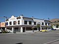
Campbell's
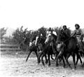
Indian women on horses, 1912


Individual evidence
- ^ Population Estimates . United States Census Bureau . Archived from the original on October 19, 2016. Info: The archive link was automatically inserted and has not yet been checked. Please check the original and archive link according to the instructions and then remove this notice. Retrieved June 30, 2016.
- ↑ US Board on Geographic Names . United States Geological Survey . October 25, 2007. Retrieved January 31, 2008.
- ↑ 2010 Census Redistricting Data (Public Law 94-171) Summary File . In: American FactFinder . United States Census Bureau . Archived from the original on July 21, 2011. Retrieved September 25, 2012.
- ^ Northwest Journal: The Life of David Thompson
- ↑ US Gazetteer files: 2010, 2000, and 1990 . United States Census Bureau . February 12, 2011. Retrieved April 23, 2011.
- ↑ US Gazetteer files 2010 . United States Census Bureau . Archived from the original on January 24, 2012. Retrieved on December 19, 2012.
- ↑ NowData - NOAA Online Weather Data . National Oceanic and Atmospheric Administration . Accessed December 31, 2016.
- ↑ United States Census Bureau : Census of Population and Housing . Archived from the original on May 12, 2015. Retrieved August 29, 2013.
- ^ Population and Housing Unit Estimates . Retrieved June 9, 2017.
- ↑ American FactFinder . United States Census Bureau . Retrieved December 19, 2012.
swell
- Hull, Lindley M. (editor): A History of Central Washington: Including the Famous Wenatchee, Entiat, Chelan and the Columbia Valleys, with an Indexed Eighty Scenic Historical Illustrations . Spokane, Washington: Shaw & Borden Company, 1929. Print.
Web links
- City of Chelan - Official Website (English)
- City of Chelan at HistoryLink (English)
- Link catalog on the subject of Chelan (Washington) at curlie.org (formerly DMOZ ) (English)