
Alpe Adria cycle path
| Alpe Adria bike path Ciclovia Alpe Adria |
|
|---|---|

|
|
| overall length | approx. 410 km |
| location | Salzburg , Carinthia , Friuli-Venezia Giulia |
| Starting point | Salzburg |
| Target point | Grado |
| Places along the way | Salzburg, Villach , Udine , Grado |
| Flooring | mostly paved. In some areas unpaved dirt roads |
| Height difference | Total ascent approx. 3500 meters in altitude |
| difficulty | medium |
| Website URL | Official homepage of the tourism associations |

The Alpe Adria bike path (also Ciclovia Alpe Adria bike path or Italian Ciclovia Alpe Adria ) is an approximately 410 km long cycle track which from the Austrian Salzburg over the Alps into Italy Grado on the Adriatic leads.
general description
With Salzburg as the starting point, the Alps as the stage and Grado on the Adriatic as the destination, the cycle path connects extremely beautiful and popular holiday destinations. Because of this and the fact that high alpine passes are bridged by the Tauernschleuse by train and are therefore no longer available, the cycle path has been a popular transalp since its opening in 2012, as technically and physically not too difficult . The best months for a visit are June and July and September, in August it can get very hot, especially in Friuli. A large part of the route leads over bike paths, the signs are usually good and uniform. In the Netherlands , the cycle path was named cycle route of the year in early 2015 .
Stages
In many travel guides and reports, the entire route of the Alpe Adria cycle path is usually described or driven in six to eight daily stages. Cyclists with good fitness levels can sometimes ride the route in just three days. Most of the areas cycled through are well developed for tourism, so that an individual subdivision of the stages is usually not a problem.
Salzburg
1st stage: Salzburg - Bischofshofen (54 kilometers):
- From Salzburg you follow the Salzach mostly flat and on bike paths to the south, before you have to make the first meters of altitude to Pass Lueg . Continue to Bischofshofen, now partly on the B 159 with car traffic.
2nd stage: Bischofshofen - Bad Gastein (52 kilometers):
- Via St. Johann im Pongau an der Salzach to Schwarzach , where the ascent to the Gastein Valley begins . The valley itself is rather flat, but the ascent to Bad Gastein is steep.
Carinthia
3rd stage: Bad Gastein - Spittal an der Drau (59 kilometers):
- Shortly after Bad Gastein, at Böckstein station, you change to an hourly train that crosses the main Alpine ridge through the Tauern tunnel in around 12 minutes. From Mallnitz it goes steeply into Mölltal down ere in Möllbrücke the Drava with the Drauradweg is achieved.
4th stage: Spittal an der Drau - Villach (39 kilometers):
- From Spittal to Villach you follow the Drau without any inclines.
Friuli Venezia Giulia
5th stage: Villach - Tarvis (37 kilometers):
- While still in Villach, you switch from the Drau to the Gail cycle path, which you follow to Arnoldstein . Behind the village it goes up to the Austrian-Italian border. In Italy (there the path is also called FVG1 - Friuli-Venezia Giulia 1 ) there is a well-developed, separate cycle path to Tarvisio.
6th stage: Tarvisio - Venzone (60 kilometers):
- The approximately 50 km between Tarvisio and Resiutta is largely on the route of the old, disused Pontebbana railway line through the Canal Valley and the Canal del Ferro (Iron Valley ). The section is paved throughout, away from roads and equipped with many rest stops.
7th stage: Venzone - Udine (55 kilometers):
- Mostly on back roads or bike paths with little traffic, the tour takes you through the sometimes quite hilly Po Valley to Udine, the largest city along the tour after Salzburg.
8th stage: Udine - Grado (59 kilometers):
- The last stage leads through the planned city of Palmanova and the Roman city of Aquileia , before Grado is reached via a dam.
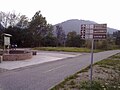
Before the junction near Tarvisio

Past the old Tarvis City train station

Canal valley, stations on the Alpe Adria cycle path

Over the Fellabrücke in front of Resiutta


Individual evidence
- ↑ Award for the cycle route of the year
- ↑ Auto lock Böckstein - Mallnitz
- ↑ Cycle path from Palmanova to Grado marked on the openstreetmap map with short interruptions: [1]
Literature and maps
- Bikeline Radtourenbuch Alpe Adria Radweg , 1: 50.000, Verlag Esterbauer , 7th edition 2019, ISBN 978-3-85000-465-7