Alpine crossing


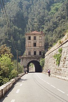

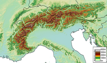
Under a Alpenüberquerung , Alps exceeded or an Alpine pass is meant a journey across the Alps , which mostly transverse, more rarely also longitudinally to Alpenhauptkamm runs and on foot, vehicles, animals, by tunneling can take place through the air. One speaks of an Alpine crossing mostly when one completely crosses the mountain range of the Alps, for example from Munich to Venice or Basel to Milan , but also for routes that still end in the inner Alps, for example from Oberstdorf to Meran . If the main Alpine ridge is only crossed over a small area (e.g. from Gries am Brenner to Gossensass in the Eisack Valley or when crossing the Hochwilde ), one speaks less of an Alpine crossing than of a crossing of the main Alpine ridge.
There are many reasons for crossing the Alps , which are between 150 and 250 kilometers wide, as a 'natural obstacle' between Central and Southern Europe on the one hand, and Western and Eastern Europe on the other; the most important motives are economic, military-political, religious, scientific, tourist and alpine in nature.
Crossing the Alps for economic reasons
trade
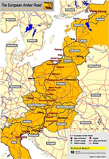
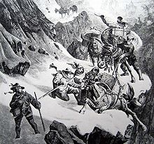
Trade routes over the main Alpine ridge have been documented since the Bronze Age , with individual finds showing the exchange of goods between northern and southern Europe as early as the end of the Neolithic period. The goods were initially carried by people on narrow mule tracks, later mostly carried by pack animals . Important connecting routes in pre-Roman times included the Col de Montgenèvre , the Great St. Bernhard , the Splügen Pass , the Reschen Pass and the Amber Road from the Baltic Sea via the Julian Alps to the Adriatic Sea . Some of the unpaved mule tracks over the Alps were converted into roads during the Roman Empire for military reasons (e.g. over the Brenner Pass ), which subsequently also benefited trade.
From around the 12th century, so-called salt roads (mostly known from pre-Roman times) gained increasing importance as important trade routes in north-south and west-east transit traffic across the Alps. On them, for example, salt was transported from salt pans in the Rhone Delta to the northern Italian metropolises and from there to Switzerland . Due to the sovereignty over important passes along these salt roads , the influence of small pass states increased . So that made Margrave Ludwig II. Saluzzo already from 1475 to 1480 the oldest tunnel in the Alps, the Buco di Viso , build, by the distance between the Provence and the Po Valley to make better passable.
Increasing traffic, including in the postal service , led to the expansion of further passes. The Gotthard Pass (through the construction of the 'Devil's Bridge') and the Brenner Pass (through the construction of the Kuntersweg ) became increasingly important. The type of locomotion (on foot; on pack animals; in carts, horse-drawn wagons, carriages; railroad and car) followed the respective technical progress with a slight time delay due to the difficult topographical conditions.
- See on railway lines crossing the Alps: Brennerbahn from 1867, Mont-Cenis-Linie ( adhesion railway ) from 1868 to 1871, Lyon - Turin from 1871, Gotthardbahn from 1882, Simplon route from 1906, Tauernbahn from 1909, Cuneo - Ventimiglia from 1928.
- For information on current Alpine transit , see also: Alpine transit traffic , New Railway Alpine Transversal (NEAT), various construction projects such as the Brenner Base Tunnel and the Mont Cenis Base Tunnel as part of the Trans-European Networks
Alpine farming
Seasonal alpine farming on pastures, which were often several hundred kilometers away from winter quarters ( see also transhumance ), has been documented since the Bronze Age, but may have even older origins. Here alpine crossings were not uncommon, such as between North to South and vice versa ( see also Oetztal and Vinschgau ) and between Provence and the Po Valley as rock engravings in the French Mercantour National Park ( Maritime Alps to attend).
Crossing the Alps for military, strategic or political reasons
The most legendary crossing of the Alps for military reasons succeeded in 218 BC. Chr. The Carthaginian leader Hannibal with his crossing of the Alps . During the Second Punic War , Hannibal crossed the wintry Alps with initially around 50,000 soldiers, 9,000 riders and 37 war elephants on a pass that has not yet been precisely determined in order to attack Rome. Half of his army and all of the elephants were lost.
As a result of the Gallic War , the Roman Empire then expanded into regions beyond the Alps and, starting in the Western Alps, fortified some cross-Alpine paths:
- the Via Julia Augusta led through the Maritime Alps ( via per Alpes maritimas ) ,
- through the Cottian Alps ( via per Alpes cottias ) the pass road over the Col de Montgenèvre was expanded,
- through the Graian Alps ( via per Alpes graias ) over the Little St. Bernhard ,
- through the Valais Alps ( via per Alpes Poeninas ) over the Great St. Bernhard ,
- in the Graubünden Alps the roads over Septimer and Julier Pass ,
- in the Eastern Alps on the Via Claudia Augusta over the Reschenpass , later the shorter Via Raetia over the Brenner
- and in the Julian Alps ( via per alpes Iulias ) the Amber Road.
Since that time, the ability to quickly move troops across the natural barrier of the main Alpine ridge has been of crucial importance to all rulers striving for supremacy in Europe. This applies to Carolingians ( Pippin the Younger 754 and 756, Charlemagne 773), Emperors of the Holy Roman Empire (such as Henry IV in 1077 on his way to Canossa and again in 1092 and Henry VII. In 1310 on his way to Rome ) as for Napoléon I , who had many passes in the Western Alps ( Simplon Pass 1801–1805, Mont Cenis 1803–1810) expanded.
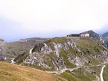
In the entire Alpine region there is still a wide network of former military roads, many of which were laid out on the eve of the First World War and later expanded under Mussolini . Some of these military roads also cross the main Alpine ridge.
Crossing the Alps for religious reasons
Pilgrimages for the purpose of visiting a certain pilgrimage site with religious significance have led to crossings of the Alps since the foundation of Christianity . The first description of such a journey by an anonymous pilgrim from Burdigala, today's Bordeaux , written on the occasion of a trip to the Holy Land in the years 333–334, can be found in the Itinerarium Burdigalense . This route led over remnants of the Roman road network via Mont Cenis and Turin to the stopover in Rome .
Pilgrims from Italy passed through the Susa Valley on their way to Santiago de Compostela , then chose one of the two Alpine crossings on Montgenèvre or Mont Cenis, where the Franks built the Abbey of Novalesa in 726 to protect pilgrims after the defeat of the Lombards . In the opposite direction, the route was used by pilgrims from southern France and Spain on their way to Rome and Jerusalem . The route over the Great St. Bernard, described by Sigeric , Archbishop of Canterbury , in 994, was also chosen from Northern Europe and England . Although many routes from Franconia to Rome are occupied, the name Via Francigena has been used for this route from Canterbury to Rome.
The hospices on the Great and Little St. Bernhard are said to have been founded in the middle of the 11th century. The first source about the use of the mule track over the Gotthard Pass, which was already well developed at that time, comes from the abbot Albert von Stade from the year 1236, who described the way in his world chronicle Annales Stadenses . In this chronicle the route over the Brenner was also listed.
Pilgrimage routes across the Alps during the Holy Years were particularly popular . On such an occasion, Erhard Etzlaub designed his Romweg map in 1500 , the first ever cartographic representation of Central Europe . It shows a transition between Chur and Chiavenna as well as a route over the Brenner ( Via Imperii ) and one over Semmering and Perchauer Sattel . Crossings on the first two routes mentioned were reconstructed for Martin Luther's trip to Rome in the winter of 1510/11 with route and time information.
In 1994, at the request of the Italian Ministry of Tourism, the 'European Institute of Cultural Routes' declared the pilgrimage from Canterbury to Rome as a 'European cultural route'.
Crossing the Alps for scientific reasons
Horace-Bénédict de Saussure , who is considered the father of modern alpine research, is said to have crossed the main Alpine ridge a total of 14 times on eight different paths using geologists' hammer and measuring instruments .
The question of which way Hannibal used to get around 218 BC Crossing the Alps has led some adventurers and researchers to cross the main ridge on elephants . So in July 1935 Richard Halliburton rode an elephant named Dally over the Great Saint Bernard and members of the Cambridge Alpine Elephant Expedition 1958-1959 in the course of the Hannibal research over the Mont Cenis.
Crossing the Alps for tourist reasons
Accommodation establishments emerged along old pilgrimage routes, which later also offered accommodation to travelers without religious motives. Visiting ancient sites in Italy had been a tradition in circles of artists and intellectuals since the late Middle Ages. Their path inevitably led across the Alps. From the end of the 17th century, nobles and members of the wealthy bourgeoisie were sent on a journey known as the Grand Tour to complete their education, which was supposed to give them the “finishing touches” when visiting important monuments and “picturesque landscapes”.
Albrecht von Haller's poem Die Alpen , published in 1729, transfigured the mountain world and its inhabitants, as did Jean-Jacques Rousseau's novel Julie or Die neue Heloise , which prompted readers to take a look at this paradise.
The Scottish doctor and (travel) writer Tobias Smollett described his journey from Nice over the Col de Tende to Turin in 1765 in great detail in Journeys through France and Italy. In contrast, the description of Johann Wolfgang von Goethe , who passed the Brenner Pass on his journey to Italy in September 1786 , was rather sparse.
See also: Alpine tourism
Crossing the Alps as a leisure activity and sporting activity
Crossing the Alps on foot
There are a variety of ways for hikers to cross the main Alpine ridge on long-distance hiking trails , including
- the longitudinal crossing of the Eastern Alps ( Vienna - Lake Maggiore ) and Western Alps (Lake Maggiore - Ligurian Sea )
- the part of the European long-distance hiking trail E1 (over the Gotthard Pass ) from Konstanz to Lake Maggiore ,
- the route from Oberstdorf to Meran , which is also integrated into the European long-distance hiking trail E5 ,
- the dream path Munich – Venice ,
- the route from Salzburg to Trieste ,
- the route from Garmisch- Partenkirchen to Brescia,
- the route from Munich to Lake Garda , a relatively new route from 2008,
- the route on the trail of the Via Claudia Augusta from Augsburg , along the Lech , via Füssen to Italy
- the Trans Swiss Trail from Porrentruy to Chiasso ,
- the Trans Swiss Trail from Rorschach to Geneva ,
- individual sections of the international Via Alpina long-distance hiking trail between France and Italy,
- the route from Kufstein to Verona , which includes the historic mule track over the Krimmler Tauern ,
- the route from Hirschegg in Kleinwalsertal to Schlinig in South Tyrol.
Crossing the Alps by bike
The crossing of the Alps with the touring bike , the bike or mountain bike is also called Transalp or Alpencross referred. Important routes are u. a .:
- the Via Claudia Augusta , which was originally laid out by the Romans, but has been redeveloped for cyclists and hikers since the mid-1990s, partly on a historic route
- The Eisack Valley Cycle Route offers an alternative stage over a disused railway line from the Brenner Pass to Bolzano , with a length of 96 km and an altitude difference of approx. 1000 meters
- Two national bicycle routes in Switzerland were created by the Veloland Switzerland Foundation from 1995 onwards, also as a Transalp Tour for bicycles:
- the north-south route : Basel - Chiasso, 363 km total length
- the Graubünden route : Chur - Bellinzona, 260 km total length
- the Heckmair route , developed and published in 1989/1990, overcomes a height difference of 13,500 meters with a total length of 312 km
- the Joe Route , developed and published in 1995, overcomes an altitude difference of 14,100 meters with a total length of 432 km
- the Albrecht route , developed and published in 2005, overcomes a height difference of almost 12,000 meters with a total length of 480 km
The BIKE Transalp , which has been held annually as a competition in eight stages since 1998, is considered a particularly tough form of crossing the Alps by bike. The TOUR Transalp has been an annual racing bike stage race for teams of two across the Alps since 2003. The race is one of the toughest stage races in the world for ambitious amateur racing cyclists.
Crossing the Alps by glider or balloon
For glider pilots, the flight routes usually lead over those Alpine passes that are as directly accessible as possible from the north or south. These include the Brenner Pass and - even more popular in terms of landscape - the Malojapass .
There are no fixed routes for balloonists as they drift with the wind. The meteorological conditions are only given on a few days in the winter half-year (December to March).
Crossing the Alps by cable car
An impressive crossing of the main Alpine ridge 'for everyone', and close to its highest point, is the 4-stage cable car ride from Chamonix (France) to Courmayeur (Italy). The first two sections of the route from Chamonix to the Aiguille du Midi (3,777 m) take a large-cabin gondola . The third stage crosses the Vallée Blanche and the Glacier du Géant to the Turin Hut (3,462 m) with the small cable car Vallée Blanche in small circulating gondolas a few kilometers from the Mont Blanc summit . A large gondola then takes you back down to Courmayeur in the Aosta Valley . You can get back to the starting point by crossing under the Alps through the Mont-Blanc tunnel .
Crossing the Alps in the longitudinal direction (east-west / west-east)
The term 'crossing the Alps' (or traversing the Alps) is meanwhile also used for the lengthwise crossing of the entire approx. 2,000 (hiking) kilometer long Alpine arc. For the first time in 1978 as part of the Alpen '78 company, the Viennese Gabi Binder and Wolfgang Ott crossed the entire Alps from east to west on the route from Vienna to Savona and climbed the main peaks of all Alpine groups.
Further east-west crossings:
- Karl Lukan (with Fritzi Lukan ) 1984 from Vienna to Nice , about it his book Alpenspaziergang ,
- TransALPedes ( Jürg Frischknecht and others), in the summer of 1992 as an environmental policy expedition from Vienna to Nice (Frischknecht and others: Alpenglühn , Rotpunkt Verlag, 1993)
- Patrick Berhault 2000/2001 as a series of 22 difficult summit ascents between Triglav and Menton ,
- Hans Thurner and Anita Lechner 2011 from Vienna to Nice in 101 days.
- The shortest documented longitudinal crossing to date (36 days) was made by a group of extreme athletes in 2018.
A long-distance hiking trail that crosses a large part of the Alps through all eight Alpine countries from Trieste to Monaco is the 'red trail' of the Via Alpina .
literature
General
- Gerold Walser : The military importance of the Alps in antiquity. In: War and Mountains. Swiss Association for Military History, Editions Gilles Attinger, Hauterive. 1994
Long-distance hiking trails and long-distance bike paths across the Alps
- Christof Herrmann: Alpine crossing Salzburg - Trieste. Bergverlag Rother, ISBN 978-3-7633-4494-9 .
- Iris Kürschner, Dieter Haas: GTA - Grande Traversata delle Alpi , ISBN 978-3-7633-4402-4
- Martin Marktl: Alpine crossing Vienna - Lake Maggiore. Bergverlag Rother, ISBN 978-3-7633-4510-6
- Kay Wewior: The Via Claudia Augusta Bike Travel Book . Verlag BoD, ISBN 978-3-8370-4543-7 .
- Bikeline bike tour book: Via Claudia Augusta . Esterbauer, February, ISBN 3-85000-131-8 .
- Hikeline long-distance hiking trail: Via Claudia Augusta . Esterbauer, ISBN 978-3-85000-510-4 .
- Christoph Tschaikner: Kompass cycling tour book Via Claudia Augusta - cycling in the footsteps of the Romans . ISBN 978-3-85026-067-1 .
- Christoph Tschaikner: Kompass cycling map Via Claudia Augusta - cycling in the footsteps of the Romans . ISBN 978-3-85026-146-3 .
Web links
- East-West crossing of the Alps by Thomas Kunz
- Longitudinal crossing of the Alps in 36 days
- List and further links to crossings of the Alps
Individual evidence
- ↑ The Roman and Greek traditions are not very precise (the top of the pass could be reached with a large army from the Rhône within nine days / there is enough space for a large army camp on the top of the pass / from the top of the pass you can see Turin eastwards and in three Days / the descent is very steep). In addition, no corresponding finds have been found on any of the initially 20 passports that were shortlisted. Recently, especially by Patrick Hunt , the Col de Clapier has been mentioned as the pass to which all of the above conditions apply.
- ^ Saussure, Voyages dans les Alpes, introduction. Volume 1 (French)
- ↑ Crossing the Alps on the "L1" from Garmisch-Partenkirchen to Brescia | www.Alpenquerung.info. Retrieved April 20, 2018 .
- ↑ On foot from Kufstein to Verona on alpentrek.de.
- ↑ Thomas Zimmerling: Crossing the Alps on quiet primal paths. Accessed January 2, 2020 .
- ^ Hans Thurner: 2000 km of freedom - on foot across the Alps from Vienna to Nice . Bruckmann, 2015, ISBN 978-3-7343-1085-0 (new edition 2018).
