
Via Francigena

The Via Francigena , also Frankenstrasse or Frankenweg , are the old highways used by pilgrims on their way from the Franconian Empire or England via the Franconian Empire to Rome to the burial place of the apostles Peter and Paul . Often the name Via Romea is also used for the destination .
Today's reconstruction of the Via Francigena is essentially based on information provided by Archbishop Sigeric of Canterbury , who made a pilgrimage to Rome in 990.
History of the pilgrimage routes to Rome

If you compare the sources and the many directions, you will see that the only real “Via Francigena” does not exist, any more than there is only one Way of St. James . The “Via Francigena” is the name given to the system of roads that leads to Rome. Existing trade and military routes (e.g. Via Aurelia , Via Emilia , Via Cassia ) were used by large flows of merchants, pilgrims and crusaders from Northern and Central Europe. They gave these travel routes the name “Via Francigena” or the “Franconian Way”. The name “Via Francigena” appears for the first time in the year 876 in the Actum Clusio of the Abbey of San Salvatore al Monte Amiata (Tuscany).
Notes on pilgrimages to Rome in ancient times
When Christianity was allowed as a religion in the Roman Empire with the Milan Agreement in 313 , it can be assumed that the first pilgrimages to the graves of the apostles Peter and Paul took place. These first pilgrims were able to use the good infrastructure of the Roman road network with its Xenodochien , the ancient hospitals, or its mansiones , the ancient hostels. In Itinerarium Burdigalense (334) calls an unknown Christian pilgrims from today's Bordeaux, traveling by land to Jerusalem, a large number of appropriate accommodation. On the way back from the Holy Land, the city of Rome is also one of his travel stops. Evidence of these early pilgrimages could be a building discovered in ancient Ostia . Under the name “ Basilica Cristiana ” a pilgrims' hostel from the early 5th century is suspected, which could be used by pilgrims who traveled to Rome by sea.
After the collapse of the Roman Empire, pilgrims travel becomes more complicated. Not only that roads and bridges are falling apart, that some hostels are no longer in operation, but the lack of safety on the roads also causes the number of pilgrims to drop sharply.
Travel reports from the time of the early Middle Ages to Sigerich
One of the oldest travel reports, probably from the 9th century, is by the British monk Gildas the Wise (about 500-570), who around the year 530 undertakes a pilgrimage to Rome. Under the title “Pro Itineris et navigii prosperitate - For safety on land and at sea”, he has handed down a pilgrimage prayer that vividly describes the dangers and worries of everyday pilgrimages.
In the "Vita Sancti Wilfrithi", created in the early 8th century, the eventful life of the English bishop and Saint Wilfrid is told. His three trips to Rome are also described. He made his first journey as a pilgrim in the period from 653–658. His second trip to Rome from 678 to 680 was aimed at obtaining support from the Pope against his deposition as bishop. In 704 he was in Rome again to get the Pope to withdraw his excommunication by an English synod. In addition to a description of the travel hazards, it is also said that Wilfrid visited the graves of the apostles and brought relics to England.
One of the great travelers to Rome in the 8th century is St. Boniface (Wynfreth). He travels to Rome a total of three times in order to get commission and confirmation from the Popes for his missionary work in Friesland, Hesse, Thuringia and Bavaria. So he was in Rome in 719 and received an order from Pope Gregory II to do a mission in Germania. From this point on he was called Boniface. In 722 Pope Gregory II consecrated Boniface in Rome as mission bishop without a permanent bishopric. In 737/38 Boniface was appointed papal legate for the entire Franconian Empire when he visited Rome again.
In the 8th century, a nun known by name as Hugeburc from the Heidenheim monastery wrote a "Vita Sancti Willibaldi" in which she reproduced a biography of the first Eichstätt Bishop Willibald (approx. 700–787). The core of the Vita Willibaldi is the itinerary of the saint. With his father and brother Wunibald, Willibald will probably set off on a pilgrimage to Rome in early summer 720 , which Willibald then took to the Holy Land and Asia Minor. With a total of 77 place names (and 13 people) the nun Hugeburc describes Willibald's path in great detail, even if she made various mistakes. The journey starts in what is now Hamblehaven and continues after crossing the English Channel along the Seine in Rouen . Without a more detailed description, the route runs through France. Hugeburc now mistakenly lets the pilgrims first “cross over” to Italy and only then reach the “castles of the Alps”. Lucca is specifically mentioned , where Willibald's father dies and is buried in the church of St. Frigdianus . In 1150 took place under the name Richard , a collection of his bones place that was probably caused by the fact that relics of Eichstaett and Heidenheim were solicited. On November 11, 720, St. Martin's Day , the brothers arrive in Rome and probably visit the Lateran first and then St. Peter . The brothers' stay in Rome was followed by a pilgrimage for Willibald and other companions via Sicily to Jerusalem and the Holy Land (723–727). He then returned to southern Italy, where he spent a decade on Monte Cassino before returning to Rome and finally to Eichstätt .
The travelogue of Sigerich
Among the many connections between Central and Northern Europe and Rome, the name "Via Francigena" has become established for one route in particular. It is the route from Canterbury to Rome described in the records of Archbishop Sigeric the Serious of Canterbury (994). He traveled from Canterbury to Rome in 990 to receive the pallium from the Pope , a woolen scarf as a token of his appointment as Archbishop. Sigerich recorded the 80 stations of his journey in writing. The document is now in the British Library in London. Assuming an average travel speed of 20 kilometers per day, 80 days are quite realistic for the total of around 1,600 kilometers on foot.
The course of the road north of the Alps according to the description of the Sigerich
From Canterbury via Calais the road ran via Arras , Licques, Wisques, Camblain l'Abbey, Arras, Laon, Reims , Châlons-sur-Marne , Bar-sur-Aube , Besançon and Pontarlier to Lausanne and Saint-Maurice in Switzerland , to cross the Alps on the Great St. Bernhard .
The course of the road south of the Alps according to the description of the Sigerich
In Italy the Via Francigena ran through the Aosta Valley , Ivrea , Vercelli , via Pavia , Piacenza , Fiorenzuola d'Arda , Fidenza to Parma , from there to cross the Apennines at the Passo della Cisa via Fornovo di Taro , Cassio, Berceto .
After Pontremoli , the path split into two routes to bypass the Apuan Alps , a western one that ran via Luni / Sarzana , Carrara and Massa , partly using the old Via Aurelia , and one that ran along the eastern side of the mountains. Both routes met again in Lucca .
From Lucca it went southeast on the Via Pisana (the Roman road from Florence to Pisa ) and the Arno , which was crossed or crossed at San Genesio (which was destroyed in 1248) and San Miniato ; From here the Via Francigena followed the valley of the Elsa (Valdelsa) on several routes that met again in Poggibonsi, only to part again shortly above. Two routes led along the two banks of the Elsa, on the right bank via Castelfiorentino and Certaldo , on the left bank directly and without touching larger towns; a third route branched off from the latter and went through the hilly landscape of Tuscany, touching the places Gambassi Terme and San Gimignano .
On this route, the Via Francigena crossed the Etruscan- era Via Volterrana several times , which came from the northeast ( Fiesole ) and headed for Volterra on two routes : the northern Volterrana crossed in Castelfiorentino and Gambassi Terme (before Gambassi Terme, Francigena and Volterrana were a few kilometers identical ), the southern Volterrana north of Certaldo and south of San Gimignano.
In Poggibonsi, on the other hand, not only did the three routes of the Francigena come together, but also the Via Regia Romana , which was previously largely identical to the southern Volterrana, but then branched off from this in Barberino Val d'Elsa to run directly to Poggibonsi .
After Poggibonsi, the Francigena split again into two stretches: the eastern one ran past the Staggia Senese castle , the western one via Monteriggioni ; after the two routes converged again, we went to Siena .
The last stops on the Via Francigena were Abbadia San Salvatore , Acquapendente , Bolsena , Montefiascone , Viterbo , Vetralla , Capranica , Ronciglione , Sutri , Nepi and finally St. Peter's Square in Rome .
The development of the pilgrimage to Rome in the time after Sigeric
Around 1155 the Icelandic abbot Nikulás Bergsson , also Nikulás von Munkathvera (Icelandic Munkaþverá) wrote a travel description with the title "Wegweiser" (Icelandic Leiðarvísir ), expressly with the aim of writing a kind of pilgrim handbook for other Icelandic pilgrims. In it he describes his journey to Rome and Jerusalem , which he undertook between 1149 and 1154, and usually lists the most important places on his way with the distances between the stages. After a boat trip from Iceland via Norway and Denmark, his route runs through Denmark and the German Empire. Some stations are Schleswig , Stade , Paderborn , Mainz , Speyer , Strasbourg , Basel and Vevey . From there he reports that the streets of the southern Franconians, the English, the Germans and the Scandinavians come together here and unite on the common path to Rome. He too then travels on the route of Sigeric to Rome and via Bari to Jerusalem. The alternative routes and detours to other destinations, which Nikulás mentions several times, could indicate that he had contact with other pilgrims from whom he was instructed about the various routes. In addition to the route description, it also offers “tourist” information. He names important shrines and bishoprics along the way and offers detailed information about the sights of the city of Rome.
A “world chronicle” recorded between 1240 and 1256 by the abbot Albert von Stade , the Annales Stadenses , contains a playful dialogue between two monastery brothers about a trip to Rome. In it Albert describes his trip to Rome, which he made in 1236 in order to receive from Pope Gregory IX. to get permission for monastic reform. He describes travel routes in an unusually precise way and gives several variants for sections of the route, so that they could be used as a guide for pilgrims at the time. His route takes him from Stade via Bremen to Münster , Maastricht , Reims , Chalon-sur-Saône , Lyon and the Alps, which he crosses between Chambéry and Susa (Piedmont) . His way there leads through Turin , Piacenza , Bologna , Arezzo and Orvieto to Rome . The way back is more direct via Arezzo, Bologna, Padua , Trient , Bozen , Brixen , Sterzing , Matrei , Innsbruck , Zirl , Mittenwald , Partenkirchen , Oberammergau , Schongau , Igling , Augsburg , Donauwörth , Marktoffingen , Dinkelsbühl , Rothenburg , Aub , Ochsenfurt , Würzburg , Schweinfurt , Münnerstadt , Neustadt , Meiningen , Schmalkalden , Gotha , Bad Langensalza , Nordhausen , Hasselfelde , Wernigerode , Hornburg , Braunschweig , Celle back to Stade. For this Romweg the term "preferred Romea " is used.
In the manuscript " Hauksbók ", probably from the beginning of the 14th century, but with a travel route that is much older, Haukr Erlendsson from Iceland describes the same route as Albert von Stade as a route to Rome with small differences.

Interest in the pilgrimage to Rome experienced an undreamt-of boost in the year 1300. There was a rumor in Europe that the Pope would proclaim a holy year and grant the pilgrims to Rome a complete indulgence from the penalties of sin , which was previously only available for crusaders . Contemporary sources assure that hundreds of thousands of pilgrims were in Rome at the time. Even though most of the pilgrims were certainly from Italy, the hospice on the Great St. Bernhard recorded a total of 20,000 overnight stays in the year 1300. The jubilee year 1450 seems to have brought most of the pilgrims to Rome. Pope Nicholas V has a special anniversary coin minted due to the abundant income. He begins the construction of St. Peter's Basilica and purchases expensive manuscripts for the Vatican Library all over the world . For the rush of pilgrims during these holy years, investments are made again and again in the infrastructure. A new bridge over the Tiber, the Ponte Sisto , was built for the jubilee year 1475 .
.jpg)
For the holy year 1500, the Romwegkarte by Erhard Etzlaub from Nuremberg (approx. 1460–1532) was published as one of the first maps . The most important routes to Rome - Rome is at the top of the map - are marked with distance information, so one can speak of an early route map. Only three alpine crossings are recorded (shown by a dotted line): a road from Ulm via Bregenz to Chur and from there via Septimerpass or Splügen via Clef to Italy; the Via Imperii from Germany via Mittenwald to Innsbruck and then over the Brenner Pass; and finally a path from Moravia to Vienna and over the “sloping Alpine passage” to Bruck, Villach and the Canal Valley. On this eastern route between Vienna and Bruck the following stations are indicated: “Neustadt” and “Schadwynn” (Schottwien).
The political and economic importance of the Via Francigena in the Middle Ages
After the Frankish king Charlemagne conquered the Longobard Empire in 774 , he and his successors had the section between Pavia and Rome expanded as an imperial road, on which monasteries and bishoprics were then built to supply the flow of pilgrims - Rome belonged to Santiago de Compostela and Jerusalem among the three most important pilgrimage destinations in the Middle Ages , the pilgrimage sign was a key.
In the vicinity of Pavias in the direction of Piacenza are the Ronkaldic fields , where the army gathered at the beginning of the 11th century that accompanied and protected the emperor for his coronation in Rome. Emperor Friedrich I. Barbarossa had court days held here in 1154 and 1158 .
In addition to its religious and politico-military value, the Via Francigena soon also acquired economic importance: it was the main artery connecting Italy with the rest of Europe, especially Western Europe. Frankish nobles (including the Guidi and Gherardesca ) soon took control of the economic and cultural centers along the Via Francigena, such as San Gimignano and Colle di Val d'Elsa .
The importance of the Via Francigena then waned with the power of the German emperors in Italy, the rise of the cities of Genoa , Pisa and Florence, which the Francigena largely bypassed, and the shift of the flow of goods to the old Roman roads (Via Aurelia and Via Cassia ) now the economic realities were better served. The end of the economic importance of the Via Francigena was then also the end of the economic importance of the cities only adjacent to it, such as San Gimignanos.
The rediscovery of the Via Francigena
With the boom of the “Camino de Santiago” in the 1990s, the “Via Francigena” was also revitalized. In 1994 the “Via Francigena” was awarded the European Institute of Cultural Routes as a European Cultural Route at the request of the Italian Ministry of Tourism, and in 2004 it was named “Major Cultural Route of the Council of Europe”.
The memorial march of some former Swiss Guards from Bellinzona to Rome in 2006 on the occasion of the 500th anniversary of the Pontifical Swiss Guard made the trail particularly popular in Switzerland.
Route to Sigerich compared to today's route
| No. | Stages according to the description of Sigerich | Today's route of the Via Francigena | |||
|---|---|---|---|---|---|
| Places in Latin | Today's place name | Starting point - destination | Distance in km |
||
| - | not mentioned | Canterbury - Dover | 32.2 | ||
| Crossing the English Channel | |||||
| 1 | LXXX | Sumeran | Sombre (district of Wissant) | Calais - Wissant | 19.7 |
| 2 | LXIX | Information is missing | |||
| 3 | LXXVIII | Gisne | Guînes | Wissant - Guînes | 20.2 |
| 4th | LXXVII | Teranburh | Thérouanne | Guînes - Licques | 15.7 |
| Licques - Wisques | 23.9 | ||||
| Wisques - Thérouanne | 13.2 | ||||
| 5 | LXXVI | Bruwaei | Bruay-la-Buissière | Thérouanne - Auchy-au-Bois | 15.1 |
| Auchy-au-Bois - Bruay-la-Buissière | 19.0 | ||||
| 6th | LXXV | Atherate | Arras | Bruay-la-Buissière - Arras | 33.6 |
| 7th | LXXIV | You in | Doingt | Arras - Bapaume | 26.2 |
| Bapaume - Péronne | 25.3 | ||||
| Peronne - Doingt | 3.0 | ||||
| 8th | LXXIII | Martinwaeth | Seraucourt-le-Grand | Doingt - Seraucourt-le-Grand | 29.2 |
| 9 | LXXII | Mundlothuin | Laon | Seraucourt-le-Grand - Tergnier | 17.0 |
| Tergnier - Laon | 33.0 | ||||
| 10 | LXXI | Corbunei | Corbeny | Laon- Bouconville-Vauclair | 18.6 |
| Bouconville-Vauclair- Corbeny | 4.5 | ||||
| 11 | LXX | Rems | Reims | Corbeny - Hermonville | 20.1 |
| Hermonville - Reims | 16.3 | ||||
| 12 | LXIX | Chateluns | Châlons-en-Champagne | Reims - Trépail | 28.1 |
| Trépail - Châlons-en-Champagne | 25.8 | ||||
| 13 | LXVIII | Funtaine | Fontaine sur Coole | Châlons-en-Champagne - Cool | 27.0 |
| 14th | LXVII | Domaniant | Donnement | Cool - Donnement | 25.7 |
| 15th | LXVI | Breone | Brienne-le-Château | Donnement - Brienne le Château | 17.8 |
| 16 | LXV | bar | Bar-sur-Aube | Brienne-le-Château - Bar-sur-Aube | 26.9 |
| 17th | LXIV | Blue cuile | Blessonville | Bar-sur-Aube - Châteauvillain (near Blessonville ) |
32.9 |
| 18th | LXIII | Oisma | Humes-Jorquenay | Châteauvillain - Langres (near Humes-Jorquenay ) |
40.9 |
| 19th | LXII | Grenant | Grenant | Langres - Coublanc (near Grenant ) |
27.0 |
| 20th | LXI | Sefui | Seveux | Coublanc - Dampierre-sur-Salon | 27.7 |
| Dampierre-sur-Salon - Savoyeux (near Seveux ) |
5.5 | ||||
| 21st | LX | Cuscei | Cussey-sur-l'Ognon | Savoyeux - Gy | 20.6 |
| Gy - Cussey-sur-l'Ognon | 16.4 | ||||
| 22nd | LIX | Bysiceon | Besançon | Cussey-sur-l'Ognon - Besançon | 17.0 |
| 23 | LVIII | Nos | Nods | Besançon - Étalans | 27.0 |
| Étalans - Chasnans (near Nods ) |
9.8 | ||||
| 24 | LVII | Punterlin | Pontarlier | Chasnans - Ouhans | 18.0 |
| Ouhans - Pontarlier | 17.0 | ||||
| 25th | LVI | Antifern | Yverdon-les-Bains | Pontarlier - Orbe | 40.2 |
| 26th | LV | Urba | Orbe | ||
| 27 | LIV | Losanna | Lausanne | Orbe - Lausanne | 32.0 |
| 28 | LIII | Vivaec | Vevey | Lausanne - Cully | 12.9 |
| Cully - Vevey | 11.3 | ||||
| 29 | LII | Burbulei | Aigle | Vevey - Montreux | 8.4 |
| Montreux - Villeneuve | 5.9 | ||||
| Villeneuve - Aigle | 12.7 | ||||
| 30th | LI | Sce Maurici | Saint-Maurice | Aigle - Saint-Maurice | 18.0 |
| 31 | L. | Ursiores | Orsières | Saint-Maurice - Martigny | 17.0 |
| Martigny - Orsières | 18.5 | ||||
| 32 | XLIX | Petrecastel | Bourg-Saint-Pierre | Orsières - Bourg-Saint-Pierre | 15.4 |
| 33 | XLVIII | Sce Remei | Saint-Rhémy-en-Bosses | Bourg-Saint-Pierre - Great St. Bernhard | 13.8 |
| Great St. Bernard - Saint-Rhémy-en-Bosses | 6.3 | ||||
| 34 | XLVII | Agusta | Aosta | Saint-Rhémy-en-Bosses - Aosta | 25.6 |
| 35 | XLVI | Publei | (Pontey?) Pont-Saint-Martin | Aosta - Nus | 15.9 |
| Nus - Saint-Vincent | 22.3 | ||||
| Saint-Vincent- Arnad | 22.4 | ||||
| Arnad - Pont-Saint-Martin | 15.9 | ||||
| 36 | XLV | Everi | Ivrea | Pont-Saint-Martin - Ivrea | 25.2 |
| 37 | XLIV | Sca Agatha | Santhià | Ivrea - Viverone | 21.4 |
| Viverone - Santhià | 16.2 | ||||
| 38 | XLIII | Vercel | Vercelli | Santhià - Vercelli | 28.6 |
| 39 | XLII | Tremel | Tromello | Vercelli - Robbio | 19.7 |
| Robbio - Mortara | 14.2 | ||||
| Mortara - Tromello | 18.1 | ||||
| 40 | XLI | Pamphica | Pavia | Tromello - Gropello Cairoli | 13.5 |
| Gropello Cairoli - Pavia | 18.1 | ||||
| 41 | XL | Sce Cristine | Santa Cristina e Bissone | Pavia - Santa Cristina e Bissone | 27.4 |
| 42 | XXXIX | Sce Andrea | Corte San Andrea | Santa Cristina e Bissone - Piacenza (crossing the Po ) |
38.2 |
| 43 | XXXVIII | Placentia | Piacenza | ||
| 44 | XXXVII | Floricum | Fiorenzuola d'Arda | Piacenza - Fiorenzuola d'Arda | 26.4 |
| 45 | XXXVI | Sce Domnine | Fidenza (until 1927 Borgo San Donino) | Fiorenzuola d'Arda - Fidenza | 22.3 |
| 46 | XXXV | Metane | Costamezzana ( Medesano ) | Fidenza - Costamezzana | 10.8 |
| 47 | XXXIV | Phileman only | Fornovo di Taro (or Felegara) | Costamezzana - Medesano | 9.7 |
| Medesano - Fornovo di Taro | 9.2 | ||||
| 48 | XXXIII | Sce Moderanne | Berceto | Fornovo di Taro - Cassio di Terenzo | 19.8 |
| Cassio di Terenzo - Berceto | 10.4 | ||||
| 49 | XXXII | Sce Benedicte | Montelungo | Berceto - Pontremoli | 29.4 |
| 50 | XXXI | Puntremel | Pontremoli | ||
| 51 | XXX | Aguilla | Aulla | Pontremoli - Villafranca in Lunigiana | 19.1 |
| Villafranca in Lunigiana - Aulla | 15.3 | ||||
| 52 | XXIX | Sce Stephane | Santo Stefano di Magra | Aulla - Sarzana | 16.3 |
| 53 | XXVIII | Luna | Luni | Sarzana - Luni | 12.7 |
| 54 | XXVII | Campmaior | Pieve di Camaiore | Luni - Massa | 14.8 |
| Massa - Pietrasanta | 15.8 | ||||
| Pietrasanta - Camaiore | 8.2 | ||||
| 55 | XXVI | Luca | Lucca | Camaiore - Lucca | 24.2 |
| 56 | XXV | Forcri | Porcari | Lucca - Porcari | 10.6 |
| 57 | XXIII | Aqua nigra | Ponte a Cappiano, district of Fucecchio | Porcari - Ponte a Cappiano | 19.7 |
| 58 | XXIII | Arne Blanca | Fucecchio | Ponte a Cappiano - Fucecchio | 4.9 |
| 59 | XXII | Sce Dionisii | San Genesio near San Miniato | Fucecchio - San Miniato Alto | 7.6 |
| 60 | XXI | Sce Peter Currant | Coiano, now part of Castelfiorentino | San Miniato Alto - Coiano | 12.1 |
| 61 | XX | Sce Maria Glan | Santa Maria a Chianni near Gambassi Terme | Coiano - Gambassi Terme | 12.2 |
| 62 | XIX | Sce Gemiane | San Gimignano | Gambassi Terme - San Gimignano | 14.5 |
| 63 | XVIII | Sce Martin in Fosse | San Martino Fosci ( Molino d'Aiano , district of Colle di Val d'Elsa ) | San Gimignano - Badia a Isola | 20.5 / 25.5 |
| 64 | XVII | Aelse | Gracciano ( Pieve d'Elsa , district of Colle di Val d'Elsa) | ||
| 65 | XVI | Burgenove | Badia a Isola, district of Monteriggioni | ||
| 66 | XV | Seocine | Siena | Badia a Isola - Monteriggioni | 3.5 |
| Monteriggioni - Siena | 20.5 | ||||
| 67 | XIV | Arbia | Ponte d'Arbia, district of Monteroni d'Arbia | Siena - Monteroni d'Arbia | 17.9 |
| Monteroni d'Arbia - Ponte d'Arbia | 9.8 | ||||
| 68 | XIII | Turreiner | Torrenieri (district of Montalcino) | Ponte d'Arbia - Buonconvento | 5.7 |
| Buonconvento - Torrenieri | 13.5 | ||||
| 69 | XII | Sce Quiric | San Quirico d'Orcia | Torrenieri - San Quirico d'Orcia | 7.4 |
| 70 | XI | Abricula | Briccole di Sotto (near Gallina , today the municipality of Castiglione d'Orcia ) | San Quirico d'Orcia - Bagno Vignoni | 5.3 |
| Bagno Vignoni - Radicofani | 27.4 | ||||
| 71 | X | Sce Petir in Pail | San Pietro in Paglia (Voltole) | Radicofani - Ponte a Rigo | 10.7 |
| 72 | IX | Aquapendente | Acquapendente | Ponte a Rigo - Acquapendente | 13.8 |
| 73 | VIII | Sca Cristina | Bolsena | Acquapendente - Bolsena | 20.2 |
| 74 | VII | Sce flavians | Montefiascone | Bolsena - Montefiascone | 18th |
| 75 | VI | Sce Valentine | Viterbo (Bullicame) | Montefiascone - Viterbo | 18.7 |
| 76 | V | Furcari | Vetralla (Forcassi) | Viterbo - Vetralla | 17.9 |
| 77 | IlIl | Suteria | Sutri | Vetralla - Sutri | 22.1 |
| 78 | III | Bacans | Baccano (Campagnano di Roma) | Sutri - Campagnano di Roma | 22.3 |
| 79 | II | Johannis VIIII | San Giovanni in Nono (La Storta) | Campagnano di Roma - La Storta | 25.6 |
| 80 | I. | Urbs Roma | Roma | La Storta - Rome | 14.8 |
Infrastructure for pilgrims
The following explanations are limited to the current road infrastructure in Italy. In recent years, a large number of pilgrimage guides have appeared that make planning the pilgrimage much easier. The signposting of the route is now almost perfect in Switzerland and Italy and the route can usually be found without a map. In France, pilgrims should be prepared for large gaps in the marking. The efforts of those responsible to follow the historic route can be seen, but keeping the route as far away as possible from busy roads is not easy. In the catchment area of the larger cities in particular, route guidance and finding are often faced with insurmountable problems. The number of overnight stays has also expanded significantly. Simple quarters are available in many of the stages, mostly offered by parishes or monasteries.
Picture gallery
- Stations on the Via Francigena

The Cathedral of Canterbury , the start of the Via Francigena.

Pilgrims to Rome leave Canterbury Cathedral through Christ Church Gate.
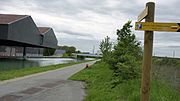
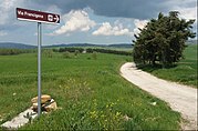
Crossing of Via Francigena (signposted in France as Grande Randonnée Route GR145) and GR654 in the Marne department , northern France.
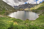
The Great St. Bernhard Pass in midsummer.
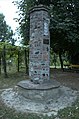
The column, erected by the Compagnia di Sigerico near Soprarivo, Calendasco . The same column is in the locality of Corte Sant'Andrea, Lombardy.
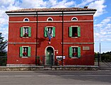
Pilgrim accommodation in Cassio

Sigerichs Mansio No. XXX in Aulla , Tuscany, is still the starting point for pilgrims today.

A medieval Italian document shows the castle of Tentennano (also called Rocca d'Orcia , part of the municipality of Castiglione d'Orcia ).

The St. Peter's Basilica in Rome with one of the objectives of the pilgrimage, the grave of the apostle Peter.
The Via Francigena beyond Rome, near Ariano Irpino , towards the Apulian ports of embarkation for the Holy Land .


Virtual inspection
With the two-part navigation bar Via Francigena , which is located at the end of the local article, the virtual ascent of this European pilgrimage is possible. In addition to the link to the previous and the following place - the following example shows the start and end points - the bar contains a fold-out overview of all places in the actual order in the direction of Rome.
← Previous location: Canterbury | Via Francigena | Town: Rome →
![]() Canterbury |
Dover |
Calais |
Wissant |
Guînes |
Licques |
Wisques |
Thérouanne |
Auchy-au-Bois |
Bruay-la-Buissière |
Arras |
Bapaume |
Peronne |
Doingt |
Seraucourt-le-Grand |
Tergnier |
Laon |
Bouconville-Vauclair |
Corbeny |
Hermonville |
Reims |
Trépail |
Châlons-en-Champagne |
Cool |
Brienne-le-Château |
Bar-sur-Aube |
Châteauvillain |
Blessonville |
Langres |
Humes-Jorquenay |
Coublanc |
Grenant |
Dampierre-sur-Salon |
Savoyeux |
Seveux |
Gy |
Cussey-sur-l'Ognon |
Besançon |
Étalans |
Chasnans |
Nods |
Ouhans |
Pontarlier |
Yverdon-les-Bains |
Orbe |
Lausanne |
Cully |
Vevey |
Montreux |
Villeneuve |
Aigle |
Saint-Maurice |
Martigny |
Orsières |
Bourg-Saint-Pierre |
Great St. Bernhard |
Saint-Rhémy-en-Bosses |
Saint-Oyen |
Étroubles |
Gignod |
Aosta |
Saint-Christophe |
Quart |
Nut |
Verrayes |
Chambave |
Saint-Denis |
Châtillon |
Saint-Vincent |
Montjovet |
Issogne |
Verrès |
Arnad |
Hône |
Bard |
Donnas |
Pont-Saint-Martin |
Carema |
Settimo Vittone |
Borgofranco d'Ivrea |
Montalto Dora |
Ivrea |
Cascinette d'Ivrea |
Burolo |
Bollengo |
Palazzo Canavese |
Piverone |
Azeglio |
Viverone |
Roppolo |
Cavaglià |
Santhià |
San Germano Vercellese |
Olcenengo |
Salasco |
Sali Vercellese |
Vercelli |
Palestro |
Robbio |
Nicorvo |
Castelnovetto |
Albonese |
Mortara |
Cergnago |
Tromello |
Garlasco |
Gropello Cairoli |
Villanova d'Ardenghi |
Zerbolò |
Carbonara al Ticino |
Pavia |
Valle Salimbene |
Linarolo |
Belgioioso |
Torre de 'Negri |
Costa de 'Nobili |
Santa Cristina e Bissone |
Miradolo Terme |
Chignolo Po |
San Colombano al Lambro |
Orio Litta |
Senna Lodigiana |
Calendasco |
Rottofreno |
Piacenza |
Podenzano |
San Giorgio Piacentino |
Pontenure |
Carpaneto Piacentino |
Cadeo |
Fiorenzuola d'Arda |
Chiaravalle della Colomba |
Alseno |
Busseto |
Fidenza |
Costamezzana |
Noceto |
Medesano |
Fornovo di Taro |
Terenzo |
Berceto |
Pontremoli |
Filattiera |
Villafranca in Lunigiana |
Bagnone |
Licciana Nardi |
Aulla |
Santo Stefano di Magra |
Sarzana |
Castelnuovo Magra |
Ortonovo |
Luni |
Fosdinovo |
Carrara |
Massa |
Montignoso |
Seravezza |
Pietrasanta |
Camaiore |
Lucca |
Capannori |
Porcari |
Montecarlo |
Altopascio |
Castelfranco di Sotto |
Santa Croce sull'Arno |
Ponte a Cappiano |
Fucecchio |
San Miniato |
Castelfiorentino |
Coiano |
Montaione |
Gambassi Terme |
San Gimignano |
Colle di Val d'Elsa |
Badia a Isola |
Monteriggioni |
Siena |
Monteroni d'Arbia |
Ponte d'Arbia |
Buonconvento |
Montalcino |
Torrenieri |
San Quirico d'Orcia |
Bagno Vignoni |
Castiglione d'Orcia |
Radicofani |
San Casciano dei Bagni |
Abbadia San Salvatore |
Piancastagnaio |
Ponte a Rigo |
Proceno |
Acquapendente |
Grotte di Castro |
San Lorenzo Nuovo |
Bolsena |
Montefiascone |
Viterbo |
Ronciglione |
Vetralla |
Capranica |
Sutri |
Monterosi |
Nepi |
Mazzano Romano |
Campagnano di Roma |
Formello |
La Storta |
Rome
Canterbury |
Dover |
Calais |
Wissant |
Guînes |
Licques |
Wisques |
Thérouanne |
Auchy-au-Bois |
Bruay-la-Buissière |
Arras |
Bapaume |
Peronne |
Doingt |
Seraucourt-le-Grand |
Tergnier |
Laon |
Bouconville-Vauclair |
Corbeny |
Hermonville |
Reims |
Trépail |
Châlons-en-Champagne |
Cool |
Brienne-le-Château |
Bar-sur-Aube |
Châteauvillain |
Blessonville |
Langres |
Humes-Jorquenay |
Coublanc |
Grenant |
Dampierre-sur-Salon |
Savoyeux |
Seveux |
Gy |
Cussey-sur-l'Ognon |
Besançon |
Étalans |
Chasnans |
Nods |
Ouhans |
Pontarlier |
Yverdon-les-Bains |
Orbe |
Lausanne |
Cully |
Vevey |
Montreux |
Villeneuve |
Aigle |
Saint-Maurice |
Martigny |
Orsières |
Bourg-Saint-Pierre |
Great St. Bernhard |
Saint-Rhémy-en-Bosses |
Saint-Oyen |
Étroubles |
Gignod |
Aosta |
Saint-Christophe |
Quart |
Nut |
Verrayes |
Chambave |
Saint-Denis |
Châtillon |
Saint-Vincent |
Montjovet |
Issogne |
Verrès |
Arnad |
Hône |
Bard |
Donnas |
Pont-Saint-Martin |
Carema |
Settimo Vittone |
Borgofranco d'Ivrea |
Montalto Dora |
Ivrea |
Cascinette d'Ivrea |
Burolo |
Bollengo |
Palazzo Canavese |
Piverone |
Azeglio |
Viverone |
Roppolo |
Cavaglià |
Santhià |
San Germano Vercellese |
Olcenengo |
Salasco |
Sali Vercellese |
Vercelli |
Palestro |
Robbio |
Nicorvo |
Castelnovetto |
Albonese |
Mortara |
Cergnago |
Tromello |
Garlasco |
Gropello Cairoli |
Villanova d'Ardenghi |
Zerbolò |
Carbonara al Ticino |
Pavia |
Valle Salimbene |
Linarolo |
Belgioioso |
Torre de 'Negri |
Costa de 'Nobili |
Santa Cristina e Bissone |
Miradolo Terme |
Chignolo Po |
San Colombano al Lambro |
Orio Litta |
Senna Lodigiana |
Calendasco |
Rottofreno |
Piacenza |
Podenzano |
San Giorgio Piacentino |
Pontenure |
Carpaneto Piacentino |
Cadeo |
Fiorenzuola d'Arda |
Chiaravalle della Colomba |
Alseno |
Busseto |
Fidenza |
Costamezzana |
Noceto |
Medesano |
Fornovo di Taro |
Terenzo |
Berceto |
Pontremoli |
Filattiera |
Villafranca in Lunigiana |
Bagnone |
Licciana Nardi |
Aulla |
Santo Stefano di Magra |
Sarzana |
Castelnuovo Magra |
Ortonovo |
Luni |
Fosdinovo |
Carrara |
Massa |
Montignoso |
Seravezza |
Pietrasanta |
Camaiore |
Lucca |
Capannori |
Porcari |
Montecarlo |
Altopascio |
Castelfranco di Sotto |
Santa Croce sull'Arno |
Ponte a Cappiano |
Fucecchio |
San Miniato |
Castelfiorentino |
Coiano |
Montaione |
Gambassi Terme |
San Gimignano |
Colle di Val d'Elsa |
Badia a Isola |
Monteriggioni |
Siena |
Monteroni d'Arbia |
Ponte d'Arbia |
Buonconvento |
Montalcino |
Torrenieri |
San Quirico d'Orcia |
Bagno Vignoni |
Castiglione d'Orcia |
Radicofani |
San Casciano dei Bagni |
Abbadia San Salvatore |
Piancastagnaio |
Ponte a Rigo |
Proceno |
Acquapendente |
Grotte di Castro |
San Lorenzo Nuovo |
Bolsena |
Montefiascone |
Viterbo |
Ronciglione |
Vetralla |
Capranica |
Sutri |
Monterosi |
Nepi |
Mazzano Romano |
Campagnano di Roma |
Formello |
La Storta |
Rome![]()
![]()
![]()
literature
- Thomas Szabo: Via Francigena . In: Lexicon of the Middle Ages (LexMA). Volume 8, LexMA-Verlag, Munich 1997, ISBN 3-89659-908-9 , Sp. 1610 f.
- Georg Kerschbaum, Reinhard Gattinger: The Via Francigena - 550 accommodations on the pilgrimage to Rome. Publishing house EUrovia, Vienna 2015, ISBN 978-3-9502194-2-5 .
- Ingrid Retterath: Via Francigena from Lausanne to Rome. (= Outdoor Manual Volume 201, 2nd edition). Conrad Stein Verlag, 2018, ISBN 978-3-86686-559-4 .
- Reinhard Gattinger, Georg Kerschbaum: Via Francigena - On foot to Rome. EUROVIA, Vienna 2005, ISBN 3-200-00500-9 . (DVD documentation)
- Reinhard Zweidler: The Franconian Way - Via Francigena. The medieval pilgrimage from Canterbury to Rome. Theiss, Stuttgart 2003, ISBN 3-8062-1755-6 .
- Bettina Dürr: Heavenly Journeys. In the footsteps of pilgrims and monks through ancient Italy. Bastei, Bergisch Gladbach 2000, ISBN 3-404-14356-6 .
- Christian Jostmann: To Rome on foot. Story of a pilgrimage. Beck, Munich 2007, ISBN 978-3-406-55739-2 .
- Berthold Burkhardt: Via Jakobi & Via Francigena, On pilgrimage routes to Rome. Jakobsweg team, Winnenden 2008, ISBN 978-3-9812350-0-5 .
- Association Internationale Via Francigena (ed.): Guida - vademecum dal Gran San Bernardo a Roma e raccordo da Arles-F a Vercelli. Association Internationale Via Francigena, Vollèges 2003, OCLC 869720700 . (Guide Vademecum B, Italian)
The magazine De strata francigena has been published since 1993 . Studi e ricerche sulle vie di pellegrinaggio del medioevo. Annuario del Centro Studi Romei . ISSN 1722-9472 .
See also
- Sigeric the Serious
- Via Romea
- Via Romea Francigena (EV5) European long-distance cycle route running parallel from Canterbury to Rome
Web links
- Via Francigena in the Open Direct Project
- Publications on the Via Francigena in the Opac of the Regesta Imperii
- Extensive collection of links to the Via Francigena
- European Institute of Cultural Routes - Via Francigena
- EUROVIA Association - extensive information on the Via Francigena
- The Via Francigena
- International Association Via Francigena Association for pilgrims and pilgrimage routes to Rome since 1997
- Francigena routes and accommodations from Canterbury to Rome
- An overview map of the signposted sections of the route
- The Via Francigena through Switzerland, from the Jura to the Great St. Bernard
- Free digital hiking map of the stages through Switzerland
Individual evidence
- ↑ ostia-antica.org
- ↑ maryjones.us ( Memento of the original from May 31, 2010 in the Internet Archive ) Info: The archive link was automatically inserted and not yet checked. Please check the original and archive link according to the instructions and then remove this notice.
- ^ Oxforddnb.com
- ↑ Andreas Bauch: Sources on the history of the diocese of Eichstätt. Volume 1: Biographies of the early days. Johann Michael Sailer Verlag, Eichstätt 1962, note 29, 90.
- ^ Manuscript (IV) British museum library W. Stubbs: Rerum Britannicarum Medii Aevii Scriptores. vol. 63. cap. VII, pp. 391-399.
- ↑ Dominik Waßenhoven: "There is the center of the world". An Icelandic pilgrim guide of the 12th century. In: Wolfgang Huschner, Frank Rexroth (Hrsg.): Donated future in medieval Europe. Festschrift for Michael Borgolte on his 60th birthday. Akademie Verlag, 2008, ISBN 978-3-05-004475-0 , pp. 29-62.
- ↑ Annales Stadenses , pp. 335-340.
- ↑ unterwegs-auf-alten-strassen.de
- ↑ unterwegs-auf-alten-strassen.de
- ↑ Reinhard Zweidler: The Frankenweg - Via Francigena. The medieval pilgrimage from Canterbury to Rome. Theiss, Stuttgart 2003, ISBN 3-8062-1755-6 .
- ↑ Distances from here to Ingrid Retterath: Via Francigena from Lausanne to Rome . (= Outdoor Handbook. Volume 201). Conrad Stein Verlag, 2011.
- ↑ Compagnia di Sigerico