
Orbe VD
| VD is the abbreviation for the canton of Vaud in Switzerland and is used to avoid confusion with other entries of the name Orbe . |
| Orbe | |
|---|---|
 |
|
| State : |
|
| Canton : |
|
| District : | Jura north vaudois |
| BFS no. : | 5757 |
| Postal code : | 1350 |
| UN / LOCODE : | CH OREB |
| Coordinates : | 530 709 / 175207 |
| Height : | 479 m above sea level M. |
| Height range : | 432–558 m above sea level M. |
| Area : | 12.05 km² |
| Residents: | 6938 (December 31, 2018) |
| Population density : | 576 inhabitants per km² |
| Unemployment rate : | 5.0% (May 31, 2,015) |
| Website: | www.orbe.ch |
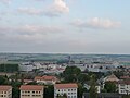
 Aerial view of Orbe |
|
| Location of the municipality | |
  |
|


Orbe is a municipality in the Jura-Nord vaudois district in the canton of Vaud in Switzerland . The former German name Orbach is no longer used today.
geography

Orbe lies at 479 m above sea level. M. , 10 km southwest of the district capital Yverdon-les-Bains (air line). The historic town extends over a promontory on three sides surrounded by the Orbe at the foot of the Jura , in the Vaud Central Plateau . Orbe lies around 40 m above the agriculturally intensively used Orbe plain ( Plaine de l'Orbe in French ).
The area of the 12.0 km² municipal area covers a section of the Vaud Central Plateau. The main part of the area is taken up by the wide Orbe Plain, a formerly marshy and often flooded area, which is now drained and traversed by the rivers Nozon , Talent and Orbe , which are trapped in canal beds . In the municipality, the Nozon flows into the Talent, and this a little further northeast into the Orbe. There is also the Entreroches Canal , which is called Canal Oriental in the north-east and forms the eastern border of the municipality, and the Canal Occidental . To the west, the municipality extends to the adjacent plateau of the Jura foot plateau and reaches Les Saugettes at 560 m above sea level. M. the highest point of Orbe. Part of this plateau is also the ledge on which the old town lies. Below the town the river Orbe, which over millions of years has cut a deep notch in the plateau through erosion , emerges into the Orbe plain. In 1997, 17% of the municipal area was in settlements, 3% in forests and woodlands, 77% in agriculture and around 3% was unproductive land.
Orbe includes extensive new residential and villa quarters, the commercial and industrial zones Granges-Saint-Martin and Granges-Saint-Germain ( 442 m above sea level ) in the Orbe plain , which are expanding ever further east, and a few individual courtyards. Orbe's neighboring municipalities are Chavornay , Arnex-sur-Orbe , Agiez , Montcherand , Valeyres-sous-Rances , Mathod and Ependes .
population
With 6938 inhabitants (as of December 31, 2018), Orbe is one of the larger municipalities in the canton of Vaud. 82.3% of the residents are French-speaking, 5.0% Portuguese-speaking and 3.1% German-speaking (as of 2000). The population of Orbe increased sharply, especially in the first decade of the 20th century. Thereafter, a further continuous increase was recorded until 1970. As a result of the economic crisis in the 1970s, there was emigration in that decade. Since then, however, the population has increased significantly again. New residential quarters have been created primarily on the eastern slope north of the historic old town and on the edge of the Jura foot plateau.
| Population development | ||||||||||||
|---|---|---|---|---|---|---|---|---|---|---|---|---|
| year | 1850 | 1900 | 1910 | 1930 | 1950 | 1960 | 1970 | 1980 | 1990 | 2000 | 2007 | 2016 |
| Residents | 1923 | 2080 | 3234 | 3422 | 3565 | 3824 | 4522 | 3985 | 5084 | 5139 | 5535 | 6903 |
economy
Today Orbe is a regionally important center with trade, industry, trade and administrative functions as well as tourist facilities.
Due to the large agricultural area in the area around Orbe, the primary sector still plays a certain role in the employment structure of the population. The agriculture combined still around 7% of the workforce in coming. Of importance are the agriculture and especially vegetable crops. There are some smaller wine-growing areas in the area of the town as well as a larger vineyard slope above the La Vaux Vully farm. The cantonal penitentiary of Bochuz (Pénitencier de Bochuz) was founded in 1899 in the Orbe plain to the left of the canalised Orbe. It operates the largest agricultural property in the canton of Vaud.
With the improved transport connections, Orbe developed into an industrial location in the course of the 19th century. First the Mühlenwerke Rod SA settled here, later a chocolate factory followed and the Paillard film apparatus factory , which was in operation from 1958 to 1971. In 1974, the Fertig Frères brewery closed down.
Today an extensive industrial and commercial quarter has developed at the foot of the city hill and in the Orbe plain. The most important company is the Nestlé coffee factory , as well as several other companies in the food industry. The numerous small and medium-sized companies in Orbe have specialized in the areas of agricultural machinery, metal construction, precision mechanics, horticulture, IT, telecommunications and the construction industry. There are also various shopping centers on the level.
Orbe also has a district hospital and several recreational facilities, including tennis courts, a swimming pool and a campsite. In terms of culture, Orbe has a theater, a cinema and the Musée du Vieil-Orbe, founded in 1878.
traffic
The community is an important transport hub. It is at the crossroads of the roads from Cossonay to Yverdon and from Chavornay to Vallorbe , another road leads to Romainmôtier . Orbe has also been connected to the Swiss motorway network since the 1980s. In 1981 the Lausanne – Yverdon section of the A1 was opened. From the Essert-Pittet junction, the A9 has been running north past Orbe to Ballaigues and then as the main road to France via the Jura pass Col de Jougne to Pontarlier or via Vallorbe into the Vallée de Joux .
The direct connection to the railway network took place on April 17, 1894 with the inauguration of the branch line from Chavornay station to Orbe through the Chemin de fer Orbe – Chavornay . Bus routes from Orbe to Yverdon, Baulmes , Vallorbe, Croy and Arnex-sur-Orbe ensure the fine distribution of public transport .
history
The earliest traces of settlement in the municipality come from the Neolithic . The real story of Orbe begins in Roman times . The Romans probably founded the Urba settlement around 150 AD on the edge of the Orbe plain when the Orbe emerged from the Jura foot plateau at a junction of the military road coming from Lausanne. One branch led from Urba over the Jura (Col de Jougne) to Besançon , the then Vesontio , the other branch followed the edge of the Orbe plain to Yverdon ( Eburodunum ) and Avenches ( Aventicum ). The settlement was sometimes referred to as Orba , villa Orbacum and Urbigenum during Roman times . The word Urba does not come from the Latin urbs (city), as is often assumed , but has its origin in Celtic, possibly even pre-Celtic roots. The root word orobis or orbe , which in Celtic times only referred to the river Orbe, simply means river . In contrast to Aventicum and Colonia Iulia Equestris (Nyon), Urba never achieved great importance as an urban settlement, but at today's Boscéaz it had an impressive Roman manor, which is considered the largest building complex of its kind in Switzerland. The excavations carried out by the University of Lausanne since 1986 indicate an outer enclosure wall measuring 420 × 370 m.
At the end of the 3rd century, the estate and the settlement were probably abandoned due to the first German invasions. While nothing is known from the early Burgundian period , Orbe became a Burgundian royal estate by the 9th century at the latest. The new settlement developed below the castle hill in the 10th century, first mentioned as villa Tabernis , and in 1049 as vicus Urbensis . Later a settlement was built on the castle hill. Since 1255 the Orbe lordship belonged to the lords of Montfaucon. Between 1270 and 1300 the settlement adjacent to the castle was fortified and given market rights. In 1404 the city of Orbe was given extensive freedom, but only three years later it was badly damaged by a city fire.
In the course of the 15th century, rule over Orbe passed to the House of Chalon, which came from Burgundy. That is why the Confederates conquered the city during the Burgundian Wars and destroyed the castle. In the Treaty of Friborg, the city of Orbe was placed under the joint administration of Friborg , Bern and the seven other places together with the Echallens domain in 1476 . In the Treaty of Beromünster in 1484, Bern released the rights of these seven places to rule by paying compensation. From then on, the Orbe-Echallens bailiwick was under the joint administration of Bern and Freiburg. The city of Orbe formed an exclave of the dominion, the center of which was in the Echallens region. Every five years, Bern or Freiburg provided the bailiff, who had his seat in Echallens. Due to the initial resistance of the Catholic Freiburg, the Reformation was not introduced in Orbe until 1554.
After the collapse of the Ancien Régime , Orbe belonged to the canton of Léman from 1798 to 1803 during the Helvetic Republic, which then became part of the canton of Vaud when the mediation constitution came into force . Since 1798 it has been the district capital of the new Orbe district, which was created from the city of Orbe and parts of the bailiwicks of Yverdon and Romainmôtier.
Attractions
Orbe has a picturesque medieval townscape. The historic old town consists of an upper part (Vieux-Bourg) with three longitudinal and one cross streets and a lower part (Neuf-Bourg), at the lower end of which is the Pont du Moulinet, a bridge from 1421.
The medieval town once had six different churches; today, however, there are only three houses of worship left. After the fire of 1407 had destroyed the former town church, the now reformed Notre-Dame church was built, which is an important building of the late Gothic flamboyant style. The church tower was created by rebuilding and enlarging a former tower in the city wall. In the years that followed, it served as both a bell tower and a defense tower and was therefore equipped with the four echauguettes (oriel-like watchtowers on the main tower) typical of Vaudois churches. The three-aisled nave was rebuilt from 1521 to 1525, and between 1687 and 1690 the former side chapels were combined on the north and south sides, so that two additional aisles were created. Inside there are remains of paintings from the 15th century. The peculiarity of this church are the sometimes bizarre figures and the curved ribs of the star vaults, which detach from the vaulted ceiling and end in a hanging keystone (especially at the southeast corner of the nave).
The castle, built in the 13th century, was largely destroyed by the Confederates in 1475. Today only the round keep (1255–1259) and a square tower of the surrounding wall are preserved. The former city wall was torn down in the 17th century, with a round tower still standing near the school.
On the main square (Place du Marché) is the Hôtel de Ville (town hall), a two-story arcaded building that was built in 1540. The facade was designed in the classic French style between 1786 and 1789 according to plans by the architect César Gasquet . In front of it is a fountain with a standard bearer figure from 1543.
The historic old town with numerous town houses and patrician houses from the 16th to 19th centuries has other important buildings. These include the Hôtel des Deux Poissons (a former Poor Clare monastery that was founded in 1426, rebuilt in the 16th century and later redesigned in Baroque style), the Grandjean house from 1781, the priory from 1756–1760 (formerly used as the barn of the Romainmôtier monastery) and the old hospital from 1778.
North of the city near Boscéaz, the mosaics found in the Roman manor have been opened to the public. The mosaics dating from around 200 to 230 AD are among the most important north of the Alps. The representations include Roman deities, animals, chariots, labyrinths and geometric decor.
Personalities
- Pierre Viret (1511–1571), reformer in Lausanne and Geneva
- Elie Bertrand (1713–1797), Reformed pastor and scientist
- Edmond Davall (1793–1860), botanist and Swiss forest scientist
- Augusta Gillabert (1869–1940), founder of the first farmers' cooperative in Switzerland
- Gustave Combe (1882–1957), Colonel Division
- Patricia Bosshard (* 1965), violinist and composer
- Benjamin Antonietti (* 1991), ice hockey player
Picture gallery

casino
Industrial zone

Courtyard of the castle

Fortification tower


Web links
|
Further content in the sister projects of Wikipedia:
|
||
|
|
Commons | - multimedia content |
|
|
Wikisource | - Sources and full texts |
- Official website of the municipality of Orbe (French)
- Fabienne Abetel-Béguelin: Orbe (municipality). In: Historical Lexicon of Switzerland .
- Details of the mosaics from Orbe
Individual evidence
- ↑ Permanent and non-permanent resident population by year, canton, district, municipality, population type and gender (permanent resident population). In: bfs. admin.ch . Federal Statistical Office (FSO), August 31, 2019, accessed on December 22, 2019 .
- ↑ Demandeurs d'emploi, chômeurs et taux de chômage par commune. ( XLS , 115 kB) Statistique Vaud, Département des finances et des relations extérieures (Statistics Vaud, Department of Finance and Foreign Affairs), accessed on June 14, 2015 (French).
L'Abbaye | L'Abergement | Agiez | Arnex-sur-Orbe | Ballaigues | Baulmes | Bavois | Belmont-sur-Yverdon | Bioley-Magnoux | Bofflens | Bonvillars | Bretonnières | Bullet | Chamblon | Champagne | Champvent | Chavannes-le-Chêne | Chavornay | Chêne-Pâquier | Le Chenit | Cheseaux-Noréaz | Les Clées | Concise | Corcelles-près-Concise | Cronay | Croy | Cuarny | Démoret | Donneloye | Ependes | Fiez | Fontaines-sur-Grandson | Giez | Grand event | Grandson | Juriens | Le Lieu | Lignette roll | Mathod | Mauborget | Molondine | Montagny-près-Yverdon | Montcherand | Mutrux | Novalles | Onnens | Orbe | Orges | Orzens | Pomy | La Praz | Premier | Provence | Rances | Romainmôtier-Envy | Rovray | Sainte-Croix | Sergey | Suchy | Suscévaz | Tévenon | Treycovagnes | Ursins | Valeyres-sous-Montagny | Valeyres-sous-Rances | Valeyres-sous-Ursins | Vallorbe | Vaulion | Villars-Epeney | Vugelles-La Mothe | Vuiteboeuf | Yverdon-les-Bains | Yvonand
Former municipalities: Arrissoules | Chanéaz | Corcelles-sur-Chavornay | Envy | Essert-Pittet | Essert-sous-Champvent | Fontanezier | Gossens | Gressy | Mézery-près-Donneloye | Prahins | Romainmôtier | Romairon | Vaugondry | Villars-Burquin | Villars-sous-Champvent
Canton of Vaud | Districts of the canton of Vaud | Municipalities of the canton of Vaud
← Previous location: Pontarlier 40.2 km | Orbe VD | Next town: Lausanne 32.0 km →
![]() Canterbury |
Dover |
Calais |
Wissant |
Guînes |
Licques |
Wisques |
Thérouanne |
Auchy-au-Bois |
Bruay-la-Buissière |
Arras |
Bapaume |
Peronne |
Doingt |
Seraucourt-le-Grand |
Tergnier |
Laon |
Bouconville-Vauclair |
Corbeny |
Hermonville |
Reims |
Trépail |
Châlons-en-Champagne |
Cool |
Brienne-le-Château |
Bar-sur-Aube |
Châteauvillain |
Blessonville |
Langres |
Humes-Jorquenay |
Coublanc |
Grenant |
Dampierre-sur-Salon |
Savoyeux |
Seveux |
Gy |
Cussey-sur-l'Ognon |
Besançon |
Étalans |
Chasnans |
Nods |
Ouhans |
Pontarlier |
Yverdon-les-Bains |
Orbe |
Lausanne |
Cully |
Vevey |
Montreux |
Villeneuve |
Aigle |
Saint-Maurice |
Martigny |
Orsières |
Bourg-Saint-Pierre |
Great St. Bernhard |
Saint-Rhémy-en-Bosses |
Saint-Oyen |
Étroubles |
Gignod |
Aosta |
Saint-Christophe |
Quart |
Nut |
Verrayes |
Chambave |
Saint-Denis |
Châtillon |
Saint-Vincent |
Montjovet |
Issogne |
Verrès |
Arnad |
Hône |
Bard |
Donnas |
Pont-Saint-Martin |
Carema |
Settimo Vittone |
Borgofranco d'Ivrea |
Montalto Dora |
Ivrea |
Cascinette d'Ivrea |
Burolo |
Bollengo |
Palazzo Canavese |
Piverone |
Azeglio |
Viverone |
Roppolo |
Cavaglià |
Santhià |
San Germano Vercellese |
Olcenengo |
Salasco |
Sali Vercellese |
Vercelli |
Palestro |
Robbio |
Nicorvo |
Castelnovetto |
Albonese |
Mortara |
Cergnago |
Tromello |
Garlasco |
Gropello Cairoli |
Villanova d'Ardenghi |
Zerbolò |
Carbonara al Ticino |
Pavia |
Valle Salimbene |
Linarolo |
Belgioioso |
Torre de 'Negri |
Costa de 'Nobili |
Santa Cristina e Bissone |
Miradolo Terme |
Chignolo Po |
San Colombano al Lambro |
Orio Litta |
Senna Lodigiana |
Calendasco |
Rottofreno |
Piacenza |
Podenzano |
San Giorgio Piacentino |
Pontenure |
Carpaneto Piacentino |
Cadeo |
Fiorenzuola d'Arda |
Chiaravalle della Colomba |
Alseno |
Busseto |
Fidenza |
Costamezzana |
Noceto |
Medesano |
Fornovo di Taro |
Terenzo |
Berceto |
Pontremoli |
Filattiera |
Villafranca in Lunigiana |
Bagnone |
Licciana Nardi |
Aulla |
Santo Stefano di Magra |
Sarzana |
Castelnuovo Magra |
Ortonovo |
Luni |
Fosdinovo |
Carrara |
Massa |
Montignoso |
Seravezza |
Pietrasanta |
Camaiore |
Lucca |
Capannori |
Porcari |
Montecarlo |
Altopascio |
Castelfranco di Sotto |
Santa Croce sull'Arno |
Ponte a Cappiano |
Fucecchio |
San Miniato |
Castelfiorentino |
Coiano |
Montaione |
Gambassi Terme |
San Gimignano |
Colle di Val d'Elsa |
Badia a Isola |
Monteriggioni |
Siena |
Monteroni d'Arbia |
Ponte d'Arbia |
Buonconvento |
Montalcino |
Torrenieri |
San Quirico d'Orcia |
Bagno Vignoni |
Castiglione d'Orcia |
Radicofani |
San Casciano dei Bagni |
Abbadia San Salvatore |
Piancastagnaio |
Ponte a Rigo |
Proceno |
Acquapendente |
Grotte di Castro |
San Lorenzo Nuovo |
Bolsena |
Montefiascone |
Viterbo |
Ronciglione |
Vetralla |
Capranica |
Sutri |
Monterosi |
Nepi |
Mazzano Romano |
Campagnano di Roma |
Formello |
La Storta |
Rome
Canterbury |
Dover |
Calais |
Wissant |
Guînes |
Licques |
Wisques |
Thérouanne |
Auchy-au-Bois |
Bruay-la-Buissière |
Arras |
Bapaume |
Peronne |
Doingt |
Seraucourt-le-Grand |
Tergnier |
Laon |
Bouconville-Vauclair |
Corbeny |
Hermonville |
Reims |
Trépail |
Châlons-en-Champagne |
Cool |
Brienne-le-Château |
Bar-sur-Aube |
Châteauvillain |
Blessonville |
Langres |
Humes-Jorquenay |
Coublanc |
Grenant |
Dampierre-sur-Salon |
Savoyeux |
Seveux |
Gy |
Cussey-sur-l'Ognon |
Besançon |
Étalans |
Chasnans |
Nods |
Ouhans |
Pontarlier |
Yverdon-les-Bains |
Orbe |
Lausanne |
Cully |
Vevey |
Montreux |
Villeneuve |
Aigle |
Saint-Maurice |
Martigny |
Orsières |
Bourg-Saint-Pierre |
Great St. Bernhard |
Saint-Rhémy-en-Bosses |
Saint-Oyen |
Étroubles |
Gignod |
Aosta |
Saint-Christophe |
Quart |
Nut |
Verrayes |
Chambave |
Saint-Denis |
Châtillon |
Saint-Vincent |
Montjovet |
Issogne |
Verrès |
Arnad |
Hône |
Bard |
Donnas |
Pont-Saint-Martin |
Carema |
Settimo Vittone |
Borgofranco d'Ivrea |
Montalto Dora |
Ivrea |
Cascinette d'Ivrea |
Burolo |
Bollengo |
Palazzo Canavese |
Piverone |
Azeglio |
Viverone |
Roppolo |
Cavaglià |
Santhià |
San Germano Vercellese |
Olcenengo |
Salasco |
Sali Vercellese |
Vercelli |
Palestro |
Robbio |
Nicorvo |
Castelnovetto |
Albonese |
Mortara |
Cergnago |
Tromello |
Garlasco |
Gropello Cairoli |
Villanova d'Ardenghi |
Zerbolò |
Carbonara al Ticino |
Pavia |
Valle Salimbene |
Linarolo |
Belgioioso |
Torre de 'Negri |
Costa de 'Nobili |
Santa Cristina e Bissone |
Miradolo Terme |
Chignolo Po |
San Colombano al Lambro |
Orio Litta |
Senna Lodigiana |
Calendasco |
Rottofreno |
Piacenza |
Podenzano |
San Giorgio Piacentino |
Pontenure |
Carpaneto Piacentino |
Cadeo |
Fiorenzuola d'Arda |
Chiaravalle della Colomba |
Alseno |
Busseto |
Fidenza |
Costamezzana |
Noceto |
Medesano |
Fornovo di Taro |
Terenzo |
Berceto |
Pontremoli |
Filattiera |
Villafranca in Lunigiana |
Bagnone |
Licciana Nardi |
Aulla |
Santo Stefano di Magra |
Sarzana |
Castelnuovo Magra |
Ortonovo |
Luni |
Fosdinovo |
Carrara |
Massa |
Montignoso |
Seravezza |
Pietrasanta |
Camaiore |
Lucca |
Capannori |
Porcari |
Montecarlo |
Altopascio |
Castelfranco di Sotto |
Santa Croce sull'Arno |
Ponte a Cappiano |
Fucecchio |
San Miniato |
Castelfiorentino |
Coiano |
Montaione |
Gambassi Terme |
San Gimignano |
Colle di Val d'Elsa |
Badia a Isola |
Monteriggioni |
Siena |
Monteroni d'Arbia |
Ponte d'Arbia |
Buonconvento |
Montalcino |
Torrenieri |
San Quirico d'Orcia |
Bagno Vignoni |
Castiglione d'Orcia |
Radicofani |
San Casciano dei Bagni |
Abbadia San Salvatore |
Piancastagnaio |
Ponte a Rigo |
Proceno |
Acquapendente |
Grotte di Castro |
San Lorenzo Nuovo |
Bolsena |
Montefiascone |
Viterbo |
Ronciglione |
Vetralla |
Capranica |
Sutri |
Monterosi |
Nepi |
Mazzano Romano |
Campagnano di Roma |
Formello |
La Storta |
Rome![]()
![]()
![]()