
Juriens
| Juriens | |
|---|---|
 |
|
| State : |
|
| Canton : |
|
| District : | Jura north vaudois |
| BFS no. : | 5754 |
| Postal code : | 1326 |
| Coordinates : | 524 271 / 171610 |
| Height : | 797 m above sea level M. |
| Height range : | 714–1292 m above sea level M. |
| Area : | 9.35 km² |
| Residents: | 308 (December 31, 2018) |
| Population density : | 33 inhabitants per km² |
| Website: | www.juriens.ch |
 Aerial view of Juriens |
|
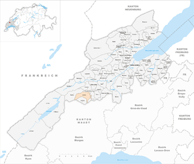
| Location of the municipality | |
  |
|
Juriens is a municipality in the Jura-Nord vaudois district in the canton of Vaud in Switzerland .
geography
Juriens lies at 797 m above sea level. M. , 7 km southwest of Orbe and 18 km southwest of the district capital Yverdon-les-Bains (linear distance). The farming village extends on a ledge on the Jura slope , above the Nozon valley .
The 9.4 km² municipal area covers a section of the Vaud Jura. The community soil extends from the Jura slope south of the Nozontal westwards over the densely wooded steep slopes ( La Côte and Drochard ) to the height at Chalet Dernier , on which at 1290 m above sea level. M. the highest point of Juriens is reached. On this chain between the upper Nozon Valley and the Central Plateau there are extensive Jura high pastures with the typical mighty spruce trees , which either stand individually or in groups. In 1997, 2% of the municipal area was accounted for by settlements, 51% for forests and woodlands and 47% for agriculture.
Some individual farms on the Jura heights belong to Juriens. Neighboring municipalities to Juriens are Romainmôtier-Envy , Moiry , La Praz , Mont-la-Ville and Vaulion .
population
With 308 inhabitants (as of December 31, 2018), Juriens is one of the small communities in the canton of Vaud. 94.1% of the residents are French-speaking, 2.1% German-speaking and 1.7% English-speaking (as of 2000). The population of Juriens was 280 in 1850 and 287 in 1910. Thereafter, a decrease of around a third to 201 inhabitants was recorded by 1980, since then a slight upward trend has been observed again.
economy
Juriens was a predominantly agricultural village until the second half of the 20th century . In the lower part of the municipality arable farming is practiced , while cattle breeding and dairy farming predominate on the Jura heights . There are other jobs in local small businesses and in a convalescent home for the elderly, which is part of the Saint-Loup regional hospital in Pompaples .
traffic
The community is located off the major thoroughfares, with the main access from Romainmôtier-Envy . Juriens is connected to the public transport network through the Postbus course that runs from Croy to L'Isle .
history
The first written mention of the village was in 1263 under the name Jurians , which is probably due to a Burgundian settler named Juringos . Juriens belonged to the Romainmôtier monastery in the Middle Ages . With the conquest of Vaud by Bern in 1536, the village became part of the Kastlanei and Landvogtei Romainmôtier. After the collapse of the Ancien Régime , Juriens belonged to the canton of Léman from 1798 to 1803 during the Helvetic Republic, which then became part of the canton of Vaud when the mediation constitution came into force . It was assigned to the Orbe district in 1798. Juriens was struck by numerous serious fires, the last of which destroyed almost half of the village in 1811.
Attractions
The Church of Juriens was built in 1968. In the center of the village there are some typical farmhouses from the 19th century.
Web links
- Official website of the Municipality of Juriens (French)
- Guy Le Comte: Juriens. In: Historical Lexicon of Switzerland .
- Aerial photography
Individual evidence
- ↑ Permanent and non-permanent resident population by year, canton, district, municipality, population type and gender (permanent resident population). In: bfs. admin.ch . Federal Statistical Office (FSO), August 31, 2019, accessed on December 22, 2019 .
L'Abbaye | L'Abergement | Agiez | Arnex-sur-Orbe | Ballaigues | Baulmes | Bavois | Belmont-sur-Yverdon | Bioley-Magnoux | Bofflens | Bonvillars | Bretonnières | Bullet | Chamblon | Champagne | Champvent | Chavannes-le-Chêne | Chavornay | Chêne-Pâquier | Le Chenit | Cheseaux-Noréaz | Les Clées | Concise | Corcelles-près-Concise | Cronay | Croy | Cuarny | Démoret | Donneloye | Ependes | Fiez | Fontaines-sur-Grandson | Giez | Grand event | Grandson | Juriens | Le Lieu | Lignette roll | Mathod | Mauborget | Molondine | Montagny-près-Yverdon | Montcherand | Mutrux | Novalles | Onnens | Orbe | Orges | Orzens | Pomy | La Praz | Premier | Provence | Rances | Romainmôtier-Envy | Rovray | Sainte-Croix | Sergey | Suchy | Suscévaz | Tévenon | Treycovagnes | Ursins | Valeyres-sous-Montagny | Valeyres-sous-Rances | Valeyres-sous-Ursins | Vallorbe | Vaulion | Villars-Epeney | Vugelles-La Mothe | Vuiteboeuf | Yverdon-les-Bains | Yvonand
Former municipalities: Arrissoules | Chanéaz | Corcelles-sur-Chavornay | Envy | Essert-Pittet | Essert-sous-Champvent | Fontanezier | Gossens | Gressy | Mézery-près-Donneloye | Prahins | Romainmôtier | Romairon | Vaugondry | Villars-Burquin | Villars-sous-Champvent
Canton of Vaud | Districts of the canton of Vaud | Municipalities of the canton of Vaud