
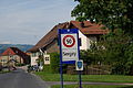
Sergey
| Sergey | |
|---|---|
 |
|
| State : |
|
| Canton : |
|
| District : | Jura north vaudois |
| BFS no. : | 5762 |
| Postal code : | 1355 |
| Coordinates : | 528 281 / 178.17 thousand |
| Height : | 612 m above sea level M. |
| Height range : | 542–637 m above sea level M. |
| Area : | 1.46 km² |
| Residents: | 146 (December 31, 2018) |
| Population density : | 100 inhabitants per km² |
| Website: | www.sergey.ch |
_280.JPG) Sergey |
|
| Location of the municipality | |
  |
|
Sergey is a municipality in the Jura-Nord vaudois district in the canton of Vaud in Switzerland .
geography
Sergey is 612 m above sea level. M. , 4 km northwest of Orbe and 11 km west-southwest of the district capital Yverdon-les-Bains (beeline). The farming village extends on the Jura foot plateau between the Orbe plain and the Jura.
The area of the municipality, which is just 1.5 km² in size, includes a section of the Jura foot plateau. In the Bois Gillard is at 640 m above sea level. M. reached the highest point of Sergey. In the south, the municipality extends to the edge of the Chassagne forest , while in the east the Ruisseau du Vua brook and a right side valley are sunk into the plateau. In 1997, 12% of the municipal area was accounted for by settlements, 23% for forests and woodlands and 65% for agriculture.
The neighboring municipalities of Sergey are Rances in the north, Valeyres-sous-Rances in the east, Montcherand in the south-southeast , Les Clées in the south and L'Abergement in the west .
population
With 146 inhabitants (as of December 31, 2018), Sergey is one of the smallest municipalities in the canton of Vaud. 98.2% of the residents are French-speaking, 0.9% German-speaking and 0.9% speak Dutch (as of 2000). The population of Sergey in 1900 was 113 people. Thereafter, a decrease to 71 inhabitants was recorded by 1970, since then the population has increased again slightly.
economy
Sergey is still an agricultural village today . On the fertile soils of the Jura foot plateau mainly arable farming is practiced, in the vicinity of the village there are also fruit trees . The local small business offers a few more jobs. There is a larger gravel pit to the south-east of the village. Since Sergey has gradually developed into a residential community over the past few decades, many employed people are commuters who work mainly in Orbe or Yverdon .
traffic
The community is located away from the major thoroughfares. The main access is from Orbe . Sergey is connected to the public transport network through the Postbus course, which runs from Orbe to Vallorbe .
history
A grave mound from the late Iron Age testifies to an early settlement of the municipality. The village was probably built at the beginning of the 14th century. In the Middle Ages , Sergey was part of the Les Clées reign . With the conquest of Vaud by Bern in 1536, the village became part of the Kastlanei Les Clées under the governor of Yverdon. After the collapse of the Ancien Régime , Sergey belonged to the canton of Léman from 1798 to 1803 during the Helvetic Republic, which then became part of the canton of Vaud when the mediation constitution came into force . It was assigned to the Orbe district in 1798.
photos
Entrance
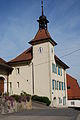
school
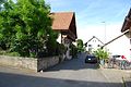
Village center

Village square
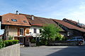
Row of houses in the village center
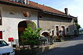
Village center
_262.JPG)
_269.JPG)
_272.JPG)
_265.JPG)
_276.JPG)
_279.JPG)
Web links
- Sergey Municipality Official Website (French)
- Pierre-Yves Favez: Sergey. In: Historical Lexicon of Switzerland .
Individual evidence
- ↑ Permanent and non-permanent resident population by year, canton, district, municipality, population type and gender (permanent resident population). In: bfs. admin.ch . Federal Statistical Office (FSO), August 31, 2019, accessed on December 22, 2019 .
L'Abbaye | L'Abergement | Agiez | Arnex-sur-Orbe | Ballaigues | Baulmes | Bavois | Belmont-sur-Yverdon | Bioley-Magnoux | Bofflens | Bonvillars | Bretonnières | Bullet | Chamblon | Champagne | Champvent | Chavannes-le-Chêne | Chavornay | Chêne-Pâquier | Le Chenit | Cheseaux-Noréaz | Les Clées | Concise | Corcelles-près-Concise | Cronay | Croy | Cuarny | Démoret | Donneloye | Ependes | Fiez | Fontaines-sur-Grandson | Giez | Grand event | Grandson | Juriens | Le Lieu | Lignette roll | Mathod | Mauborget | Molondine | Montagny-près-Yverdon | Montcherand | Mutrux | Novalles | Onnens | Orbe | Orges | Orzens | Pomy | La Praz | Premier | Provence | Rances | Romainmôtier-Envy | Rovray | Sainte-Croix | Sergey | Suchy | Suscévaz | Tévenon | Treycovagnes | Ursins | Valeyres-sous-Montagny | Valeyres-sous-Rances | Valeyres-sous-Ursins | Vallorbe | Vaulion | Villars-Epeney | Vugelles-La Mothe | Vuiteboeuf | Yverdon-les-Bains | Yvonand
Former municipalities: Arrissoules | Chanéaz | Corcelles-sur-Chavornay | Envy | Essert-Pittet | Essert-sous-Champvent | Fontanezier | Gossens | Gressy | Mézery-près-Donneloye | Prahins | Romainmôtier | Romairon | Vaugondry | Villars-Burquin | Villars-sous-Champvent
Canton of Vaud | Districts of the canton of Vaud | Municipalities of the canton of Vaud