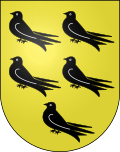
Corcelles-sur-Chavornay
| Corcelles-sur-Chavornay | ||
|---|---|---|
| State : |
|
|
| Canton : |
|
|
| District : | Jura north vaudois | |
| Municipality : | Chavornay | |
| Postal code : | 1374 | |
| former BFS no. : | 5751 | |
| Coordinates : | 535 865 / 172803 | |
| Height : | 558 m above sea level M. | |
| Area : | 5.48 km² | |
| Residents: | 353 (December 31, 2015) | |
| Population density : | 64 inhabitants per km² | |
| Website: | www.chavornay.ch | |
|
Corcelles-sur-Chavornay church |
||
| map | ||
|
|
||
Corcelles-sur-Chavornay was a municipality in the Jura-Nord vaudois district of the canton of Vaud in Switzerland until December 31, 2016 . On January 1, 2017, Corcelles-sur-Chavornay merged with the municipality of Essert-Pittet to form the new municipality of Chavornay .
geography
Corcelles-sur-Chavornay is 558 m above sea level. M. , six kilometers east-southeast of Orbe and nine kilometers south-southwest of the district capital Yverdon-les-Bains (as the crow flies). The clustered village extends on a gently sloping westward slope above Chavornay, around 100 m above the Orbe plain , in the Vaud Central Plateau .
The 5.5 km² municipal area covers a section of the Vaud Central Plateau. The western part of the municipality includes the open slope of Corcelles-sur-Chavornay with the source streams of the Ruisseau de Sadaz . In the north, the Ruisseau des Combes stream forms the border in sections. To the east, the municipality extends to the broad, wooded ridge between the Orbe plain and the valley of the upper Buron . The ridge forms a northern branch of the Gros de Vaud plateau . A narrow corner of the area extends beyond the Buron stream. In the forest area Bois Désert is 620 m above sea level. M. the highest point of Corcelles-sur-Chavornay reached. In 1997, 5% of the municipal area was accounted for by settlements, 30% for forests and woodland and 65% for agriculture.
Corcelles-sur-Chavornay has a number of individual farms. The neighboring communities of Corcelles-sur-Chavornay in the West Chavornay , north Suchy , northeast Essertines-sur-Yverdon , southeast Vuarrens and south Penthéréaz .
population
With 353 inhabitants (as of December 31, 2015) Corcelles-sur-Chavornay is one of the small communities in the canton of Vaud. 92.8% of the residents are French-speaking, 4.9% German-speaking and 1.0% Spanish-speaking (as of 2000). The population of Corcelles-sur-Chavornay was 336 in 1850 and 307 in 1900. After the population had decreased to 233 by 1970, an increasing trend has been observed since then.
economy
Corcelles-sur-Chavornay was a predominantly agricultural village until the second half of the 20th century . Even today, the have farming and fruit growing an important role in the employment structure of the population. There is a small wine-growing area on a southern slope below the village .
Since the 18th century there was a brickworks on the ridge west of the Burontal, which was in operation until 1909. From the mid-19th century until after 1900, Corcelles-sur-Chavornay made clocks at home. Today there are relatively few jobs outside the primary sector in local small businesses and in the service sector. A recovery clinic has been located in Pré Carré since 1924. In the last few decades the village has developed into a residential community. Many workers are therefore commuters who work in the Yverdon-les-Bains area and in the greater Lausanne area .
traffic
The community has good transport connections. It is located on a connection road from Chavornay to Vuarrens ; There are also good connections to the other neighboring villages. The Chavornay motorway junction on the A1 (Lausanne-Yverdon) opened in 1981 is only around 2 km from the town center. Corcelles-sur-Chavornay is connected to the public transport network by a postbus course that runs from Chavornay to Echallens .
history
The place was first mentioned in a document in 885 under the name Corceles . The names Corzales (1228), Courcelle (1397) and Courselles (1433) appeared later . The place name is derived from the Latin word corticella (small courtyard).
Corcelles-sur-Chavornay belonged in the Middle Ages to the Kingdom of Upper Burgundy . Since the 12th century it was under the rule of Bavois and came under the influence of Savoy after 1263 . As part of an inheritance division, the village broke away from Bavois in 1520 and henceforth formed its own small lordship.
With the conquest of Vaud by Bern in 1536, Corcelles-sur-Chavornay came under the administration of the Yverdon bailiffs. After the collapse of the Ancien Régime , the village belonged to the canton of Léman from 1798 to 1803 during the Helvetic Republic, which then became part of the canton of Vaud when the mediation constitution came into force . In 1798 it was assigned to the Orbe district.
Attractions
The current building of the parish church mentioned in the 13th century was built in 1754. The castle with a central tower dates from the 17th century. It was a rest home from 1884 to 1963; today it houses rental apartments. Some characteristic farmhouses from the 17th to 19th centuries have been preserved in the town center.
Web links
- Official website of the municipality of Corcelles-sur-Chavornay (French)
- Anne Rochat-Morel: Corcelles-sur-Chavornay. In: Historical Lexicon of Switzerland .
- Aerial photography
Individual evidence


