Echallens
| Echallens | |
|---|---|
| State : |
|
| Canton : |
|
| District : | Gros-de-Vaud |
| BFS no. : | 5518 |
| Postal code : | 1040 |
| Coordinates : | 538 258 / 165891 |
| Height : | 617 m above sea level M. |
| Height range : | 591–673 m above sea level M. |
| Area : | 6.66 km² |
| Residents: | 5740 (December 31, 2018) |
| Population density : | 862 inhabitants per km² |
| Unemployment rate : | 3.4% (May 31, 2,015) |
| Website: | www.echallens.ch |
|
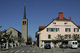
Saint Jean Catholic Church |
|
| Location of the municipality | |
Echallens ([ eʃalɑ̃ ] or [ ɛʃalɑ̃ ], in the native Franco-Provencal dialect [ (a) ɛʦaˈlɛː ]) is a political municipality and capital of the Gros-de-Vaud district in the canton of Vaud in Switzerland . The former German name Tscherlitz was mainly used between the 16th and 18th centuries, but is not in use today.
geography
Echallens is 617 m above sea level. M. , 14 km north of the canton capital Lausanne (linear distance). The municipality extends over the extensive plateau of the central Gros de Vaud , on both sides of the Talent River , on the northwestern edge of the heights of the Jorat , in the Vaudois Plateau .
The area of the 6.7 km² municipal area includes a section of the gently undulating plateau des Gros de Vaud, the granary of the canton of Vaud. The area is traversed from east to west by the Talent, which emerges from the heights of the Jorat above Echallens and forms only a 10 to 20 m deep valley in the area of the village. The plateau around Echallens has very little relief. In the extreme south-west, the municipality extends into the valley of the Mortigue (a tributary of the Talent). The only larger elevation is in the southeast in the wooded area of the Bois de la Commune , in which at 672 m above sea level. M. the highest point of Echallens is reached. In 1997, 18% of the municipal area was in settlements, 13% in forests and woodlands, 68% in agriculture and a little less than 1% was unproductive land.
Echallens includes extensive new residential areas and a few individual courtyards. Neighboring municipalities to Echallens are Villars-le-Terroir , Poliez-le-Grand , Bottens , Assens , Saint-Barthélemy and Goumoëns .
population
With 5740 inhabitants (as of December 31, 2018) Echallens is one of the medium-sized municipalities in the canton of Vaud. 89.1% of the residents are French-speaking, 2.9% German-speaking and 2.1% Portuguese-speaking (as of 2000). The population of Echallens was 957 inhabitants in 1850 and 1096 inhabitants in 1900. After a slow but continuous growth until 1970 (1643 inhabitants), an increased development spurt began, combined with a tripling of the population within 30 years.
economy
Echallens is a regional commercial and administrative center and the center of the fertile agricultural area of the Gros de Vaud. Up until the end of the 19th century, Echallens was a predominantly agricultural village. Today arable farming and fruit growing only play a marginal role in the income structure of the population.
Industrialization began in Echallens towards the end of the 19th century, but affected the place far less than other Vaudois communities of comparable size. Therefore, the community developed slowly into an industrial location. Around 1910 the industry was mainly characterized by the processing of agricultural products; there were also mechanical engineering, metal construction and textile industries.
The economic upswing began in the 1970s with the creation of new industrial zones. Today there are numerous small and medium-sized enterprises that focus on construction, mechanical engineering (especially agricultural machinery), transport, horticulture, computer technology and mechanical workshops.
The service sector accounts for the majority of jobs (almost 70%). There are numerous jobs in administration, in banking and insurance as well as in the catering and hotel industries. Echallens is the seat of the district court and the location of an agricultural cooperative with grain silos.
In the last few decades the village has developed into a residential community thanks to its good transport links and attractive location. Extensive new residential areas emerged mainly on the eastern edge of Echallens to the right of the Talent and in the south. Some employees are therefore commuters who work in the greater Lausanne area .
Education and sport
As a regional center, Echallens has all school levels from primary school to high school. In 1977 a new school center was opened. There are also numerous sports facilities in the village (including tennis courts, soccer fields and a fitness center). The most famous sports club in Echallens is FC Echallens .
traffic
The community has good transport connections. It is located on the main road 5 from Lausanne via Echallens to Yverdon-les-Bains . The La Sarraz motorway junction on the A1 (Lausanne – Yverdon) opened in 1981 is around 7 km from the town center.
On June 2, 1874, the Cheseaux-sur-Lausanne - Echallens section of the Chemin de fer Lausanne-Echallens-Bercher (LEB) narrow-gauge railway was put into operation. The continuation of this line to Bercher was inaugurated on November 24, 1898. In addition to the train station, there are the Sur Roche and Grésaley stops on the outskirts of Echallens. The bus routes to Chavornay , Yverdon and Thierrens ensure the fine distribution of public transport .
history
The municipality of Echallens was settled very early. Remains of a Bronze Age foundry and burial grounds from the La Tène period and the early Middle Ages were discovered.
The first written mention of the place took place in 1141 under the name Charlens . Later the names Challeins , Escharlens (1177), Eschallens (1228), Eschalleins (1279), first Echallens (1315), then Echalans (1381) and Echallan (1414). The place name goes back to the personal name Carl (today French Charles ) and means for the people of Carl .
Originally the place belonged to the Bishop of Lausanne. At the end of the 12th century, the lords of Montfaucon, a branch of the Counts of Montbéliard in the Free County of Burgundy , established the rule of Echallen and had the castle built in the second half of the 13th century. In 1317, the sovereignty of the House of Savoy over the lordship of Echallen was recognized by the de Montfaucon family. The patch that had developed around the castle over the years was surrounded by a curtain wall around 1350, and Echallens was granted city rights in 1351. Since then, a weekly market has been held in the town, but from the 16th century onwards, due to the relatively minor importance of Echallens, it was only held irregularly.
In 1410, the rule of Echallens passed to the House of Chalon , which came from Burgundy. That is why the Confederates seized this rule after the Burgundian Wars and in 1476 placed it under the joint administration of Friborg , Bern and the seven other places. In the Beromünster Treaty of 1484, Bern released the rights of these seven places on Echallens by paying compensation. From then on, the Orbe-Echallens Bailiwick, to which the former territory of Echallens belonged and the city of Orbe and the village of Mex belonged as exclaves , was under the joint administration of Bern and Freiburg. Every five years, Bern or Freiburg provided the bailiff, who had his seat in Echallens.
Due to the joint rule of Catholic Freiburg and Bern, which has been Protestant since the Reformation , the latter was unable to enforce the Reformation in the Orbe-Echallens Bailiwick. The area therefore remained mostly Catholic for a long time, and numerous churches, including those of Echallens, were used equally for more than 300 years.
After the collapse of the Ancien Régime , Echallens belonged to the canton of Léman from 1798 to 1803 during the Helvetic Republic , which then became part of the canton of Vaud when the mediation constitution came into force . For some time it was even discussed whether Echallens should become the capital of the new canton of Vaud as a counterweight to the center of Lausanne. Since 1798 it has been the district capital of the newly created district of Echallens.
Attractions
Echallens Castle was built on a small hill in the second half of the 13th century. It was sacked by the Confederates in 1475. After it was rebuilt, it served as a residence for the Orbe-Echallens bailiffs. Today only a round tower remains from the medieval building, the north wing was built in 1719. Since 1816 the castle has been owned by the municipality, which housed the municipal administration and a primary school in it.
Although a church was mentioned in Echallens as early as 1141, today's church buildings are relatively new. On the site of the parity church from 1727, today's Catholic church was built in 1883. The reformed church dates from 1865.
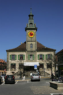
Nothing is left of the former walling of the town. The Hôtel de Ville (town hall) was built in 1781. Some town and patrician houses from the 17th to 19th centuries have been preserved in the center, including the Bezenson house and the Hôtel des Balances. In 1989 the Maison du Blé et du Pain (Craft Museum) was inaugurated. This is where Le Chemin des Blés begins.
Personalities
Sons and Daughters of the Church:
- Hans Hurni (1926–2017), banker and football official
- Michel Mayor (* 1942), professor of astronomy and co-discoverer of the first extrasolar planet
- Gabriel Wüthrich (* 1981), soccer goalkeeper
- Léna Mettraux (* 1998), cyclist
Web links
- Official website of the municipality of Echallens (French)
- Marianne Stubenvoll: Echallens (municipality). In: Historical Lexicon of Switzerland .
- Aerial photography
- Castle world: Château d'Echallens
- Echallens Castle (French)
- Website of the Maison du Blé et du Pain
Individual evidence
- ↑ Permanent and non-permanent resident population by year, canton, district, municipality, population type and gender (permanent resident population). In: bfs. admin.ch . Federal Statistical Office (FSO), August 31, 2019, accessed on December 22, 2019 .
- ↑ Demandeurs d'emploi, chômeurs et taux de chômage par commune. ( XLS , 115 kB) Statistique Vaud, Département des finances et des relations extérieures (Statistics Vaud, Department of Finance and Foreign Affairs), accessed on June 14, 2015 (French).
- ↑ Nicolas Pépin, Échallens VD (Échallens) in: Dictionnaire toponymique des communes suisses - Lexicon of Swiss community names - Dizionario toponomastico dei comuni svizzeri (DTS | LSG) , Center de dialectologie, Université de Neuchâtel, Verlag Huber, Frauenfeld / Stuttgart / Vienna 2005 , ISBN 3-7193-1308-5 and Éditions Payot, Lausanne 2005, ISBN 2-601-03336-3 , p. 310.
- ↑ Le Chemin des Blés
- ↑ Philippe Jaton: Chemin des Bles. The temples en chapelles sur le Chemin des Blés. (Swiss Art Guide, No. 693, Series 70). Ed. Society for Swiss Art History GSK. Bern 2001, ISBN 978-3-85782-693-1 .


