
Penthaz
| Penthaz | |
|---|---|
 |
|
| State : |
|
| Canton : |
|
| District : | Gros-de-Vaud |
| BFS no. : | 5496 |
| Postal code : | 1303 |
| UN / LOCODE : | CH PEN |
| Coordinates : | 530995 / 161 338 |
| Height : | 482 m above sea level M. |
| Height range : | 413-529 m above sea level M. |
| Area : | 3.84 km² |
| Residents: | 1749 (December 31, 2018) |
| Population density : | 455 inhabitants per km² |
| Website: | www.penthaz.ch |
 Reformed Church of Penthaz |
|
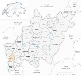
| Location of the municipality | |
  |
|
Penthaz is a municipality in the Gros-de-Vaud district in the canton of Vaud in Switzerland .
geography
Penthaz is 482 m above sea level. M. , 3 km south-east of Cossonay and 12 km north-west of the canton capital Lausanne (linear distance). The clustered village extends on a slope sloping to the west over the valley of the Venoge , in the Gros de Vaud , in the Waadtländer Mittelland .
The area of the 3.9 km² municipal area includes a section of the Gros de Vaud, the granary of the canton of Vaud. The municipality extends from the Venoge floodplain eastwards over the slope of Penthaz to the high plateau of the Gros de Vaud, on which at 526 m above sea level. M. the highest point of the municipality is reached (on the Montilier corridor ). The eastern boundary is temporarily the A1 motorway. In 1997, 17% of the municipal area was in settlements, 13% in forests and woodlands, 69% in agriculture and a little less than 1% was unproductive land.
Several new housing estates belong to Penthaz. The neighboring communities of Penthaz are in the north Penthalaz , in the north-northeast Daillens , east Bournens , southeast Sullens , south Vufflens-la-Ville and in the West Gollion .
population
With 1749 inhabitants (as of December 31, 2018), Penthaz is one of the medium-sized municipalities in the canton of Vaud. 89.4% of the residents are French-speaking, 3.8% German-speaking and 2.5% Italian-speaking (as of 2000). The population of Penthaz was 259 in 1900. Since 1960 (270 inhabitants) a rapid increase in population with a fivefold increase in the number of inhabitants has been observed within 40 years.
economy
Until the second half of the 20th century, Penthaz was a predominantly agricultural village. Today arable farming and fruit growing only play a subordinate role in the income structure of the population. There is a gravel pit in the south of the municipality.
Since the 1960s, the economic structure of Penthaz has been massively changed with the creation of two industrial zones. Today, companies in the building trade, IT, mechanical workshops and a wine shop have established themselves in the village. The archiving center of the Cinémathèque Suisse is located in Penthaz. In the last few decades the village has developed into a residential community. Many workers are therefore commuters who mainly work in the neighboring towns of Cossonay and Penthalaz and in the greater Lausanne area .
traffic
The community has good transport connections. It is located on the main road 9 from Lausanne via Cossonay to Vallorbe . The Cossonay motorway junction on the A1 (Lausanne-Yverdon) opened in 1981 is around 1.5 km from the town center. Penthaz is connected to the public transport network through a PostBus course that runs from Cossonay-Gare to Cheseaux-sur-Lausanne . A local bus line also connects the village with the train station in Cossonay-Gare and with the neighboring villages of Penthalaz and Daillens.
history
Traces from Roman times have been discovered in the municipality , the road from Lausanne to Orbe led past Penthaz. The place was first mentioned in a document in 1011 under the name Penta . The spellings Pentha and Penthaz have been handed down since 1574 . The name refers to a place on the slope (French pente = slope, slope).
Since the Middle Ages, Penthaz belonged to the dominion of Cossonay and after 1420 to the Savoyard Castlanei Cossonay. With the conquest of Vaud by Bern in 1536, the village came under the administration of the Bailiwick of Morges . After the collapse of the Ancien Régime , Penthaz belonged to the canton of Léman from 1798 to 1803 during the Helvetic Republic, which then became part of the canton of Vaud when the mediation constitution came into force . In 1798 it was assigned to the Cossonay district.
Attractions
The church of Penthaz is mentioned as early as 1228. As part of a restoration in 1922, the remains of the Romanesque church were found. Penthaz Castle is a manor house that was built around the middle of the 18th century. In the town center there are some typical farmhouses from the 17th to 19th centuries.
Web links
- Official website of the municipality of Penthaz (French)
- François Béboux: Penthaz. In: Historical Lexicon of Switzerland .
- Community information
- Aerial photography
- Cinémathèque Suisse website (French)
Individual evidence
- ↑ Permanent and non-permanent resident population by year, canton, district, municipality, population type and gender (permanent resident population). In: bfs. admin.ch . Federal Statistical Office (FSO), August 31, 2019, accessed on December 22, 2019 .
Assens | Bercher | Bettens | Bioley-Orjulaz | Bottens | Boulens | Bournens | Boussens | Bretigny-sur-Morrens | Cugy | Daillens | Echallens | Essertines-sur-Yverdon | Etagnières | Fey | Froideville | Goumoëns | Jorat-Menthue | Lussery-Villars | Mex | Montanaire | Morrens | Montilliez | Ogens | Oppens | Oulens-sous-Echallens | Pailly | Penthalaz | Penthaz | Penthéréaz | Poliez-Pittet | Rueyres | Saint Barthélemy | Sullens | Villars-le-Terroir | Vuarrens | Vufflens-la-Ville
Former municipalities: Chapelle-sur-Moudon | Correvon | Denezy | Dommartin | Eclagnens | Goumoens-la-Ville | Goumoens-le-Jux | Lussery | Malapalud | Martherenges | Montaubion Chardonney | Naz | Neyruz-sur-Moudon | Peney-le-Jorat | Peyres-Possens | Poliez-le-Grand | Saint-Cierges | Sottens | Sugnens | Thierrens | Villars-Lussery | Villars-Mendraz | Villars-Tiercelin
Canton of Vaud | Districts of the canton of Vaud | Municipalities of the canton of Vaud