
Pompaples
| Pompaples | |
|---|---|
 |
|
| State : |
|
| Canton : |
|
| District : | Morges |
| BFS no. : | 5497 |
| Postal code : | 1318 |
| UN / LOCODE : | CH PPA |
| Coordinates : | 528 976 / 168804 |
| Height : | 490 m above sea level M. |
| Height range : | 437-582 m above sea level M. |
| Area : | 4.44 km² |
| Residents: | 847 (December 31, 2018) |
| Population density : | 191 inhabitants per km² |
| Website: | www.pompaples.ch |
 Aerial view |
|
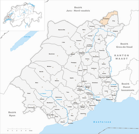
| Location of the municipality | |
  |
|
Pompaples is a municipality in the Morges district in the canton of Vaud in Switzerland . Due to its location on the Mediterranean - North Sea watershed , Pompaples is also called "Le milieu du Monde" ("Center of the World").
geography
Pompaples is 490 m above sea level. M. , 1 km north of La Sarraz and 18 km north of the district capital Morges (as the crow flies). The former street-line village extends on both sides of the Nozon , at the foot of the Jura , in the Vaudois Central Plateau .
The 4.5 km² municipal area covers a section of the Vaud Central Plateau. The southwestern part lies in the area of the Jura foot plateau, in which the Nozon has carved a valley; here are the easily accessible climbing rocks of Saint-Loup. On the plateau north of the Nozon valley is 583 m above sea level. M. reached the highest point of Pompaples. The southern border runs on a ridge that forms the watershed between the catchment areas of the Rhine and Rhone . To the northeast, the municipality extends over the slopes of the Jura foot plateau, which slopes down to the Orbe plain, and is subdivided by the Orgevaux valley . The outermost north-east part lies in the lowlands of the intensely agriculturally used Plaine de l'Orbe, in which the Entreroches Canal marks the border. In 1997, 9% of the municipal area was in settlements, 18% in forests and woodlands, 72% in agriculture and a little less than 1% was unproductive land.

The settlement of Saint-Loup ( 525 m above sea level ) south of the Nozon Valley and a few individual farms belong to Pompaples . The neighboring municipalities of Pompaples are La Sarraz , Arnex-sur-Orbe , Bavois and Orny .
population
With 847 inhabitants (as of December 31, 2018) Pompaples is one of the smaller municipalities in the canton of Vaud. 90.0% of the residents are French-speaking, 2.5% Portuguese-speaking and 2.4% German-speaking (as of 2000). The population of Pompaples was 349 in 1900. A continuous increase in population has been observed since 1980 (544 inhabitants).
economy
Until the 20th century, Pompaples was a predominantly agricultural village. Today arable farming and fruit growing only play a subordinate role in the income structure of the population. Further jobs are available in local small businesses and in the service sector. There is a company in the village that specializes in the construction of swimming pools and a landscape gardening company. The Moulin de Bornu mill , founded in the 16th century, ceased operations in the mid-20th century. A canal was created from the Nozon to this mill. Below the mill, part of the water flows back into the Nozon and thus to the Rhine, while the other over the here only at 490 m above sea level. M. lying main watershed to the Venoge (catchment area of the Rhône). That is why Pompaples is also known as Milieu du monde (middle of the world).
The Saint-Loup Hospital was founded in 1852 and was managed by the Vaudois deaconesses until 1956. The hospital, the largest employer in the village, also has a nursing school.
traffic
The community has good transport connections. It is located on the main road 9 from Lausanne to Vallorbe . The La Sarraz motorway junction on the A1 (Lausanne-Yverdon) opened in 1981 is around 6 km from the town center. The Cossonay-Vallorbe railway line passes Pompaples but has no train station; the nearest train station is in La Sarraz . The village is connected to the public transport network through a postbus course that runs from La Sarraz via Pompaples to the Saint-Loup Hospital.
history
The first written mention of the place took place in 1049 under the name Pons Papuli . The names Pompaploz (in the 14th century) and Pompapuli (end of the 15th century) also appeared later . The etymology of the place name is controversial. The name goes back either to the Latin pons (bridge) and Papulus (a Geneva bishop of the 6th century) or also to the Latin word populus (poplar).
Pompaples was part of the La Sarraz dominion since the Middle Ages . With the conquest of Vaud by Bern in 1536, the village came under the administration of the Bailiwick of Romainmôtier . After the collapse of the Ancien Régime , Pompaples belonged to the canton of Léman from 1798 to 1803 during the Helvetic Republic, which then became part of the canton of Vaud when the mediation constitution came into force . In 1798 it was assigned to the Cossonay district.
Attractions

Some characteristic farmhouses from the 17th to 19th centuries have been preserved in the town center. Pompaples does not have its own church, it belongs to the parish of La Sarraz.
The Moulin Bornu house ("au milieu du monde") has a pond, one of which flows into the North Sea and the other into the Mediterranean .
Born in Pompaples
- Christophe Bertschy (* 1970), comic book artist and illustrator
- Danilo Wyss (* 1985), racing cyclist
Web links
- Official website of the municipality of Pompaples (French)
- Patrick-R. Monbaron: Pompaples. In: Historical Lexicon of Switzerland .
- Aerial photography
Individual evidence
- ↑ Permanent and non-permanent resident population by year, canton, district, municipality, population type and gender (permanent resident population). In: bfs. admin.ch . Federal Statistical Office (FSO), August 31, 2019, accessed on December 22, 2019 .
- ↑ Switzerland, 1974: "au milieu du monde". Retrieved October 19, 2019 .
Aclens | Allaman | Apple's | Aubonne | Bale | Berolle | Bière | Bougy-Villars | Bremblens | Buchillon | Bussy Chardonney | La Chaux (Cossonay) | Chavannes-le-Veyron | Chevilly | Chigny | Clarmont | Cossonay | Cottens | Cuarnens | Denens | Denges | Dizy | Echandens | Echichens | Eclépens | Etoy | Féchy | Ferreyres | Gimel | Gollion | Grancy | L'Isle | Lavigny | Lonay | Lully | Lussy-sur-Morges | Mauraz | Moiry | Mollens | Montherod | Mont-la-Ville | Montricher | Morges | Orny | Pampigny | Pompaples | Préverenges | Reverolle | Romanel-sur-Morges | Saint-Livres | Saint-Oyens | Saint-Prex | La Sarraz | Saubraz | Senarclens | Sévery | Tolochenaz | Vaux-sur-Morges | Villars-sous-Yens | Vufflens-le-Château | Vullierens | Yens
Former municipalities: Bussy-sur-Morges | Chardonney-sur-Morges | Colombier | Monnaz | Pizy | Saint-Saphorin-sur-Morges
Municipalities that moved to the District de Ouest Lausanne on January 1st, 2008 : Bussigny-près-Lausanne | Chavannes-près-Renens | Ecublens | Saint-Sulpice | Villars-Sainte-Croix
Canton of Vaud | Districts of the canton of Vaud | Municipalities of the canton of Vaud