
Gimel VD
| VD is the abbreviation for the canton of Vaud in Switzerland and is used to avoid confusion with other entries of the name Gimel . |
| Gimel | |
|---|---|
 |
|
| State : |
|
| Canton : |
|
| District : | Morges |
| BFS no. : | 5428 |
| Postal code : | 1188 |
| Coordinates : | 513353 / 151 345 |
| Height : | 730 m above sea level M. |
| Height range : | 670–1496 m above sea level M. |
| Area : | 18.88 km² |
| Residents: | 2190 (December 31, 2018) |
| Population density : | 116 inhabitants per km² |
| Website: | www.gimel.ch |
 Gimel |
|
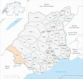
| Location of the municipality | |
  |
|
Gimel ([ ʒimɛl ], in the native Franco-Provençal dialect [ (a) ʣəˈmœː ]) is a municipality in the Morges district of the canton of Vaud in Switzerland .
geography
Gimel is 730 m above sea level. M. , sixteen kilometers west of the district capital Morges (as the crow flies). The clustered village extends slightly above the Saubrette valley , at the southern foot of the Jura and on the upstream Jura foot plateau.
The area of the 18.9 km² municipal area includes a section of the southern slopes of the Jura and the Vaud Jura. The southern part of the municipality is occupied by the Saubrette, a side stream of the Aubonne . In the very south, the area includes a small section of the Jura foot plateau with the Bois des Ursins and the Ruisseau des Rotières stream (which at times forms the southern border). In addition, Gimel owns a small portion of the Prévondavaux valley , which once served as a meltwater channel for the Ice Age Rhone glacier . To the north, the municipality extends over the Mont Chaubert ( 1090 m above sea level ), a forest height in front of the Jura, and the densely wooded headwaters of the Toleure up to the crest of the anticlines of the Mont-Tendre chain . The northern border runs on the Col du Marchairuz pass and over the Monts de Bière , on which 1490 m above sea level. M. the highest point of Gimel is reached. The only larger forest clearing on the ridge is the Pré d'Aubonne , a typical Jura high pasture with spruce trees standing individually or in groups . In 1997, 5% of the municipal area was in settlements, 62% in forests and woodland, 32% in agriculture and a little less than 1% was unproductive land.
Gimel includes the hamlets of La Rosière ( 731 m above sea level ), Sept-Fontaines ( 741 m above sea level ) and Bauloz ( 840 m above sea level ), all on the slope of Mont Chaubert, as well as numerous individual farms. Gimel's neighboring municipalities are Bière , Saubraz , Montherod , Aubonne , Essertines-sur-Rolle , Saint-Oyens , Longirod , Saint-George and Le Chenit .
population
With 2190 inhabitants (as of December 31, 2018), Gimel is one of the medium-sized municipalities in the canton of Vaud. 88.7% of the residents are French-speaking, 2.7% German-speaking and 2.4% Italian-speaking (as of 2000). The population of Gimel was 820 in 1850 and 797 in 1900. Since then, there has been a steady increase in population.
economy
Up until the beginning of the 20th century, Gimel was a predominantly agricultural village. Today agriculture plays only a subordinate role as a branch of the population. On the agricultural areas at the foot of the Jura, arable farming predominates, while cattle and dairy farming are practiced on the highlands . Due to the large area of forest, forestry also has a certain importance. Further jobs are available in local trade (craft businesses) and in the service sector. In the last few decades the village has developed into a residential community. Many workers are therefore commuters who go to work in the larger towns along Lake Geneva. Another important employer is the Hôpital psychogériatrique de Gimel, where 80 patients are cared for by 110 employees.
traffic
The community has good transport connections. It is on the main road that leads from Aubonne via Gimel over the Col du Marchairuz into the Vallée de Joux . Gimel is connected to the towns on Lake Geneva by the postbus lines to Nyon , Rolle and Aubonne , and another postbus course runs via Bière to L'Isle .
In the first half of the 20th century, Gimel was the terminus of the electric overland tram lines Rolle - Gimel (RG, in operation from 1898 to 1938) and Allaman - Aubonne - Gimel (AAG, in operation from 1898 to 1950).
history
Gimel can look back on a very long tradition of settlement. Bowl stones from the Neolithic , traces from the Bronze Age , Iron Age graves and the remains of a Roman settlement were found in the municipality . The place was first mentioned in a document in 979 under the name Gemella . The names Gimellis (1051), Gemes (1139), Gimelz (1172), Gimez (1265), Gemels (1285), Gemello (1299) and Gymelz (1494) appeared later . The place name is derived from the Latin word gemella ( twin ).
In the Middle Ages , the Abbey of Saint-Maurice and then the Monastery of Romainmôtier owned rich land in the municipality of Gimel . The village probably came to the Lords of Aubonne in 1357. Since the conquest of Vaud by Bern in 1536, Gimel shared the fortunes of Aubonne and in 1701 came to the Aubonne Bailiwick. It formed its own court in it. After the collapse of the Ancien Régime , the village belonged to the canton of Léman from 1798 to 1803 during the Helvetic Republic, which then became part of the canton of Vaud when the mediation constitution came into force . In 1798 it was assigned to the Aubonne district.
In the 19th century Gimel developed into a spa and bathing resort after an alkaline spring was discovered. This also led to the development of traffic with two electric railways from Rolle and Aubonne.
Attractions
The parish church of Saint-Pierre, which was mentioned in the 12th century, was redesigned in the 17th century. The rectory, which was renovated in 1956, dates back to the Middle Ages. Some farmhouses from the 17th to 19th centuries have been preserved in the town center.
Web links
- Official website of the municipality of Gimel (French)
- Germain Hausmann: Gimel. In: Historical Lexicon of Switzerland .
- Aerial photography
Individual evidence
- ↑ Permanent and non-permanent resident population by year, canton, district, municipality, population type and gender (permanent resident population). In: bfs. admin.ch . Federal Statistical Office (FSO), August 31, 2019, accessed on December 22, 2019 .
- ↑ Chantal Schüle-Marro, Gimel VD (Aubonne) in: Dictionnaire toponymique des communes suisses - Lexicon of Swiss community names - Dizionario toponomastico dei comuni svizzeri (DTS | LSG) , Center de dialectologie, Université de Neuchâtel, Verlag Huber, Frauenfeld / Stuttgart / Vienna 2005, ISBN 3-7193-1308-5 and Éditions Payot, Lausanne 2005, ISBN 2-601-03336-3 , p. 388.
Aclens | Allaman | Apple's | Aubonne | Bale | Berolle | Bière | Bougy-Villars | Bremblens | Buchillon | Bussy Chardonney | La Chaux (Cossonay) | Chavannes-le-Veyron | Chevilly | Chigny | Clarmont | Cossonay | Cottens | Cuarnens | Denens | Denges | Dizy | Echandens | Echichens | Eclépens | Etoy | Féchy | Ferreyres | Gimel | Gollion | Grancy | L'Isle | Lavigny | Lonay | Lully | Lussy-sur-Morges | Mauraz | Moiry | Mollens | Montherod | Mont-la-Ville | Montricher | Morges | Orny | Pampigny | Pompaples | Préverenges | Reverolle | Romanel-sur-Morges | Saint-Livres | Saint-Oyens | Saint-Prex | La Sarraz | Saubraz | Senarclens | Sévery | Tolochenaz | Vaux-sur-Morges | Villars-sous-Yens | Vufflens-le-Château | Vullierens | Yens
Former municipalities: Bussy-sur-Morges | Chardonney-sur-Morges | Colombier | Monnaz | Pizy | Saint-Saphorin-sur-Morges
Municipalities that moved to the District de Ouest Lausanne on January 1st, 2008 : Bussigny-près-Lausanne | Chavannes-près-Renens | Ecublens | Saint-Sulpice | Villars-Sainte-Croix
Canton of Vaud | Districts of the canton of Vaud | Municipalities of the canton of Vaud