
Moiry VD
| VD is the abbreviation for the canton of Vaud in Switzerland and is used to avoid confusion with other entries of the name Moiry . |
| Moiry | |
|---|---|
 |
|
| State : |
|
| Canton : |
|
| District : | Morges |
| BFS no. : | 5490 |
| Postal code : | 1148 |
| Coordinates : | 524 593 / 166819 |
| Height : | 625 m above sea level M. |
| Height range : | 549–755 m above sea level M. |
| Area : | 6.66 km² |
| Residents: | 310 (December 31, 2018) |
| Population density : | 47 inhabitants per km² |
| Website: | www.moiry.ch |
 Look at Moiry |
|
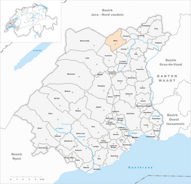
| Location of the municipality | |
  |
|
Moiry is a municipality in the Morges district in the canton of Vaud in Switzerland .
geography
Moiry is 625 m above sea level. M. , 16 km north of the district capital Morges (linear distance). The clustered village extends on a slope sloping to the south-east, at the southern foot of the Jura , above the valley of the upper Venoge , in the Vaud Central Plateau .
The area of the 6.7 km² municipal area includes a section at the southern foot of the Jura. The southeastern border runs along the Venoge, which flows here in a valley parallel to the Jura. From the Venoge the parish extends northwest over the terrace of Moiry and the lower southern Jura slope. This is made up of extensive forest areas ( Bois Joly , Bois de Moiry and Bois Collard ). The highest point of Moiry is 750 m above sea level. M. reached at the Pierre Pouilleuse , an erratic block . In 1997, 3% of the municipal area was accounted for by settlements, 56% for forests and woodlands and 41% for agriculture.
A few individual farms belong to Moiry. Neighboring municipalities of Moiry are Ferreyres , Chevilly , La Chaux (Cossonay) , Cuarnens , Mont-la-Ville , La Praz , Romainmôtier-Envy and an exclave of Croy .
population
With 310 inhabitants (as of December 31, 2018) Moiry is one of the small communities in the canton of Vaud. 94.6% of the residents are French-speaking, 2.5% German-speaking and 1.0% Italian-speaking (as of 2000). The population of Moiry was 219 in 1900. After the population had decreased to 147 by 1960, a significant increase in population was observed again.
economy
Up until the second half of the 20th century, Moiry was a predominantly agricultural village. Even today, arable farming and cattle breeding play an important role in the income structure of the population. Further jobs are available in local small businesses (including a wood processing company) and in the service sector. In the last few decades the village has also developed into a residential community. Many workers are therefore commuters who mainly work in the area around La Sarraz and Cossonay .
traffic
The community is located away from major thoroughfares on a connecting road from La Sarraz to L'Isle . Moiry is connected to the public transport network through a postbus course that runs from La Sarraz to L'Isle.
history
There were several iron smelting furnaces in the municipality of Moiry during Roman times . The first written mention of the place took place in the 11th century under the names Villa Mauriaco and Moriaco . Later the names Moriei (1011), Moiriacum (1049), Moirie (1219), Moërier (1264), Moyrie (1269), Moirey (1325), Muerye (1345), Muerier (1368), then Moeyrier and only in the 18th century 4th century Moiry . The place name goes back to the Latin word Moriecus (village of the Moors), which indicates that Moors once settled here.
In the Middle Ages , the Romainmôtier monastery owned rich estates in Moiry. The village belonged to the La Sarraz dominion. With the conquest of Vaud by Bern in 1536, Moiry came under the administration of the Bailiwick of Romainmôtier . After the collapse of the Ancien Régime , the village belonged to the canton of Léman from 1798 to 1803 during the Helvetic Republic, which then became part of the canton of Vaud when the mediation constitution came into force . In 1798 it was assigned to the Cossonay district.
Attractions
Moiry has a small church and some characteristic farmhouses from the 17th to 19th centuries.
Web links
- Official website of the municipality of Moiry (French)
- Fabienne Abetel-Béguelin: Moiry. In: Historical Lexicon of Switzerland .
Individual evidence
- ↑ Permanent and non-permanent resident population by year, canton, district, municipality, population type and gender (permanent resident population). In: bfs. admin.ch . Federal Statistical Office (FSO), August 31, 2019, accessed on December 22, 2019 .
Aclens | Allaman | Apple's | Aubonne | Bale | Berolle | Bière | Bougy-Villars | Bremblens | Buchillon | Bussy Chardonney | La Chaux (Cossonay) | Chavannes-le-Veyron | Chevilly | Chigny | Clarmont | Cossonay | Cottens | Cuarnens | Denens | Denges | Dizy | Echandens | Echichens | Eclépens | Etoy | Féchy | Ferreyres | Gimel | Gollion | Grancy | L'Isle | Lavigny | Lonay | Lully | Lussy-sur-Morges | Mauraz | Moiry | Mollens | Montherod | Mont-la-Ville | Montricher | Morges | Orny | Pampigny | Pompaples | Préverenges | Reverolle | Romanel-sur-Morges | Saint-Livres | Saint-Oyens | Saint-Prex | La Sarraz | Saubraz | Senarclens | Sévery | Tolochenaz | Vaux-sur-Morges | Villars-sous-Yens | Vufflens-le-Château | Vullierens | Yens
Former municipalities: Bussy-sur-Morges | Chardonney-sur-Morges | Colombier | Monnaz | Pizy | Saint-Saphorin-sur-Morges
Municipalities that moved to the District de Ouest Lausanne on January 1st, 2008 : Bussigny-près-Lausanne | Chavannes-près-Renens | Ecublens | Saint-Sulpice | Villars-Sainte-Croix
Canton of Vaud | Districts of the canton of Vaud | Municipalities of the canton of Vaud