
Mont-la-Ville
| Mont-la-Ville | |
|---|---|
 |
|
| State : |
|
| Canton : |
|
| District : | Morges |
| BFS no. : | 5491 |
| Postal code : | 1328 |
| Coordinates : | 521209 / 166 585 |
| Height : | 835 m above sea level M. |
| Height range : | 728–1441 m above sea level M. |
| Area : | 19.79 km² |
| Residents: | 465 (December 31, 2018) |
| Population density : | 23 inhabitants per km² |
| Website: | www.mont-la-ville.ch |
 Mont-la-Ville church |
|
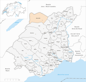
| Location of the municipality | |
  |
|
Mont-la-Ville is a municipality in the Morges district in the canton of Vaud in Switzerland .
geography
Mont-la-Ville is 835 m above sea level. M. , 17 km northwest of the district capital Morges (air line). The scattered village extends on the southeast slope of the foremost Jura mountains , a scenic location high above the plane of the Vaud Midland .
The 19.8 km² municipal area covers a section of the Vaudois Jura. The eastern part of the area is occupied by the broad and relatively gently rising southeast slope of the Mollendruz chain. In the lower areas there is the extensive deforested island of Mont-la-Ville, above the forest area Côte de Mont la Ville . To the west, the municipality extends over the broad ridge of the Mollendruz chain (at Boutavent-Dessus 1262 m above sea level ) with the Col du Mollendruz pass . The uppermost part of the Vaulion valley basin and the southern slope of the Dent de Vaulion also belong to Mont-la-Ville . The western border runs over the Pétra Felix pass and the Haut du Mollendruz ridge , on which at 1,441 m above sea level. M. the highest point that is reached by Mont-la-Ville. On the Jura heights there are extensive high pastures with the typical mighty spruce trees , which either stand individually or in groups. In 1997, 3% of the municipal area was accounted for by settlements, 53% for forests and woodlands and 44% for agriculture.
The hamlet of Chaume ( 865 m above sea level ) to the west of the village and numerous individual farms, which are widely scattered on the Jura heights, belong to Mont-la-Ville . Neighboring municipalities to Mont-la-Ville are Moiry , Cuarnens , L'Isle , L'Abbaye , Vaulion , Juriens and La Praz .
population
With 465 inhabitants (as of December 31, 2018), Mont-la-Ville is one of the small communities in the canton of Vaud. 96.7% of the residents are French-speaking, 1.5% German-speaking and 0.9% Italian-speaking (as of 2000). The population of Mont-la-Ville was 447 in 1900. After the population had decreased to 268 by 1970, a slight increase in population was observed again.
economy
Until the second half of the 20th century, Mont-la-Ville was a predominantly agricultural village. Even today, arable farming in the area of the village and livestock and dairy farming in the higher elevations play an important role in the income structure of the population. Since the community could previously live from the rich income from forestry , local taxes only had to be levied from 1983. Further jobs are available in local small businesses and in the service sector. In the last few decades the village has also developed into a residential community. Many workers are therefore commuters who work mainly in the larger villages of the Vaud Central Plateau. Mont-la-Ville has a Nordic ski center on the Col du Mollendruz. In winter, cross-country trails are groomed at the top of the pass.
traffic
The municipality is located on the main road that leads from Cossonay via L'Isle over the Col du Mollendruz into the Vallée de Joux . Mont-la-Ville is connected to the public transport network through a postbus course that runs from L'Isle to Croy .
history
The municipality of Mont-la-Ville was already populated in prehistoric times. The Abri Freymond was temporarily inhabited during the Paleolithic , about 10,000 to 5500 years before Christ. This place was also used in the Neolithic and Bronze Age .
The first documentary mention of Mont-la-Ville took place in 1141 under the name Montevilla . The place name is derived from the Latin mons (mountain) and villa (village). During the Middle Ages , Mont-la-Ville first belonged to the lords of La Sarraz, then to Les Clées . With the conquest of Vaud by Bern in 1536, Mont-la-Ville came under the administration of the Kastlanei Les Clées in the Bailiwick of Yverdon . It formed an exclave of the Bailiwick of Yverdon, far away from their home area. After the collapse of the Ancien Régime , the village belonged to the canton of Léman from 1798 to 1803 during the Helvetic Republic, which then became part of the canton of Vaud when the mediation constitution came into force . In 1798 it was assigned to the Cossonay district.
Attractions
The Saint-Michel church was built in 1825. In the old village center there are some characteristic farmhouses from the 17th to 19th centuries.
Web links
- Community information
- Official website of the municipality
- François Béboux: Mont-la-Ville. In: Historical Lexicon of Switzerland .
- Aerial photography
Individual evidence
- ↑ Permanent and non-permanent resident population by year, canton, district, municipality, population type and gender (permanent resident population). In: bfs. admin.ch . Federal Statistical Office (FSO), August 31, 2019, accessed on December 22, 2019 .
Aclens | Allaman | Apple's | Aubonne | Bale | Berolle | Bière | Bougy-Villars | Bremblens | Buchillon | Bussy Chardonney | La Chaux (Cossonay) | Chavannes-le-Veyron | Chevilly | Chigny | Clarmont | Cossonay | Cottens | Cuarnens | Denens | Denges | Dizy | Echandens | Echichens | Eclépens | Etoy | Féchy | Ferreyres | Gimel | Gollion | Grancy | L'Isle | Lavigny | Lonay | Lully | Lussy-sur-Morges | Mauraz | Moiry | Mollens | Montherod | Mont-la-Ville | Montricher | Morges | Orny | Pampigny | Pompaples | Préverenges | Reverolle | Romanel-sur-Morges | Saint-Livres | Saint-Oyens | Saint-Prex | La Sarraz | Saubraz | Senarclens | Sévery | Tolochenaz | Vaux-sur-Morges | Villars-sous-Yens | Vufflens-le-Château | Vullierens | Yens
Former municipalities: Bussy-sur-Morges | Chardonney-sur-Morges | Colombier | Monnaz | Pizy | Saint-Saphorin-sur-Morges
Municipalities that moved to the District de Ouest Lausanne on January 1st, 2008 : Bussigny-près-Lausanne | Chavannes-près-Renens | Ecublens | Saint-Sulpice | Villars-Sainte-Croix
Canton of Vaud | Districts of the canton of Vaud | Municipalities of the canton of Vaud