
Cuarnens
| Cuarnens | |
|---|---|
 |
|
| State : |
|
| Canton : |
|
| District : | Morges |
| BFS no. : | 5479 |
| Postal code : | 1309 |
| Coordinates : | 523 390 / 164 241 |
| Height : | 620 m above sea level M. |
| Height range : | 589–748 m above sea level M. |
| Area : | 7.13 km² |
| Residents: | 478 (December 31, 2018) |
| Population density : | 67 inhabitants per km² |
| Website: | www.cuarnens.ch |
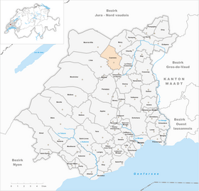
| Location of the municipality | |
  |
|
Cuarnens is a municipality in the Morges district in the canton of Vaud in Switzerland .
geography

Cuarnens lies at 620 m above sea level. M. , 13 km (as the crow flies) north of the district capital Morges . The clustered village extends on the Jura foot plateau, on both sides of the upper Venoge , in the Vaudois Central Plateau .
The area of the 7.2 km² municipal area includes a section of the Jura foot plateau. The area is traversed from southwest to northeast by the Venoge, which over the course of millions of years has created a valley that is slightly sunk into the plateau. The whole south and east is taken up by the extensive plateau. To the northwest, the municipality extends over the valley of the Morvaz to the lower southern slopes of the Jura , where at 750 m above sea level. M. the highest point of Cuarnens is reached. The part of the slope belonging to the municipality is covered by the forest area Les Rueyres , in which the erratic block Pierre Pendue stands. In 1997, 4% of the municipal area was accounted for by settlements, 31% for forests and woodlands and 65% for agriculture.
A few individual farms belong to Cuarnens. The neighboring municipalities of Cuarnens are Moiry , La Chaux (Cossonay) , Chavannes-le-Veyron , L'Isle and Mont-la-Ville .
population
With 478 inhabitants (as of December 31, 2018), Cuarnens is one of the small communities in the canton of Vaud. 85.6% of the residents are French-speaking, 10.1% German-speaking and 1.8% Portuguese-speaking (as of 2000). The population of Cuarnens was 414 in 1850 and 481 in 1900. After the population had decreased to 275 by 1970, a significant population increase has been observed again since then.
economy
Up until the second half of the 20th century, Cuarnens was a predominantly agricultural village. Even today, agriculture and animal husbandry have a certain importance in the income structure of the population. Further jobs are available in local small businesses and in the service sector. There are several sawmills along the Venoge. In the last few decades the village has also developed into a residential community. Many workers are therefore commuters who work in Cossonay and the greater Lausanne area.
traffic
The community is very well developed in terms of traffic. It is located on the main road from Cossonay over the Col du Mollendruz pass into the Vallée de Joux . The village is connected to the public transport network through the Postbus course that runs from Cossonay to L'Isle . Another bus line connects L'Isle via Cuarnens with La Sarraz .
history
The remains of Roman settlements have been discovered in the municipality of Cuarnens . A Roman villa existed from the 1st to the 3rd century AD. There was also a Roman military camp near today's village. A burial ground probably dating from the Burgundian period was also found.
The place was first mentioned in a document in 1001 under the name Quarningis . Later the names Quarnens (1049), Villa Quarnensis (1095) and Guarnens appeared in the 12th century. The place name is derived from the personal name Warni and means for the people of Warni .
In Cuarnens the Premonstratensian Abbey Lac de Joux ( L'Abbaye ) owned rich estates in the Middle Ages . Since 1141 she had a mill on the Venoge. The Romainmôtier Monastery and the Dominican Monastery of Lausanne also had basic rights here. The village was under the rule of La Sarraz before becoming its own small rule in 1583, which changed hands several times.
With the conquest of Vaud by Bern in 1536, Cuarnens came under the administration of the Bailiwick of Romainmôtier. After the collapse of the Ancien Régime , the village belonged to the canton of Léman from 1798 to 1803 during the Helvetic Republic, which then became part of the canton of Vaud when the mediation constitution came into force . In 1798 it was assigned to the Cossonay district.
Attractions
The Reformed parish church of Saint-Didier was rebuilt from 1733 to 1737 on the site of a church that was mentioned in 1001. The 17th century castle La Grange was largely demolished in 1928, today only the main facade from 1637 remains. In the old town center there are some characteristic farmhouses from the 18th and 19th centuries.
Web links
- Community information
- Emmanuel Abetel: Cuarnens. In: Historical Lexicon of Switzerland .
- Aerial photography
Individual evidence
- ↑ Permanent and non-permanent resident population by year, canton, district, municipality, population type and gender (permanent resident population). In: bfs. admin.ch . Federal Statistical Office (FSO), August 31, 2019, accessed on December 22, 2019 .
Aclens | Allaman | Apple's | Aubonne | Bale | Berolle | Bière | Bougy-Villars | Bremblens | Buchillon | Bussy Chardonney | La Chaux (Cossonay) | Chavannes-le-Veyron | Chevilly | Chigny | Clarmont | Cossonay | Cottens | Cuarnens | Denens | Denges | Dizy | Echandens | Echichens | Eclépens | Etoy | Féchy | Ferreyres | Gimel | Gollion | Grancy | L'Isle | Lavigny | Lonay | Lully | Lussy-sur-Morges | Mauraz | Moiry | Mollens | Montherod | Mont-la-Ville | Montricher | Morges | Orny | Pampigny | Pompaples | Préverenges | Reverolle | Romanel-sur-Morges | Saint-Livres | Saint-Oyens | Saint-Prex | La Sarraz | Saubraz | Senarclens | Sévery | Tolochenaz | Vaux-sur-Morges | Villars-sous-Yens | Vufflens-le-Château | Vullierens | Yens
Former municipalities: Bussy-sur-Morges | Chardonney-sur-Morges | Colombier | Monnaz | Pizy | Saint-Saphorin-sur-Morges
Municipalities that moved to the District de Ouest Lausanne on January 1st, 2008 : Bussigny-près-Lausanne | Chavannes-près-Renens | Ecublens | Saint-Sulpice | Villars-Sainte-Croix
Canton of Vaud | Districts of the canton of Vaud | Municipalities of the canton of Vaud