
L'Abbaye
| L'Abbaye | |
|---|---|
 |
|
| State : |
|
| Canton : |
|
| District : | Jura north vaudois |
| BFS no. : | 5871 |
| Postal code : | 1344 L'Abbaye 1346 Les Bioux 1342 Le Pont |
| Coordinates : | 514.41 thousand / 167080 |
| Height : | 1014 m above sea level M. |
| Height range : | 986–1650 m above sea level M. |
| Area : | 31.88 km² |
| Residents: | 1476 (December 31, 2018) |
| Population density : | 46 inhabitants per km² |
| Website: | www.labbaye.ch |
 L'Abbaye |
|
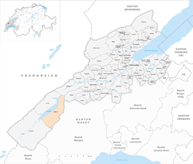
| Location of the municipality | |
  |
|
L'Abbaye ([ labei ] or [ labeji ], in the native Franco-Provencal dialect [ (a) labaːˈi ] or [ (a) labaˈji ]) is a municipality in the district of Jura-Nord vaudois in the canton of Vaud in Switzerland .
geography

L'Abbaye is 1014 m above sea level. M. , 29 km southwest of the district capital Yverdon-les-Bains and 28 km northwest of Lausanne (linear distance). The village extends in the Vallée de Joux on the alluvial cone of the Lionne on the east bank of Lac de Joux , in the Vaudois Jura .
The area of the 31.9 km² municipal area comprises a section in the Vaud Jura and around half of the water area of Lac de Joux. The area extends from the flat edge of the bank to the southeast on the anticline of Mont Tendre . This has an approximately 3 km wide north shoulder, which is occupied by extensive forests ( Grand Bois à Ban and Bois de la Rippe ) as well as by Jura high pastures (including the Communal de l'Abbaye ), which are typically powerful either individually or in groups standing spruce trees. The landscape shows numerous aboveground depressions and sinkholes as well as cart fields as typical phenomena of the karst . The highest point of L'Abbaye is 1650 m above sea level. M. on the western slope of Mont Tendre. In the east, the border runs over the Haut du Mollendruz ( 1,441 m above sea level ) and the Pétra Felix pass crossing ( 1144 m above sea level ). To the northeast of Lac de Joux and the adjoining Lac Brenet, the communal soil extends over the hilly landscape of Les Agouillons (up to 1217 m above sea level ), the Sagne Vuagnard moorland and the valley of the Ruisseau des Epoisats brook to the summit of the Dent de Vaulion ( 1483 m above sea level ). In 1997, 4% of the municipal area was accounted for by settlements, 57% for forests and woodlands, 37% for agriculture and a little more than 2% was unproductive land.
L'Abbaye includes the two villages Le Pont ( 1008 m above sea level ) on the northeast bank of the Lac de Joux and Les Bioux ( 1022 m above sea level ) on the southeast bank. The latter consists of the practically contiguous street row settlements Bas des Bioux ( 1010 m above sea level ), Vers chez Aron ( 1022 m above sea level ) and Vers chez Grosjean ( 1025 m above sea level ). Furthermore, L'Abbaye also includes numerous individual farms, which are widely scattered on the Jura heights. The neighboring municipalities of L'Abbaye are Vallorbe , Vaulion , Mont-la-Ville , L'Isle , Montricher , Le Chenit and Le Lieu .
population
With 1,476 inhabitants (as of December 31, 2018), L'Abbaye is one of the medium-sized municipalities in the canton of Vaud. 94.0% of the residents are French-speaking, 2.5% German-speaking and 1.5% Portuguese-speaking (as of 2000). The population of L'Abbaye was 1018 in 1850 and 1350 in 1900. During the 20th century, the population fluctuated between 1050 and 1350. Since the last low (1068 inhabitants after the economic crisis in 1980) the population has increased significantly again.
economy
In addition to agriculture , craft and industrial activities developed in L'Abbaye early on . At the beginning of the development, at the end of the 15th century, there were forges and hammer mills as well as threshing mills and sawmills, which used the water power of the Lionne. A blast furnace existed from 1557 until the 18th century, and metal processing companies were added from around 1650. In the course of the 18th century, these businesses were replaced by watchmaking , which was initially done at home, and since the middle of the 19th century in factories. At the end of the 19th century, ice extraction in Le Pont became very important. The ice was sawn from the ice cover of Lac de Joux during the winter, then stored and transported to the Swiss plateau and as far as Paris in the summer .
Today the population is employed in the watch industry (mainly based in Les Bioux), in sawmills, in the tourist sector and in local small businesses. Agriculture is of little importance with cattle breeding and dairy farming as well as cheese production.
tourism
The area around Lac de Joux, Mont Tendre, the heights of Mollendruz and the Dent de Vaulion are popular excursion destinations. In summer, water sports can be practiced on the lake. The Jura heights are suitable as a recreation and hiking destination. Several ski lifts operate at L'Abbaye during the winter. The Juraparc animal park is located in Le Pont .
traffic
The municipality is located on the main road from Vallorbe to Le Brassus. From this main road the road branches off in L'Abbaye over the Col du Mollendruz to Cossonay . On October 31, 1886, the Vallorbe – Le Pont railway line went into operation. The extension to Le Brassus built by the Pont – Brassus Railway (PBr) was opened on August 21, 1899. L'Abbaye and Les Bioux are connected to the public transport network by the bus route from Le Pont to Le Sentier.
history

The local history of L'Abbaye begins with the founding of a Premonstratensian monastery in 1126 by Gozbert, who was a student of St. Norbert von Xanten. The monastery was dedicated to St. Mary Magdalene. In 1228 the place is mentioned as Abbatia de lacu Jurensi ( Abbaye du Lac de Joux ). The canons cleared the land along the Lac de Joux, and the village of L'Abbaye developed around the monastery from the beginning of the 14th century.
With the conquest of Vaud by Bern in 1536 and the introduction of the Reformation , the monastery was secularized. L'Abbaye came under the administration of the Romainmôtier Bailiwick . Since 1571, after being separated from Le Lieu , L'Abbaye formed an independent municipality. The fractions L'Abbaye, Le Pont and Les Bioux have been sub-municipalities with their own municipal assembly and administration since 1766. After the collapse of the Ancien Régime , L'Abbaye belonged to the canton of Léman from 1798 to 1803 during the Helvetic Republic, which then became part of the canton of Vaud when the mediation constitution came into force . In 1798 the municipality was assigned to the La Vallée district. The village of L'Abbaye was hit by serious fires several times, the last one in 1966.
Attractions
Only the Gothic church tower from the 16th century remains from the former abbey . A late Gothic arcade in the cloister was rebuilt in 1971 to celebrate the 400-year independence of the community. The current reformed church of L'Abbaye dates from 1865. Les Bioux also has a reformed church, a wooden structure from 1698. Some characteristic farmhouses of the Vaud Jura from the 18th and 19th centuries have been preserved.
literature
- Helvetia sacra, Volume IV / 3: The Premonstratensians in Switzerland, edited by several authors, edited by Bernard Andenmatten and Brigitte Degler-Spengler , Basel 2002. Lac de Joux (L'Abbaye VD), prémontrés, p. 451-493. Author: Bernard Andenmatten. http://www.helvetiasacra.ch
Web links
- Official website of the municipality of L'Abbaye (French)
- Rémy Rochat: Abbaye, L '. In: Historical Lexicon of Switzerland .
- Rémy Rochat: Bioux, Les. In: Historical Lexicon of Switzerland .
- Rémy Rochat: Pont, Le. In: Historical Lexicon of Switzerland .
- Aerial photography
- Vallée de Joux (French)
Individual evidence
- ↑ Permanent and non-permanent resident population by year, canton, district, municipality, population type and gender (permanent resident population). In: bfs. admin.ch . Federal Statistical Office (FSO), August 31, 2019, accessed on December 22, 2019 .
- ↑ Wulf Müller, L'Abbaye VD (La Vallée) in: Dictionnaire toponymique des communes suisses - Lexicon of Swiss municipality names - Dizionario toponomastico dei comuni svizzeri (DTS | LSG) , Center de dialectologie, Université de Neuchâtel, Verlag Huber, Frauenfeld / Stuttgart / Vienna 2005, ISBN 3-7193-1308-5 and Éditions Payot, Lausanne 2005, ISBN 2-601-03336-3 , p. 494.
L'Abbaye | L'Abergement | Agiez | Arnex-sur-Orbe | Ballaigues | Baulmes | Bavois | Belmont-sur-Yverdon | Bioley-Magnoux | Bofflens | Bonvillars | Bretonnières | Bullet | Chamblon | Champagne | Champvent | Chavannes-le-Chêne | Chavornay | Chêne-Pâquier | Le Chenit | Cheseaux-Noréaz | Les Clées | Concise | Corcelles-près-Concise | Cronay | Croy | Cuarny | Démoret | Donneloye | Ependes | Fiez | Fontaines-sur-Grandson | Giez | Grand event | Grandson | Juriens | Le Lieu | Lignette roll | Mathod | Mauborget | Molondine | Montagny-près-Yverdon | Montcherand | Mutrux | Novalles | Onnens | Orbe | Orges | Orzens | Pomy | La Praz | Premier | Provence | Rances | Romainmôtier-Envy | Rovray | Sainte-Croix | Sergey | Suchy | Suscévaz | Tévenon | Treycovagnes | Ursins | Valeyres-sous-Montagny | Valeyres-sous-Rances | Valeyres-sous-Ursins | Vallorbe | Vaulion | Villars-Epeney | Vugelles-La Mothe | Vuiteboeuf | Yverdon-les-Bains | Yvonand
Former municipalities: Arrissoules | Chanéaz | Corcelles-sur-Chavornay | Envy | Essert-Pittet | Essert-sous-Champvent | Fontanezier | Gossens | Gressy | Mézery-près-Donneloye | Prahins | Romainmôtier | Romairon | Vaugondry | Villars-Burquin | Villars-sous-Champvent
Canton of Vaud | Districts of the canton of Vaud | Municipalities of the canton of Vaud