
Agiez
| Agiez | |
|---|---|
 |
|
| State : |
|
| Canton : |
|
| District : | Jura north vaudois |
| BFS no. : | 5742 |
| Postal code : | 1352 |
| Coordinates : | 528 792 / 174 797 |
| Height : | 526 m above sea level M. |
| Height range : | 450–642 m above sea level M. |
| Area : | 5.46 km² |
| Residents: | 326 (December 31, 2018) |
| Population density : | 60 inhabitants per km² |
| Website: | www.agiez.ch |
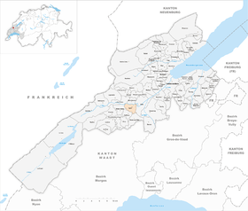
| Location of the municipality | |
  |
|
Agiez ( fr. [ A (ː) ʒje / aːʒi ], in local dialect : [ (a) aːd͡zˈiː ]) is a municipality in the district of Jura-Nord vaudois in the canton of Vaud in Switzerland .
geography
Agiez lies at 526 m above sea level. M. , 2 km west of Orbe and 12 km southwest of the district capital Yverdon-les-Bains (linear distance). The farming village extends in a slight hollow on the Jura foot plateau between the Orbe plain and the first Jura chain .
The area of the 5.5 km² municipal area includes a section of the Jura foot plateau and the valley of the Agiez brook. In the east the area extends to the Planches de Commune plateau (up to 575 m above sea level ), in the west to the heights slowly rising towards the Jura, which are partly covered by forests ( Bois de Chênes and Bois de Fives ). On the elevation Fives is at 640 m above sea level. M. reached the highest point of Agiez. The northern border runs along the Orbe , which is deepened here like a gorge into the Jura foot plateau ( Gorges de l'Orbe ) and is now a nature reserve. In 1997, 4% of the municipal area was settled, 32% forest and woodland, 63% agriculture and a little less than 1% was unproductive land.
Agiez consists of the two districts of Le Moulin ( 507 m above sea level ) on the Dorfbach and Le Coin on the slope to the west as well as several individual farms. Neighboring municipalities to Agiez are Orbe , Montcherand , Les Clées , Bretonnières , Bofflens and Arnex-sur-Orbe .
population
With 326 inhabitants (as of December 31, 2018), Agiez is one of the small communities in the canton of Vaud. 96.4% of the residents are French-speaking, 1.8% Portuguese-speaking and 0.9% German-speaking (as of 2000). The population of Agiez was 344 in 1850 and 279 in 1900. A further decline in population took place until 1970 (185 inhabitants). Since then, a slight upward trend has been observed again.
economy
Agiez is still an agricultural village today . Thanks to the fertile soils on the Jura foot plateau, mainly arable farming is practiced , and there is some viticulture near the village . The local small business offers additional jobs. A mill on the Dorfbach had existed since the 15th century. At the end of the 19th century, the production of ashlar stones employed many villagers in a nearby quarry. In recent years Agiez has developed into a residential community. Many workers are therefore commuters who mainly work in Orbe .
traffic
The community is quite accessible. It is on the main road from Orbe via Croy and over the Pétra Félix pass into the Vallée de Joux . Agiez is connected to the public transport network through a post bus course that runs from Orbe to Vaulion .
history
Finds from the Neolithic and medieval graves indicate an early inspection and settlement of the municipal area. The place was first mentioned in a document in 982: Et ego Haziacus ... in pago de Atiaco . The place name is derived from the Latin personal name Abidius with the Celtic place name suffix -akos / -acum .
Agiez, which belonged to the Kingdom of Burgundy , was donated to the Romainmôtier monastery in 1028 at the latest . From then on, the interests of the monastery were represented by a Meier resident in Agiez. With the conquest of Vaud by Bern in 1536, the village came to the Kastlanei and Landvogtei Romainmôtier. After the collapse of the Ancien Régime , Agiez belonged to the canton of Léman from 1798 to 1803 during the Helvetic Republic, which then became part of the canton of Vaud when the mediation constitution came into force . It was assigned to the Orbe district.
Attractions
The reformed parish church of Agiez was first mentioned in the 14th century. The current building dates largely from 1687 and has a paneled barrel vault. A Gothic side chapel was built in the 15th century. The Château d'Agiez, the former seat of the Meier, is actually a fortified mansion, the current structure of which dates from the 16th century. It has a massive hexagonal stair tower.
Web links
- Official website of the municipality of Agiez
- Community information
- Sabine Carruzzo-Frey: Agiez. In: Historical Lexicon of Switzerland .
- Château d'Agiez (French)
Individual evidence
- ↑ Permanent and non-permanent resident population by year, canton, district, municipality, population type and gender (permanent resident population). In: bfs. admin.ch . Federal Statistical Office (FSO), August 31, 2019, accessed on December 22, 2019 .
- ↑ a b Nicolas Pépin: Agiez VD (Orbe) in: Dictionnaire toponymique des communes suisses - Lexicon of Swiss community names - Dizionario toponomastico dei comuni svizzeri (DTS | LSG). Center de dialectologie, Université de Neuchâtel, Verlag Huber, Frauenfeld / Stuttgart / Vienna 2005, ISBN 3-7193-1308-5 and Éditions Payot, Lausanne 2005, ISBN 2-601-03336-3 , p. 77.
L'Abbaye | L'Abergement | Agiez | Arnex-sur-Orbe | Ballaigues | Baulmes | Bavois | Belmont-sur-Yverdon | Bioley-Magnoux | Bofflens | Bonvillars | Bretonnières | Bullet | Chamblon | Champagne | Champvent | Chavannes-le-Chêne | Chavornay | Chêne-Pâquier | Le Chenit | Cheseaux-Noréaz | Les Clées | Concise | Corcelles-près-Concise | Cronay | Croy | Cuarny | Démoret | Donneloye | Ependes | Fiez | Fontaines-sur-Grandson | Giez | Grand event | Grandson | Juriens | Le Lieu | Lignette roll | Mathod | Mauborget | Molondine | Montagny-près-Yverdon | Montcherand | Mutrux | Novalles | Onnens | Orbe | Orges | Orzens | Pomy | La Praz | Premier | Provence | Rances | Romainmôtier-Envy | Rovray | Sainte-Croix | Sergey | Suchy | Suscévaz | Tévenon | Treycovagnes | Ursins | Valeyres-sous-Montagny | Valeyres-sous-Rances | Valeyres-sous-Ursins | Vallorbe | Vaulion | Villars-Epeney | Vugelles-La Mothe | Vuiteboeuf | Yverdon-les-Bains | Yvonand
Former municipalities: Arrissoules | Chanéaz | Corcelles-sur-Chavornay | Envy | Essert-Pittet | Essert-sous-Champvent | Fontanezier | Gossens | Gressy | Mézery-près-Donneloye | Prahins | Romainmôtier | Romairon | Vaugondry | Villars-Burquin | Villars-sous-Champvent
Canton of Vaud | Districts of the canton of Vaud | Municipalities of the canton of Vaud