
Arnex-sur-Orbe
| Arnex-sur-Orbe | |
|---|---|
 |
|
| State : |
|
| Canton : |
|
| District : | Jura north vaudois |
| BFS no. : | 5743 |
| Postal code : | 1321 |
| Coordinates : | 529649 / 171 761 |
| Height : | 543 m above sea level M. |
| Height range : | 437–614 m above sea level M. |
| Area : | 7.62 km² |
| Residents: | 630 (December 31, 2018) |
| Population density : | 83 inhabitants per km² |
| Website: | www.arnex-sur-orbe.ch |
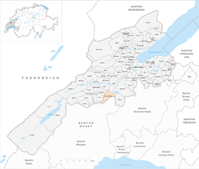
| Location of the municipality | |
  |
|
Arnex-sur-Orbe is a municipality in the Jura-Nord vaudois district in the canton of Vaud in Switzerland .
geography
Arnex-sur-Orbe lies at 543 m above sea level. M. , 3 km south-south-west of the town of Orbe and 13 km south-west of the district capital Yverdon-les-Bains (linear distance). The clustered village extends in the Swiss plateau on the eastern edge of the Jura foot plateau, around 100 m above the plain of the Orbe (French Plaine de l'Orbe ).
The area of the 7.6 km² municipal area covers a section of the Arnex-sur-Orbe area at an average of 550 m above sea level. M. lying Jura foot plateaus. To the west, the municipality extends to the Crêt de la Croix ( 580 m above sea level ) and into the Bioute forest , on the edge of which there are some protected ponds (including the Étang d'Arnex ). The area extends in a narrow tip to the southwest over the Le Chaney elevation (at 614 m above sea level, the highest point of Arnex-sur-Orbe) to the Nozon river , which runs here in a valley cut around 100 m into the Jura foot plateau . The south-eastern border forms a side valley of the Nozon. In the east, Arnex-sur-Orbe has a small portion of the Orbe plain, the eastern border is the Canal d'Entreroches . In 1997, 6% of the municipal area was in settlements, 20% in forests and woodlands, 73% in agriculture and a little less than 1% was unproductive land.
Arnex-sur-Orbe has a number of individual farms. The neighboring municipalities of Arnex-sur-Orbe are Orbe , Agiez , Bofflens , Croy , La Sarraz , Pompaples , Bavois and Chavornay .
population
With 630 inhabitants (as of December 31, 2018), Arnex-sur-Orbe is one of the smaller municipalities in the canton of Vaud. 94.0% of the residents are French-speaking, 2.1% German-speaking and 1.7% Portuguese-speaking (as of 2000). The population of Arnex-sur-Orbe was 621 in 1850 and 612 in 1900. After that, there was a population decline until 1970 (457 inhabitants). Since then, a slight upward trend has been observed again.
economy
Arnex-sur-Orbe is still an agricultural village today . Thanks to the fertile soils on the Jura foot plateau, mainly arable farming is practiced. Vines are planted on the slopes below the village on the edge of the Orbe plain (around 65 hectares of vineyards). The local small business offers additional jobs. In recent years Arnex-sur-Orbe has developed into a residential community. Many workers are therefore commuters who mainly work in Orbe .
traffic
Although the community is off the main thoroughfares, it is still easy to reach, as the connections to the A1 and A9 motorways are only about 5 km away. On July 1, 1870, the Cossonay - Vallorbe railway line with a station in Arnex-sur-Orbe was put into operation. Arnex-sur-Orbe is connected to Orbe through a postbus course .
history
Finds from the Neolithic (in the Nozon Valley), Roman times and the early Middle Ages (graves) indicate an early settlement of the municipality. The place was first mentioned in a document in 1049 under the name Arniacum ; In 1228 the name Arnei appeared . The place name probably goes back to the Latin personal name Arnius .
Arnex-sur-Orbe came to the Romainmôtier monastery in 1049 as a gift from Adalbert von Grandson . From then on, the interests of the monastery were represented by a Meier based in Arnex-sur-Orbe. With the conquest of Vaud by Bern in 1536, the village came to the Kastlanei and Landvogtei Romainmôtier. After the collapse of the Ancien Régime , Arnex-sur-Orbe belonged to the canton of Léman from 1798 to 1803 during the Helvetic Republic, which then became part of the canton of Vaud when the mediation constitution came into force . It was assigned to the Orbe district in 1798.
Attractions
The village church of Saint-Martin is mentioned as early as 1228. The medieval choir dates from the 14th century, the nave for the most part from the 18th century. The castle of Arnex-sur-Orbe, the former seat of the Meier, was built in the 17th century. In the densely built-up old town center of the wine-growing village, some characteristic farmhouses from the 17th to 19th centuries have been preserved.
Web links
- Official website of the municipality of Arnex-sur-Orbe (French)
- Anne Rochat-Morel: Arnex-sur-Orbe. In: Historical Lexicon of Switzerland .
- Aerial photography
Individual evidence
- ↑ Permanent and non-permanent resident population by year, canton, district, municipality, population type and gender (permanent resident population). In: bfs. admin.ch . Federal Statistical Office (FSO), August 31, 2019, accessed on December 22, 2019 .
L'Abbaye | L'Abergement | Agiez | Arnex-sur-Orbe | Ballaigues | Baulmes | Bavois | Belmont-sur-Yverdon | Bioley-Magnoux | Bofflens | Bonvillars | Bretonnières | Bullet | Chamblon | Champagne | Champvent | Chavannes-le-Chêne | Chavornay | Chêne-Pâquier | Le Chenit | Cheseaux-Noréaz | Les Clées | Concise | Corcelles-près-Concise | Cronay | Croy | Cuarny | Démoret | Donneloye | Ependes | Fiez | Fontaines-sur-Grandson | Giez | Grand event | Grandson | Juriens | Le Lieu | Lignette roll | Mathod | Mauborget | Molondine | Montagny-près-Yverdon | Montcherand | Mutrux | Novalles | Onnens | Orbe | Orges | Orzens | Pomy | La Praz | Premier | Provence | Rances | Romainmôtier-Envy | Rovray | Sainte-Croix | Sergey | Suchy | Suscévaz | Tévenon | Treycovagnes | Ursins | Valeyres-sous-Montagny | Valeyres-sous-Rances | Valeyres-sous-Ursins | Vallorbe | Vaulion | Villars-Epeney | Vugelles-La Mothe | Vuiteboeuf | Yverdon-les-Bains | Yvonand
Former municipalities: Arrissoules | Chanéaz | Corcelles-sur-Chavornay | Envy | Essert-Pittet | Essert-sous-Champvent | Fontanezier | Gossens | Gressy | Mézery-près-Donneloye | Prahins | Romainmôtier | Romairon | Vaugondry | Villars-Burquin | Villars-sous-Champvent
Canton of Vaud | Districts of the canton of Vaud | Municipalities of the canton of Vaud