
Orzens
| Orzens | |
|---|---|
 |
|
| State : |
|
| Canton : |
|
| District : | Jura north vaudois |
| BFS no. : | 5925 |
| Postal code : | 1413 |
| Coordinates : | 542259 / 174 992 |
| Height : | 622 m above sea level M. |
| Height range : | 495–686 m above sea level M. |
| Area : | 4.20 km² |
| Residents: | 196 (December 31, 2018) |
| Population density : | 47 inhabitants per km² |
| Website: | www.orzens.ch |
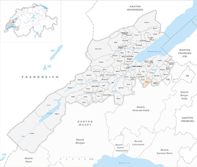
| Location of the municipality | |
  |
|
Orzens is a municipality in the Jura-Nord vaudois district in the canton of Vaud in Switzerland .
geography
Orzens is 622 m above sea level. M. , 7 km south-southeast of the district capital Yverdon-les-Bains (linear distance). The street line village extends on the upper western valley slope of the Mentue , in the Molasse hill country of the northern Vaudois Central Plateau .
The area of the 4.2 km² large municipal area covers a section of the hill country between the Orbe plain and the Broye . Orzens occupies the relatively gently sloping eastward slope of the wide ridge between the Buron valley in the west and the Sauteru and Mentue valley system in the east. The slope is subdivided by the valley of the Barbeire . In the east the parish reaches up to the Sauteru; the southeastern border forms its left tributary Greyle . To the west the area extends into the forest Bois Pontey and reaches on the ridge at Le Biolet with 686 m above sea level. M. the highest point of Orzens. In 1997, 4% of the municipal area was accounted for by settlements, 16% for forests and woodlands and 80% for agriculture.
Orzens includes the hamlet of Champs Plats ( 598 m above sea level ) south of the Barbeire stream, as well as some individual farms. The neighboring municipalities of Orzens are in the northeast Bioley-Magnoux , in the southeast Oppen , in the south Pailly , in the southwest Essertines-sur-Yverdon , in the west Ursins , in the north Cronay and in the north-northeast Donneloye .
population
With 196 inhabitants (as of December 31, 2018) Orzens is one of the small communities in the canton of Vaud. 95.9% of the residents are French-speaking, 1.5% German-speaking and 1.0% English-speaking (as of 2000). Orzens had a population of 281 in 1900. After the population had decreased to 164 people by 1980, a slight increase in population has been registered since then.
economy
Orzens was a predominantly agricultural village until the second half of the 20th century . Even today, arable farming , fruit growing and cattle breeding play an important role in the income structure of the population. Further jobs are available in local small businesses and in the service sector. In the last few decades Orzens has also developed into a residential community. Some workers are therefore commuters who work mainly in Yverdon .
traffic
The community is located off the main thoroughfares, on a connecting road from Essertines-sur-Yverdon to Donneloye . Orzens is connected to the public transport network through the Postbus course, which runs from Yverdon to Bercher .
history
The first written mention of the place took place in 1177 under the name Orsens , in 1226 the name Orseins appeared . Just like the name of the neighboring municipality of Ursins , the place name is probably derived from the Burgundian personal name Urs (from Latin ursus , bear) and means for the people of Urs .
Orzens belonged to the dominion of Saint-Martin-du-Chêne in the Middle Ages and later to that of Bioley-Magnoux. With the conquest of Vaud by Bern in 1536, the village came under the administration of the Bailiwick of Yverdon . Under the rule of Bern it formed its own little rule. After the collapse of the Ancien Régime , Orzens belonged to the canton of Léman from 1798 to 1803 during the Helvetic Republic, which then became part of the canton of Vaud when the mediation constitution came into force . In 1798 it was assigned to the Yverdon district.
Attractions
Orzens Castle, a stately mansion with a small residential tower, was built around 1700. It was restored in 1907 and renovated in 1942. The church is on the field south of the village. Some characteristic farmhouses from the 17th to 19th centuries have been preserved in the town center.
Web links
- Official website of the municipality of Orzens (French)
- Philippe Heubi: Orzens. In: Historical Lexicon of Switzerland .
- Aerial views of the village
- Château d'Orzens
Individual evidence
- ↑ Permanent and non-permanent resident population by year, canton, district, municipality, population type and gender (permanent resident population). In: bfs. admin.ch . Federal Statistical Office (FSO), August 31, 2019, accessed on December 22, 2019 .
L'Abbaye | L'Abergement | Agiez | Arnex-sur-Orbe | Ballaigues | Baulmes | Bavois | Belmont-sur-Yverdon | Bioley-Magnoux | Bofflens | Bonvillars | Bretonnières | Bullet | Chamblon | Champagne | Champvent | Chavannes-le-Chêne | Chavornay | Chêne-Pâquier | Le Chenit | Cheseaux-Noréaz | Les Clées | Concise | Corcelles-près-Concise | Cronay | Croy | Cuarny | Démoret | Donneloye | Ependes | Fiez | Fontaines-sur-Grandson | Giez | Grand event | Grandson | Juriens | Le Lieu | Lignette roll | Mathod | Mauborget | Molondine | Montagny-près-Yverdon | Montcherand | Mutrux | Novalles | Onnens | Orbe | Orges | Orzens | Pomy | La Praz | Premier | Provence | Rances | Romainmôtier-Envy | Rovray | Sainte-Croix | Sergey | Suchy | Suscévaz | Tévenon | Treycovagnes | Ursins | Valeyres-sous-Montagny | Valeyres-sous-Rances | Valeyres-sous-Ursins | Vallorbe | Vaulion | Villars-Epeney | Vugelles-La Mothe | Vuiteboeuf | Yverdon-les-Bains | Yvonand
Former municipalities: Arrissoules | Chanéaz | Corcelles-sur-Chavornay | Envy | Essert-Pittet | Essert-sous-Champvent | Fontanezier | Gossens | Gressy | Mézery-près-Donneloye | Prahins | Romainmôtier | Romairon | Vaugondry | Villars-Burquin | Villars-sous-Champvent
Canton of Vaud | Districts of the canton of Vaud | Municipalities of the canton of Vaud