
Valeyres-sous-Ursins
| Valeyres-sous-Ursins | |
|---|---|
 |
|
| State : |
|
| Canton : |
|
| District : | Jura north vaudois |
| BFS no. : | 5934 |
| Postal code : | 1412 |
| Coordinates : | 540 161 / 177514 |
| Height : | 551 m above sea level M. |
| Height range : | 447-596 m above sea level M. |
| Area : | 2.87 km² |
| Residents: | 233 (December 31, 2018) |
| Population density : | 81 inhabitants per km² |
| Website: | www.valeyres-sous-ursins.ch |
 Valeyres-sous-Ursins |
|
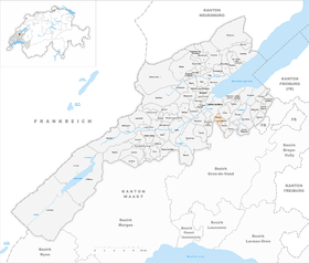
| Location of the municipality | |
  |
|
Valeyres-sous-Ursins is a municipality in the district of Jura-Nord vaudois in the canton of Vaud in Switzerland .
geography
Valeyres-sous-Ursins lies at 551 m above sea level. M. , 4 km south-southeast of the district capital Yverdon-les-Bains (air line). The street row village extends on a promontory east of the valley of the Buron , in the Waadtländer Mittelland .
The area of the 2.8 km² municipal area covers a section of the hill country between the Orbe plain and the Broyetal . The central part of the area is taken up by the terrace and the ledge on which the village is located. To the west, the slope gently emerges from the Buron valley before a 40 m high drop into the actual valley. The municipality is bounded by the Buron to the west, by its right side stream Niauque to the north and east, and by another small erosion valley in the southwest . To the south, the municipality extends to the slope of the ridge that separates the Buron valley in the west from the valley of the Mentue in the east. On the Fin d'Essertines corridor is 598 m above sea level. M. reached the highest point of Valeyres-sous-Ursins. In 1997, 5% of the municipal area was accounted for by settlements, 19% for forests and trees and 76% for agriculture.
Valeyres-sous-Ursins has a number of individual farms. The neighboring municipalities of Valeyres-sous-Ursins are Pomy , Ursins , Essertines-sur-Yverdon and Gressy .
population
With 233 inhabitants (as of December 31, 2018), Valeyres-sous-Ursins is one of the small communities in the canton of Vaud. 95.6% of the residents are French-speaking, 1.1% German-speaking and 1.1% Italian-speaking (as of 2000). The population of Valeyres-sous-Ursins was 189 in 1900. After the population had decreased to 123 by 1970, an increase in population has since been registered again.
economy
Valeyres-sous-Ursins was a predominantly agricultural village until the second half of the 20th century . Even today, arable farming , fruit growing and cattle breeding play an important role in the income structure of the population. Further jobs are available in local small businesses and in the service sector. A mill on the Buron has been mentioned since the 14th century. In the last few decades, Valeyres-sous-Ursins has also developed into a residential community. Some workers are therefore commuters who work mainly in the Yverdon area .
traffic
The community is very well developed in terms of traffic, although it is located away from the major thoroughfares. The Yverdon-Sud motorway junction on the A1 (Lausanne-Yverdon) opened in 1981 is around 4 km from the town center. Valeyres-sous-Ursins is connected to the public transport network by a Postbus course that runs from Yverdon to Bercher .
history
During Roman times there was a refuge at what is now Valeyres-sous-Ursins. Numerous coin finds were also made. The first written mention of the place took place in 1184 under the name de Valeres . The place name goes back to the Roman gender or personal names Valerius and Valeria and points to the finds from Roman times.
Since the Middle Ages, Valeyres-sous-Ursins has been under the rule of Belmont . With the conquest of Vaud by Bern in 1536, the village came under the administration of the Bailiwick of Yverdon , the lower jurisdiction was held by the Kastlanei Belmont. After the collapse of the Ancien Régime , Valeyres-sous-Ursins belonged to the canton of Léman from 1798 to 1803 during the Helvetic Republic, which then became part of the canton of Vaud when the mediation constitution came into force . In 1798 it was assigned to the Yverdon district.
Attractions
Valeyres-sous-Ursins has the typical character of a street-lined village with side-by-side farmhouses, most of which date from the 18th and 19th centuries. The village does not have its own church, it belongs to the parish of Gressy .
Web links
- Community information
- Olivier Dessemontet: Valeyres-sous-Ursins. In: Historical Lexicon of Switzerland .
- Aerial view of the village
Individual evidence
- ↑ Permanent and non-permanent resident population by year, canton, district, municipality, population type and gender (permanent resident population). In: bfs. admin.ch . Federal Statistical Office (FSO), August 31, 2019, accessed on December 22, 2019 .
L'Abbaye | L'Abergement | Agiez | Arnex-sur-Orbe | Ballaigues | Baulmes | Bavois | Belmont-sur-Yverdon | Bioley-Magnoux | Bofflens | Bonvillars | Bretonnières | Bullet | Chamblon | Champagne | Champvent | Chavannes-le-Chêne | Chavornay | Chêne-Pâquier | Le Chenit | Cheseaux-Noréaz | Les Clées | Concise | Corcelles-près-Concise | Cronay | Croy | Cuarny | Démoret | Donneloye | Ependes | Fiez | Fontaines-sur-Grandson | Giez | Grand event | Grandson | Juriens | Le Lieu | Lignette roll | Mathod | Mauborget | Molondine | Montagny-près-Yverdon | Montcherand | Mutrux | Novalles | Onnens | Orbe | Orges | Orzens | Pomy | La Praz | Premier | Provence | Rances | Romainmôtier-Envy | Rovray | Sainte-Croix | Sergey | Suchy | Suscévaz | Tévenon | Treycovagnes | Ursins | Valeyres-sous-Montagny | Valeyres-sous-Rances | Valeyres-sous-Ursins | Vallorbe | Vaulion | Villars-Epeney | Vugelles-La Mothe | Vuiteboeuf | Yverdon-les-Bains | Yvonand
Former municipalities: Arrissoules | Chanéaz | Corcelles-sur-Chavornay | Envy | Essert-Pittet | Essert-sous-Champvent | Fontanezier | Gossens | Gressy | Mézery-près-Donneloye | Prahins | Romainmôtier | Romairon | Vaugondry | Villars-Burquin | Villars-sous-Champvent
Canton of Vaud | Districts of the canton of Vaud | Municipalities of the canton of Vaud