Prahins
| Prahins | ||
|---|---|---|
| State : |
|
|
| Canton : |
|
|
| District : | Jura north vaudois | |
| Municipality : | Donneloye | |
| Postal code : | 1408 | |
| former BFS no. : | 5927 | |
| Coordinates : | 546 623 / 176 125 | |
| Height : | 693 m above sea level M. | |
| Area : | 2.42 km² | |
| Residents: | 123 (December 31, 2011) | |
| Population density : | 51 inhabitants per km² | |
|
Prahins |
||
| map | ||
|
|
||
Until December 31, 2011, Prahins was a municipality in the Jura-Nord vaudois district of the canton of Vaud in Switzerland . Since January 1, 2012, it has merged with Donneloye .
geography
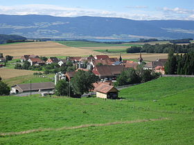
Prahins is 693 m above sea level. M. , nine kilometers east-southeast of the district capital Yverdon-les-Bains (linear distance ). The street line village extends on a protrusion in the Molasse hill country of the northern Vaudois Central Plateau , east of the valley of the Mentue .
The area of the 2.4 km² former municipality covers a small section of the hill country between Lake Neuchâtel and the Broyetal . The west-sloping slope of Prahins is bounded in the northeast by the Flonzel stream. Above the village is 740 m above sea level. M. reached the highest point of Prahins. In the south, the former commune extends into the Bois de la Faye forest , in the south-west a steep valley begins that drops rapidly to the Les Vernettes brook , which forms the western border. In the north-western part of the municipality are the forest heights Bois de la Dame ( 680 m above sea level ) and the Saumont (also 680 m above sea level ). In 1997, 4% of the former municipal area was accounted for by settlements, 26% for forests and woodlands and 70% for agriculture.
population
With 123 inhabitants (as of December 31, 2012), Prahins is one of the small former municipalities of the canton of Vaud. 92.1% of the residents are French-speaking, 6.4% German-speaking and 1.6% English-speaking (as of 2000). The population of Prahins was 175 in 1900. After the population had decreased by more than 50% to 79 people by 1970, a significant increase in population has since been registered again.
economy
Prahins still lives mainly from agriculture , especially from agriculture and cattle breeding . Outside the primary sector there are only a few jobs in the village. Some workers are also commuters who work mainly in Yverdon .
traffic
The former community is very well developed in terms of traffic. It is located on the main road from Yverdon to Moudon , which has a local bypass near Prahins. Prahins is connected to the public transport network by a postbus course that runs from Yverdon to Thierrens .
history
The first written mention of the place took place in 1187 under the name Prehens . The origin of the place name is not known. Prahins belonged to the Donneloye rule in the Middle Ages . With the conquest of Vaud by Bern in 1536, the village came under the administration of the Bailiwick of Yverdon . After the municipality, which was split up into seven fiefdoms until the second half of the 18th century, Prahins briefly formed its own small lordship. After the collapse of the Ancien Régime , the village belonged to the canton of Léman from 1798 to 1803 during the Helvetic Republic, which then became part of the canton of Vaud when the mediation constitution came into force . In 1798 it was assigned to the Yverdon district.
Attractions
The Reformed Church of Prahins was built in 1900 in the neo-Romanesque style. Several stately farmhouses from the 17th to 19th centuries have been preserved in the village. Prahins also owns an old threshing machine that is operated by horses.
Web links
- Philippe Heubi: Prahins. In: Historical Lexicon of Switzerland .
- Community information
- Aerial views of the village


