
Saint George
| Saint George | |
|---|---|
 |
|
| State : |
|
| Canton : |
|
| District : | Nyon |
| BFS no. : | 5434 |
| Postal code : | 1188 |
| Coordinates : | 509549 / 152 142 |
| Height : | 936 m above sea level M. |
| Height range : | 773–1445 m above sea level M. |
| Area : | 12.32 km² |
| Residents: | 1032 (December 31, 2018) |
| Population density : | 84 inhabitants per km² |
| Website: | www.stgeorge.ch |
 Saint George old mill |
|
| Location of the municipality | |
  |
|
Saint-George is a municipality in the Nyon district in the canton of Vaud in Switzerland .
geography
Saint George is 936 m above sea level. M. , 15 km north of the district capital Nyon (air line). The village extends in the headwaters of the Saubrette , on the southern slope of the Jura , at the foot of the Crêt de la Neuve .
The area of the 12.3 km² municipal area covers a section of the Vaudois Jura in the area of the source brooks of the Saubrette , which drains the area to the Aubonne . The southern part of the municipality is occupied by the Saubrette valley, the height at the Jura foot and the Mont Chaubert ( 1090 m above sea level ). To the north, the parish extends over the densely forested area of Les Mossières and La Charbonnière to the anticline of the Mont-Tendre chain . South of the Col du Marchairuz is at 1450 m above sea level. M. reached the highest point of Saint-George. The only larger forest clearing on the Jura ridge is the Pré de Rolle pasture . In 1997, 5% of the municipal area was accounted for by settlements, 76% for forests and woodlands and 19% for agriculture.
Saint-George includes the houses of Maison Neuve ( 930 m above sea level ) south of the village, some single-family and holiday home quarters on the slope of Mont Chaubert and some individual farms. The neighboring parishes of Saint George are Gimel in the northeast and east , Longirod in the south and southwest and Le Chenit in the northwest .
population
With 1,032 inhabitants (as of December 31, 2018), Saint-George is one of the smaller municipalities in the canton of Vaud. 86.6% of the residents are French-speaking, 7.0% German-speaking and 3.2% English-speaking (as of 2000). The population of Saint-George was 380 in 1900. After the population had decreased to 238 inhabitants by 1960, a rapid increase in population has been recorded since then, with the number of inhabitants almost tripling within 40 years.
economy
Until the middle of the 20th century, Saint-George was a predominantly agricultural village. Agriculture still plays an important role as a livelihood for the population, with livestock and dairy farming dominating over arable farming . Further jobs are available in local small businesses and especially in the service sector. Saint-George is home to the Fondation pour la sauvegarde du patrimoine artisanal (Foundation for the Protection of Handicrafts). In the last few decades the village has developed into a residential community thanks to its attractive location. Many workers are therefore commuters who go to work in the larger towns along Lake Geneva.
tourism
Saint-George is a resort town with numerous holiday and weekend homes. On the Jura slope above the village, two ski lifts are in operation in winter.
traffic
The community has good transport connections. It is on the main road that leads from Aubonne via Gimel over the Col du Marchairuz into the Vallée de Joux . Saint-George is also easily accessible from Gland . The town is connected to Nyon by a postbus course .
history
The first written mention of the place took place in 1153 under the name Sancti-Georgii in Essartinis . The village goes back to a small Benedictine priory that was under the care of the Saint-Jean priory near Geneva . With the conquest of Vaud by Bern in 1536, the priory was secularized and Saint-George came under the administration of the Bailiwick of Morges . After the collapse of the Ancien Régime , the village belonged to the canton of Léman from 1798 to 1803 during the Helvetic Republic, which then became part of the canton of Vaud when the mediation constitution came into force . In 1798 it was assigned to the Aubonne district.
The Saint-George lockout was built during World War II and is considered a military monument of regional importance.
Attractions
The church of Saint George was first mentioned in 1153. Since then, the building has undergone numerous alterations and renovations.
Web links
- Official website of the municipality of Saint-George (French)
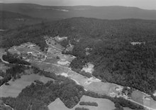
- Aerial photography
- Germain Hausmann: Saint-George. In: Historical Lexicon of Switzerland .
Individual evidence
- ↑ Permanent and non-permanent resident population by year, canton, district, municipality, population type and gender (permanent resident population). In: bfs. admin.ch . Federal Statistical Office (FSO), August 31, 2019, accessed on December 22, 2019 .
Arnex-sur-Nyon | Arzier-Le Muids | Basins | Begnins | Bogis-Bossey | Borex | Bursinel | Bursins | Burtigny | Chavannes-de-Bogis | Chavannes-des-Bois | Chéserex | Coinsins | Commugny | Coppet | Crans-près-Céligny | Crassier | Duillier | Dully | Essertines-sur-Rolle | Eysins | Founex | Genolier | Gilly | Gingins | Givrins | Gland | Grens | Longirod | Luins | Marchissy | Lousy | Mont-sur-Rolle | Nyon | Perroy | Prangins | La rib | Role | Saint-Cergue | Saint George | Signy-Avenex | Tannay | Tartegnin | Trélex | Le Vaud | Vich | Vinzel
Canton of Vaud | Districts of the canton of Vaud | Municipalities of the canton of Vaud