Montaubion chardonney
| Montaubion chardonney | ||
|---|---|---|
| State : |
|
|
| Canton : |
|
|
| District : | Gros-de-Vaud | |
| Municipality : | Jorat-Menthue | |
| Postal code : | 1041 | |
| former BFS no. : | 5677 | |
| Coordinates : | 544 581 / 166540 | |
| Height : | 761 m above sea level M. | |
| Area : | 2.09 km² | |
| Residents: | 69 (December 31, 2010) | |
| Population density : | 33 inhabitants per km² | |
| map | ||
|
|
||
Montaubion-Chardonney was a municipality in the district of Gros-de-Vaud in the canton of Vaud in Switzerland . Montaubion-Chardonney merged on July 1, 2011 with the municipalities of Peney-le-Jorat , Sottens , Villars-Mendraz and Villars-Tiercelin to form the new municipality of Jorat-Menthue .
geography
Montaubion-Chardonney is 15 kilometers north of the canton capital of Lausanne (as the crow flies). The double community, consisting of Montaubion ( 761 m above sea level. M. ) and Chardonney ( 768 m above sea level. M. ), extending east of the valley of Mentue , in Molassehügelland the Vaud Midland . The two villages are separated from each other by a side valley of the Mentue.
The area of the 2.1 km² former municipal area comprises a section of the Molasse hill country on the northern roof of the Jorat . The western border runs along the Mentue cut into the molasse layers . From here the parish extends eastward over the terrace of Chardonney into the forest of Les Tailles and on the slope of the hill reaches Le Faz at 861 m above sea level. M. the highest point of Montaubion-Chardonney. To the north, the area extends to the meadow hill Grands Champs ( 792 m above sea level ). In 1997, 5% of the municipal area was accounted for by settlements, 32% for forests and trees and 63% for agriculture.
In addition to the two hamlets of Montaubion and Chardonney, a few individual farms were part of the community. The neighboring communities of Montaubion-Chardonney were Peyres-Possens , Sottens , Villars-Mendraz , Peney-le-Jorat , Villars-Tiercelin and Dommartin .
population
With 69 inhabitants (as of December 31, 2010), Montaubion-Chardonney was one of the smallest communities in the canton of Vaud. 93.2% of the residents are French-speaking, 2.7% German-speaking and 1.4% Italian-speaking (as of 2000). The population of Montaubion-Chardonney was 116 in 1900. After that, a decrease of almost 50% to 61 inhabitants was recorded by 1970 due to strong emigration; since then the population has increased slightly again.
economy
Montaubion-Chardonney still lives mainly from agriculture , especially from agriculture , fruit growing and cattle breeding . There is a sawmill at the Mentue.
traffic
Montaubion-Chardonney is located away from the major thoroughfares on a connecting road from Moudon to Dommartin . Montaubion and Chardonney are connected to the public transport network by a postbus course that runs from Echallens to Thierrens .
history
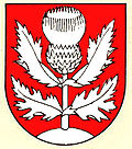
The first written mention of the place Montaubion took place in 1223 under the name Montalbium . Later the names appeared in monte Albeonis and in monte Albionis (around 1230) and Montoubyun (also in the 13th century). The place name goes back to the Latin word mons (mountain) and the name Albion . Chardonney first appeared in the documents as Chardenai in 1225 and was later referred to as Chardonnay . This name is derived from the French word chardon (thistle).
In the Middle Ages, Montaubion and Chardonney were under the rule of Dommartin, which in turn belonged to the Lausanne cathedral chapter. With the conquest of Vaud by Bern in 1536, the villages came under the administration of Kastlanei Dommartin, an exclave in the Bailiwick of Lausanne . After the collapse of the Ancien Régime , Montaubion-Chardonney belonged to the canton of Léman from 1798 to 1803 during the Helvetic Republic , which then became part of the canton of Vaud when the mediation constitution came into force . In 1798 it was assigned to the Moudon district.
Attractions
Web links
- Community information
- Jean-Jacques Bouquet: Montaubion Chardonney. In: Historical Lexicon of Switzerland .
- Aerial view of Chardonney


