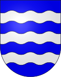
Malapalud
| Malapalud | ||
|---|---|---|
| State : |
|
|
| Canton : |
|
|
| District : | Gros-de-Vaud | |
| Municipality : | Assens | |
| Postal code : | 1042 | |
| former BFS no. : | 5526 | |
| Coordinates : | 538 894 / 163 569 | |
| Height : | 663 m above sea level M. | |
| Area : | 0.83 km² | |
| Residents: | 92 (December 31, 2008) | |
| Population density : | 111 inhabitants per km² | |
| map | ||
|
|
||
Malapalud was until December 31, 2008 a municipality in the Gros-de-Vaud district of the canton of Vaud in Switzerland .
On January 1, 2009, Malapalud merged with the municipality of Assens to form the new municipality of Assens.
geography
Malapalud is 663 m above sea level. M. , two kilometers south of Echallens and eleven kilometers north of the canton capital Lausanne (as the crow flies). The small farming village extends on a plateau of the Gros de Vaud , west of the Talent , on the northwestern edge of the heights of the Jorat , in the Vaudois Central Plateau .
The area of the 0.8 km² former municipality covers a small section of the Vaud Central Plateau. The municipality floor extended from the upper reaches of the Talent westward to the approximately 700 m wide plateau of Malapalud, on the 676 m above sea level. M. ( Mont Raimond ) the highest point is reached. In the north, the border ran along the edge of the forest of the Bois de la Commune of Echallens. In 1997, 4% of the municipal area was accounted for by settlements, 18% for forests and woodlands and 78% for agriculture.
The Berchères farm ( 650 m above sea level ) belonged to Malapalud . The neighboring communities of Malapalud were Echallens , Bottens and Assens .
population
With 92 inhabitants (at the end of 2008) Malapalud was one of the smallest municipalities in the canton of Vaud. 77.1% of the residents are French-speaking, 14.8% German-speaking and 6.6% Portuguese-speaking (as of 2000). The population of Malapalud was 58 in 1900. After the population had decreased to 48 people by 1990, a slight increase in population was recorded again.
economy
Malapalud still lives from agriculture , especially from agriculture and cattle breeding . There is a horse racing track on the grounds of the Berchères farm, where horse breeding is carried out. Except in a sawmill there are no other jobs in the village. Some of the villagers are commuters and work in Echallens.
traffic
The former municipality is located off the main thoroughfares, around 1 km from the main road from Lausanne to Echallens . Malapalud has no connection to the public transport network.
history
The place name is derived from the Latin words mala palus and literally means bad swamp (bad terrain in a swampy area). In the Middle Ages, Malapalud belonged to Boten's rule. After the Burgundian Wars , the village came to the Orbe-Echallens Bailiwick in 1476 , which was under the common rule of Bern and Friborg . After the collapse of the Ancien Régime , Malapalud belonged to the canton of Léman from 1798 to 1803 during the Helvetic Republic, which then became part of the canton of Vaud when the mediation constitution came into force . In 1798 it was assigned to the Echallens district. Malapalud does not have its own church, it belongs to the parish of Assens .
Attractions
Web links
- Marianne Stubenvoll: Malapalud. In: Historical Lexicon of Switzerland .
- Community information
- Aerial photography


