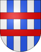
Signau district
| Signau district | |
|---|---|
| Basic data | |
| Country: |
|
| Canton : |
|
| Main town : | Signau |
| Area : | 320.11 km² |
| Residents: | 24,250 (December 31, 2008) |
| Population density : | 76 inhabitants per km² |
| map | |
The Signau district was an administrative unit of the Canton of Bern until December 31, 2009 . The administrative district with the main town Signau comprised nine communities with 24,250 inhabitants (as of December 31, 2008) on 320.11 km²:
Communities
| Name of the parish | Population (December 31, 2008) |
Area in km² | Inhabitants per km² |
|---|---|---|---|
| Eggiwil | 2467 | 60.30 | 41 |
| Langnau in the Emmental | 8956 | 48.36 | 185 |
| Lauperswil | 2652 | 21.19 | 125 |
| Röthenbach in the Emmental | 1281 | 36.80 | 35 |
| Rüderswil | 2338 | 17.21 | 136 |
| Schangnau | 936 | 36.48 | 26th |
| Signau | 2722 | 22.13 | 123 |
| Turbidity | 1462 | 61.99 | 24 |
| Trubschachen | 1436 | 15.65 | 92 |
| Total (9) | 24,250 | 320.11 | 76 |
Changes in the community
- 1867: Change of name Lauperswil Vierter → Trubschachen
- 2010: District change of all 9 municipalities from the Signau district → Emmental district


