Burgdorf district
| Burgdorf district | |
|---|---|
| Basic data | |
| Country: |
|
| Canton : |
|
| Main town : | Burgdorf |
| Area : | 197.30 km² |
| Residents: | 46,127 (December 31, 2008) |
| Population density : | 234 inhabitants per km² |
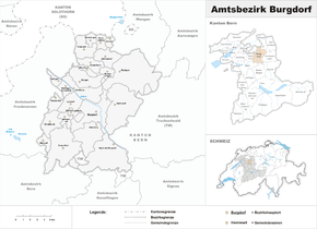
| map | |
The Burgdorf district was an administrative unit of the Canton of Bern until December 31, 2009 . The seat of the governor was Burgdorf Castle in Burgdorf . The district comprised 24 communities on 197.30 km²:
Communities
| Name of the parish | Population (December 31, 2008) |
Area in km² | Inhabitants per km² |
|---|---|---|---|
| Aefligen | 1006 | 2.04 | 493 |
| Alchenstorf | 565 | 6.57 | 86 |
| Bäriswil | 991 | 2.73 | 363 |
| Burgdorf BE | 15'238 | 15.56 | 979 |
| Ersigen | 1483 | 8.76 | 169 |
| Hasle near Burgdorf | 3081 | 21.89 | 141 |
| Heimiswil | 1626 | 23.36 | 70 |
| Clairvoyant | 181 | 1.48 | 122 |
| Hindelbank | 2006 | 6.75 | 297 |
| Höchstetten BE | 257 | 2.64 | 97 |
| Kernenried | 426 | 3.33 | 128 |
| Kirchberg BE | 5608 | 9.05 | 620 |
| Koppigen | 2069 | 6.93 | 299 |
| Krauchthal | 2273 | 19.43 | 117 |
| Lyssach | 1390 | 6.05 | 230 |
| Mötschwil | 138 | 2.95 | 47 |
| Niederösch | 226 | 4.60 | 49 |
| Oberburg BE | 2846 | 14.14 | 201 |
| Oberösch | 110 | 2.10 | 52 |
| Rüdtligen-Alchenflüh | 2169 | 2.72 | 797 |
| Rumendingen | 81 | 2.44 | 33 |
| Rüti near Lyssach | 157 | 1.29 | 122 |
| Willadingen | 181 | 2.17 | 83 |
| Wynigen | 2019 | 28.32 | 71 |
| Total (24) | 46,127 | 197.30 | 234 |
Changes in the community
- 1887: Merger of Brechershäusern and Wynigen → Wynigen
- 1888: Alchenstorf and Wil near Koppigen → Alchenstorf merge
- 1911: Merger of Bickigen-Schwanden and Wynigen → Wynigen
- 1911: Change of name Mötschwil-Schleumen → Mötschwil
- 1926: Change of name Rüdtligen → Rüdtligen-Alchenflüh
- 2010: District change from Bäriswil from the Burgdorf district to the Bern-Mittelland administrative district
- 2010: District change of all other 23 municipalities from the Burgdorf district → Emmental district
literature
- Anne-Marie Dubler : The legal sources of the Canton of Bern, Part Two: Rights of the Landscape, Volume 9: The legal sources of the city of Burgdorf and its lordships and the Burgdorf mayor's office (= Swiss Lawyers Association. Legal Sources Foundation [Ed.]: Collection of Swiss Legal Sources . II. Department). Sauerländer, Aarau 1995, ISBN 3-7941-4010-9 ( online ).


