Coronet Peak
| Coronet Peak | ||
|---|---|---|
|
Coronet Peak from the southeast with Lake Hayes |
||
| height | 1651 m | |
| location | Queenstown-Lakes District , Otago , New Zealand's South Island | |
| Mountains | New Zealand Alps | |
| Dominance | 6.5 km → Vanguard Peak | |
| Notch height | 769 m | |
| Coordinates | 44 ° 54 '57 " S , 168 ° 44' 22" E | |
|
|
||
| rock | Otago - slate | |
| Age of the rock | Permian to Triassic | |
| particularities | Mountain slide, ski area | |
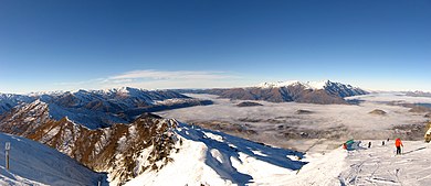
The Coronet Peak ( English for Diademspitze ) is a 1651 m high mountain in the New Zealand Alps not far from Queenstown . With the ski resort in New Zealand, which opened in 1947 and is located on the southern slope, it is one of the most important winter sports areas in the southern hemisphere .
Location and surroundings
Coronet Peak rises on the edge of the Wakatipu Basin about 15 kilometers northeast of Queenstown on the shores of Lake Wakatipu and towers above it by 1,340 meters. The nearest settlement is the former gold rush town of Arrowtown in a basin east of the mountain. The ski area of the same name can be reached by road from Queenstown. At 4.8 km, the Skippers Road, a well-known tourist road, branches off, which leads over a saddle into the canyon of the same name . About 16 kilometers southeast and 33 kilometers north-northeast of Coronet Peak are two other well-known ski areas: The Remarkables and Treble Cone.
Geology and geomorphology
The Wakatipu Basin is built from the Paleozoic Otago slate . This is part of the Haast Schiefer Terran , which extends over large areas in the lower part of the South Island. The rock consists of green schist , quartz , feldspar and pelitic lithologies that emerged from sandstone , claystone and volcanic rock .
At Coronet Peak there is one of the largest mass movements in the basin, which takes up almost the entire southern slope of the mountain between Arthur's Point and Arrowtown. It is a deep landslide that was probably triggered 135,000 years ago by ice undercut as a result of a glacier advance. The translational slide with a planar shear surface and a slope between 15 and 25 ° has an estimated volume of around one billion cubic meters and can be morphologically divided into two zones. The larger zone has a well-developed topography and is now moving at a rate of less than 2.5 mm / year.
tourism
The southern flank of the mountain, which is congruent with the landslide, is now subject to intensive use. In the summer months it serves as a sheep pasture and as an exercise area for hikers, mountain bikers and paragliders .
The winter sports area at Coronet Peak has existed since July 1947 and is New Zealand's oldest commercial ski area. The first ascent aid consisted of a simple rope lift constructed by jet boat inventor Bill Hamilton . The first owner was the Mount Cook and Southern Lakes Tourist Company. The season initially lasted only four weeks, but was extended from 1992 through the introduction of a snowmaking system.
Today the ski area, the base of which is at 1180 m , covers an area of 280 hectares and slopes of all levels of difficulty . There are eight lifts, including three chairlifts , a drag lift and, since 2019, a gondola lift . Night skiing is possible on certain days of the week. According to its own information, the company NZ Ski Ltd. operated ski area with more than 200 snow cannons over the largest snowmaking system in the southern hemisphere . The season usually runs from early June to early October. The Australia New Zealand Cup , organized by the FIS , stops at Coronet Peak each year in August or September.
Web links
- Official website (English)
Individual evidence
- ↑ Amanda Jayne Willetts: The Geology and Geomorphology of the Coronet Peak and Arthurs Point Landslide Complexes. Master's thesis at the University of Canterbury , Christchurch 2000, p. 5. Online PDF , accessed on January 7, 2020 (English).
- ^ D. Craw: Lithologic Variations in the Otago Schist, Mt Aspiring area, NW Otago, New Zealand. In: New Zealand Journal of Geology and Geophysics Vol. 27 (1984), pp. 151-166 (English).
- ↑ Amanda Jayne Willetts: The Geology and Geomorphology of the Coronet Peak and Arthurs Point Landslide Complexes. Master's thesis at the University of Canterbury , Christchurch 2000.
- ↑ Ben Mackey: Seismic Hazard in Queenstown Lakes District. Otago Regional Council, Dunedin 2015, p. 64. Online PDF , accessed January 7, 2020.
- ↑ Tracey Roxburgh: Big night planned for ski area's 70th birthday. Otago Daily Times , July 27, 2017, accessed January 7, 2020 .
- ^ Coronet Peak Ski Area. Queenstown , accessed January 7, 2020 .
- ↑ Trade & Media. NZ Ski Limited, accessed January 7, 2020 .


