
Department of Guainía
 |
 |
| Data | |
|---|---|
| Capital | Inírida |
| governor | Javier Eliécer Zapata Parrado (2016-2019) |
| surface | 72,238 km² |
|
Population (Total) - 2005 Census - Population Density |
35,230 0.5 inhabitants / km² |
| urbanization | 15.5% |
| Literacy rate | 65% |
| Number of parishes | 9 |
| Popular name | guainiano / a, guainarense |
| Important cities | Inírida |
| map | |
 .svg) |
|
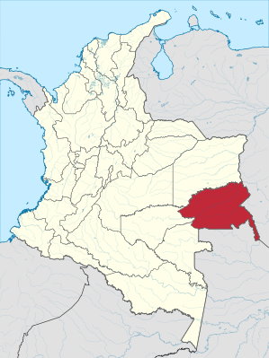
The Departamento de Guainía is a province in eastern Colombia . It borders Venezuela to the east and Brazil to the south, the provinces of Vaupés and Guaviare to the west and Vichada to the north .
The economy is poor. In addition to agriculture, there is also fishing , hunting and livestock farming as well as gold and diamond deposits in the mountainous areas on the borders with Venezuela and Brazil.
The majority of the population are indigenous people from various tribes of the area.
Administrative division
The Departamento de Guainía consists of a municipality ( Municipio ) and eight offices ("Corregimientos Departamentales" marked with a CD at the end) due to the low population density. The offices are characterized by the lack of urban structures. The following shows the municipality and the eight offices with their total number of inhabitants from the census of the Colombian statistical office DANE from 2005, extrapolated for 2018.
| local community | Population 2018 |
|---|---|
| Inírida | 20,312 |
| Barranco Minas CD | 4,984 |
| Mapiripana CD | 2,759 |
| San Felipe CD | 2,306 |
| Puerto Colombia CD | 5,031 |
| La Guadalupe CD | 410 |
| Cacahual CD | 2,812 |
| Pana Pana CD | 3,467 |
| Morichal CD | 1,365 |
Individual evidence
- ↑ Extrapolation of the population of Colombia on the official DANE website
Amazon | Antioquia | Arauca | Atlántico | Bogotá - Distrito Capital | Bolívar | Boyacá | Caldas | Caquetá | Casanare | Cauca | Cesar | Chocó | Cordoba | Cundinamarca | Guainía | Guaviare | Huila | La Guajira | Magdalena | Meta | Nariño | Norte de Santander | Putumayo | Quindío | Risaralda | San Andrés and Providencia | Santander | Sucre | Tolima | Valle del Cauca | Vaupés | Vichada