
Department of Casanare
 |
 |
| Data | |
|---|---|
| Capital | Yopal |
| governor | Salomón Andrés Sanabria (2020-2023) |
| surface | 44,640 km² |
|
Population (Total) - 2005 Census - Population Density |
295,353 7 inhabitants / km² |
| urbanization | 44.2% |
| Literacy rate | 83% |
| Number of parishes | 19th |
| Popular name | |
| Important cities | Aguazul , Paz de Ariporo , Villanueva |
| map | |
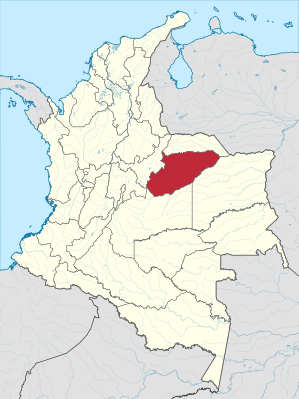 .svg) |
|
The Departamento de Casanare is a department in central and eastern Colombia . It extends from the central highlands (eastern flank of the Andes) far to the northeast, along the Río Meta river to almost the border of Venezuela. The Departamento de Casanare borders in the north on the Departamento de Arauca , in the southeast on Vichada , in the south on Meta and in the west on the Departamento de Boyacá .
The prospects for the region are very good thanks to oil production . In the agriculture dominates rice . In addition to Yuca , sugar cane , corn , cocoa , sorghum and beans grown. Cattle farming plays an important role. Cutting down the forest is less important.
Administrative division
The Departamento de Casanare consists of 19 municipalities. The population figures are based on the 2005 DANE census and extrapolated for 2018.
| local community | Population 2018 |
|---|---|
| Aguazul | 41,994 |
| Chámeza | 2,603 |
| Hato Corozal | 12,794 |
| La Salina | 1,465 |
| Maní | 11,123 |
| Monterrey | 15,399 |
| Nunchia | 8,928 |
| Orocué | 8,424 |
| Paz de Ariporo | 26,357 |
| pore | 7,909 |
| Recetor | 4,528 |
| Sabanalarga | 2,856 |
| Sácama | 2,085 |
| San Luis de Palenque | 7,905 |
| Támara | 7,029 |
| Tauramena | 24,066 |
| Trinidad | 15,840 |
| Villanueva | 24,518 |
| Yopal | 149.426 |
Web links
Individual evidence
Amazon | Antioquia | Arauca | Atlántico | Bogotá - Distrito Capital | Bolívar | Boyacá | Caldas | Caquetá | Casanare | Cauca | Cesar | Chocó | Cordoba | Cundinamarca | Guainía | Guaviare | Huila | La Guajira | Magdalena | Meta | Nariño | Norte de Santander | Putumayo | Quindío | Risaralda | San Andrés and Providencia | Santander | Sucre | Tolima | Valle del Cauca | Vaupés | Vichada