
Department of Meta
 |
 |
| Data | |
|---|---|
| Capital | Villavicencio |
| governor | Marcela Amaya (2016-2019) |
| surface | 85,635 km² |
|
Population (Total) - 2005 Census - Population Density |
783,168 9 inhabitants / km² |
| urbanization | 62.3% |
| Literacy rate | 86.3% |
| Number of parishes | 29 |
| Popular name | |
| Important cities | Granada , Acacías |
| map | |
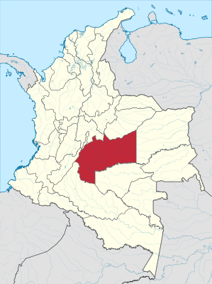 .svg) |
|
The Departamento del Meta is a department in the geographical center of Colombia , named after the River Meta, which drains to the Orinoco . The department is roughly the size of Austria and extends from the Colombian capital Bogotá about 300 km to the south and east.
The Departamento del Meta borders in the east on the Departamento de Vichada in the south on the Departamento de Guaviare in the southwest on the Departamento del Caquetá and in the west on the Departamento del Huila in the west. In the north it borders the capital Bogotá and the departments of Cundinamarca and Casanare .
landscape
Geographically , Meta comprises the hills and plateaus in the middle and upper reaches of the Río Meta and Guaviare (or its tributary Ariari ), which belong to the western catchment area of the Orinoco . In the east of the province there are also the headwaters of the Vichada and Uva and in the mountainous west - in a mountain range upstream of the Andes - the Macarena National Park .
The table land, predestined for cattle breeding, can largely be assigned to the Llanos landscape type. Almost all of its rivers and streams flow in an easterly direction (northeast to southeast), where the neighboring provinces descend to the Orinoco lowlands .
The economy is based on agriculture and the keeping of cattle . Be of crops of rice , corn , bananas and sorghum grown. The industry - apart from the oil production - plays a subordinate role and is mainly located in and around Villavicencio .
Administrative division
The area of the department is divided into 29 municipalities, see the list of Municipios in the Departamento del Meta .
Amazon | Antioquia | Arauca | Atlántico | Bogotá - Distrito Capital | Bolívar | Boyacá | Caldas | Caquetá | Casanare | Cauca | Cesar | Chocó | Cordoba | Cundinamarca | Guainía | Guaviare | Huila | La Guajira | Magdalena | Meta | Nariño | Norte de Santander | Putumayo | Quindío | Risaralda | San Andrés and Providencia | Santander | Sucre | Tolima | Valle del Cauca | Vaupés | Vichada