
Department del Cesar
 |
 |
| Data | |
|---|---|
| Capital | Valledupar |
| governor | Francisco Fernando Ovalle Angarita (2016–2019) |
| surface | 22,905 km² |
|
Population (Total) - 2005 Census - Population Density |
903,279 39 inhabitants / km² |
| urbanization | 60.4% |
| Literacy rate | 78.5% |
| Number of parishes | 25th |
| Popular name | Cesarences (cesarens) |
| Important cities | Aguachica , Agustín Codazzi |
| map | |
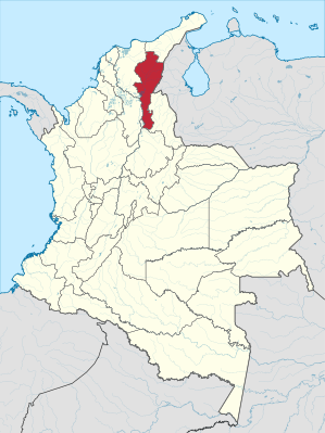 .svg) |
|
The Departamento del Cesar is a department in northeast Colombia . It borders Venezuela in the east and is otherwise surrounded by the Departamentos de La Guajira in the north, Norte de Santander in the east, Santander in the south and Bolívar and Magdalena in the west.
In agriculture , the main crops are cotton , rice and sorghum . Livestock is raised in the north and south of the province. In terms of natural resources, there are coal, oil and limestone.
Not far from the capital Valledupar, in the Sierra Nevada de Santa Marta , are the two highest peaks in the country - the Pico Cristóbal Colón and the Pico Simón Bolívar .
Administrative division
The Departamento del Cesar consists of 25 municipalities (municipios) . These are subdivided into a community center (Cabecera Municipal) and the surrounding area (Resto Rural) . The surrounding area is further subdivided into so-called police inspections (Inspecciones de Policía Municipal) , smaller offices (Corregimientos) , settlement centers (Centros Poblados) and homesteads (Caseríos) . The following lists the municipalities with their total number of inhabitants from the census of the Colombian statistical office DANE from 2005, extrapolated for 2018.
| local community | Population 2018 |
|---|---|
| Aguachica | 95,782 |
| Agustín Codazzi | 49,654 |
| Astrea | 19,348 |
| Becerril | 13,261 |
| Bosconia | 39,100 |
| Chimichagua | 30,404 |
| Chiriguaná | 18,852 |
| Curumaní | 23,360 |
| El Copey | 26,803 |
| El Paso | 23,361 |
| Gamarra | 17,278 |
| Gonzalez | 6,398 |
| La Gloria | 12,405 |
| La Jagua de Ibirico | 22,372 |
| La Paz Robles | 22,977 |
| Manaurs | 15,557 |
| Pailitas | 17,462 |
| Pelaya | 18,243 |
| Pueblo Bello | 23,985 |
| Río de Oro | 13,897 |
| San Alberto | 26,080 |
| San Diego | 13.208 |
| San Martín | 18,846 |
| Tamalameque | 13,754 |
| Valledupar | 483.286 |
Individual evidence
Amazon | Antioquia | Arauca | Atlántico | Bogotá - Distrito Capital | Bolívar | Boyacá | Caldas | Caquetá | Casanare | Cauca | Cesar | Chocó | Cordoba | Cundinamarca | Guainía | Guaviare | Huila | La Guajira | Magdalena | Meta | Nariño | Norte de Santander | Putumayo | Quindío | Risaralda | San Andrés and Providencia | Santander | Sucre | Tolima | Valle del Cauca | Vaupés | Vichada