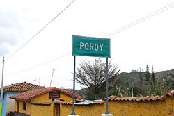
Poroy district
| Poroy district | |
|---|---|
 The Poroy district is located in the far northwest of the province of Cusco (marked in red) |
|
| Basic data | |
| Country | Peru |
| region | Cusco |
| province | Cusco |
| Seat | Poroy |
| surface | 15 km² |
| Residents | 2436 (2017) |
| density | 163 inhabitants per km² |
| founding | February 20, 1941 |
| ISO 3166-2 | PE-CUS |
| Website | munideporoy.gob.pe (Spanish) |
| politics | |
| Alcalde District | Francisco Toccas Quispe (2019-2022) |
Coordinates: 13 ° 29 ′ 43 ″ S , 72 ° 2 ′ 32 ″ W
The Poroy District is located in the Cusco Province of Cusco region in South Central Peru . The district was established on June 10, 1955. It has an area of 14.96 km². At the 2017 census, 2,436 people lived in the district. In 1993 the population was 1587, in 2007 it was 4462. The district administration is located in the village of Poroy with 1410 inhabitants (as of 2017).
Geographical location
The Poroy district is located in the far northwest of the province of Cusco. The 3499 m high village of Poroy is 7 km west-northwest of the city center of the regional capital Cusco . The national road 3S from Cusco to Abancay runs through Poroy. In addition, Poroy is an end point of the railway line Poroy - Ollantaytambo - Aguas Calientes . The famous ruined city of Machu Picchu is located near Aguas Calientes .
The district of Poroy borders in the west on the district Pucyura ( province Anta ), in the northwest on the district Cachimayo (also in the province Anta), in the east on the district Cusco and in the south on the district Ccorca .
Individual evidence
- ↑ a b Peru: Cusco Region - Provinces & Districts . www.citypopulation.de. Retrieved March 8, 2020.
