
Elster cycle path
| Elster cycle route | |
|---|---|
|
|
|
| overall length | approx. 250 km |
| location |
|
| Starting point | Elster spring at Aš 50 ° 12 ′ 1 ″ N , 12 ° 16 ′ 20 ″ E |
| Target point | in Halle an der Saale 51 ° 28 ′ 58 ″ N , 11 ° 58 ′ 12 ″ E |
| Places along the way | Adorf / Vogtl. , Plauen , Gera , Zeitz , Leipzig |
| Flooring | partly asphalted, partly water-bound surface |
| Connection to | Saale cycle route |
| Website URL | elsterradweg.de |
The Elster Cycle Path leads along the White Elster from the Czech Republic to Saxony-Anhalt.
overview
The route of the Elster cycle path was chosen for the most part along the river Weisse Elster and is characterized by different path conditions. In sections it is still being expanded. Over a length of around 250 km, it leads from the Elster spring through the four countries of the Czech Republic , Saxony , Thuringia and Saxony-Anhalt - from the Vogtland through the Thuringian slate mountains to the Leipzig lowland bay .
Its upper course is characterized by mountainous sections and is therefore suitable for sporty touring cyclists. The use of the railway is officially recommended in Adorf. From Gera downhill, the route is also suitable for inexperienced people and families with children. Getting here by Vogtlandbahn is particularly practical . Since the route mostly runs along the Eger-Plauen and Elstertal Railway , you are very flexible when planning the stages. The trains run every one or two hours, so that you can end the tour at any time and take the train home.
Stages
Elsterquelle - Adorf / Vogtl.
The Elsterradweg as such is not signposted on the Czech side. Several cycle paths can be used. A white / green marked path leads downhill from the Elster. The first place is Vernéřov (Wernersreuth) with a Bohemian tavern. In Dolní Paseky (Niederreuth) the path leads past an inconspicuous radon-containing acid spring. On the bank of the small drinking water dam, it goes to Podhradí (Neuberg), there turn right onto the road towards Doubrava (green). Continue across the border to Bad Elster through the spa facilities and after crossing the federal road 92 on the banks of the Elster to Adorf. The paths are well suited for cyclists.

First bridge over the White Elster

new bike path to Doubrava

shortly before Bad Elster am Heißenstein
Bad Elster

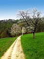
shortly before Adorf (Vogtland), coming from Bad Elster, until 2012

shortly before Adorf, newly built in 2013

first building in Adorf becomes visible


- Stage length: 22 km
- Height above sea level
- Start: 710 m
- Goal: 440 m
Adorf / Vogtl. - Oelsnitz
At the Adorf train station , the cycle path uses the access road to the Adorf railway station. From there it runs on a meadow path to the road to Leubetha . After about 100 meters the federal road 92 in the direction of Rebersreuth must be used up to the rocky curves. The Elstertal is left in Rebersreuth. The old Eichigt road is a stony dirt road and flows into the road between Eichigt and Hundsgrün . From there it goes on, again away from the Elstertal to Ebersbach , where the junction towards Unterhermsgrün is without any indication. After Unterhermsgrün you have to use the narrow and busy federal road 92 to Tanzermühle. From there there is a footpath that is free for cyclists to Oelsnitz.

Mouth of the Schwarzbach (left) in Adorf into the White Elster (right)

Cycle path near Leubetha (Vogtland), coming from Adorf


- Stage length: 17 km
- Height above sea level
- Start: 440 m
- Destination: 390 m
Oelsnitz - Plauen
- Stage length: 26 km
- Height above sea level
- Start: 390 m
- Destination: 340 m
Plauen - Greiz
Gössel Bridge in Plauen

Elstertal bridge near Jocketa
Between the Rentzschmühle and Elsterberg

Greiz-Dölau


.jpg)
- Stage length: 25 km
- Height above sea level
- Start: 340 m
- Goal: 260 m
Greiz - Berga

Greiz

Bretmühle Bridge near Neumühle / Elster
Signs to the source and mouth of the Elster near Neumühle

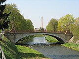
Customs house and New Elster Bridge in Berga
.jpg)

- Stage length: 15 km
- Height above sea level
- Start: 260 m
- Goal: 240 m
Berga - Gera
The cycle path between Berga and Wünschendorf runs with slight inclines on the right bank. The alternative route over the Elsterperlenweg on the left bank is more challenging.

Elster cycle path at Oberhammer

Unprotected Elster cycle path in front of Wünschendorf below the "Weiberstein" on the right bank of the Elster.
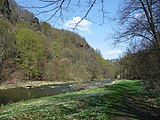
Between Berga and Wünschendorf

Wooden bridge in Wünschendorf


- Stage length: 21 km
- Height above sea level
- Start: 240 m
- Goal: 200 m
Gera - Zeitz

Pedestrian bridge in the north of Gera
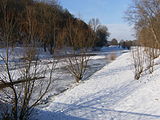
Ice drift between Gera-Thieschitz and Bad Köstritz

Bridge at Crossen on the Elster
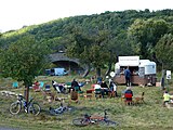
Café at Wetterzeube

.JPG)


- Stage length: 32 km
- Height above sea level
- Start: 200 m
- Goal: 150 m
Zeitz - Pegau
Auenbrücke in Zeitz
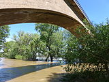
Flood in Zangenberg

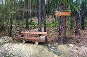
Bike stop in Göbitz

Shelter in the Elsteraue shortly before Lützkewitz, coming from Zeitz

Routing from 2016 south of Pegau to Altengroitzsch in Schwennigke-Aue


- Stage length: 23 km
- Height above sea level
- Start: 150 m
- Goal: 140 m
Pegau - Leipzig
Transmitting antenna passed at Wiederau

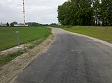
Route guidance on agricultural roads

Pumping station near Kleindalzig

Between Kleindalzig and Zitzschen

The end of the "concrete elster" near Leipzig-Hartmannsdorf
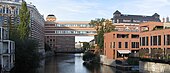
Colored yarn factories and townhouses in the south of Leipzig


- Stage length: 27 km
- Height above sea level
- Start: 140 m
- Goal: 120 m
Leipzig - estuary ( Halle (Saale) )
The paved path between the A 9 and Lochau is also suitable for inline skaters.

In the palm garden in Leipzig

Elster in Leipzig at the Nahle / Neue Luppe fork
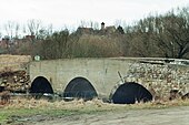
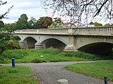
Last bridge at Halle-Ammendorf before it flows into the Saale

It flows into the Saale, in the background the E.ON AG lignite power plant in Schkopau


- Stage length: 32 km
- Height above sea level
- Start: 120 m
- Goal: 90 m
See also
List of long-distance cycle routes in Germany
literature
- Lutz Gebhardt: Weisse-Elster-Radwanderweg , green heart , ISBN 978-3-86636-122-5