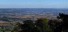
Eschweg basin
The Eschweger Basin is a basin landscape in the Lower Werrabergland in the Werra-Meißner district , Hesse ( Germany ).
Geographical location
The Eschweger basin lies between the mountains of the Gobert , Schlierbachswald and Hohen Meißner along the Werra and the weirs that flow into them . It is located clockwise between the places Jestädt and Schwebda in the north, Wanfried in the extreme northeast and Reichensachsen in the south and Abterode in the west. The central place is the district town of Eschwege .
Natural structure
According to sheet 112 Kassel, the Eschweg basin is structured as follows:
-
(to 35 East Hessian mountains )
-
(to 358 Lower Werrabergland )
- 358.2 Eschweg basin
- 358.20 Schwebda - Jestädter Werraaue
- 358.21 Eschweger hill country
- Leuchtberge (singularity, up to 319 m)
- Blauer Kuppe (Singularity, 339 m)
- 358.22 weirs lowering
- 358.23 Weidenhäuser hills
- 358.24 Wernersbergzug (up to 410 m, red sandstone )
- 358.2 Eschweg basin
-
(to 358 Lower Werrabergland )
The landscape is delimited in a clockwise direction by the following ridges:
- Southern Gobert foreland (Diedscher Kopf: 337 m) in the north
- Rosoppe-Frieda-Hügelland (Großer Dachsberg: 363 m) in the northeast
- Entry of the Werra in the extreme northeast
- Schlierbachswald (Hundsrück: 478 m) in the southeast
- Entry of the weirs in the south
- Finkenberg-Dachsberg-Zug (Dachsberg: 396 m) in the southwest
- Hoher Meißner (Kalbe: 720 m) further west
- Soodener Bergland (NN: 354 m) in the north-west
- Exit of the Werra
The basin landscape itself ends in the southwest on the flank of the Wernersberg range, which is in front of the Finkenberg-Dachsberg range, while in the northwest it only gradually ends at the Meißner foreland (358.03).
nature
The Eschweger basin consists on the one hand of the valleys of the Werraaue between Schwebda and Jestädt with its artificial lake landscape (including the Werratalsee ) and the weir valley between Reichensachsen and the confluence with the Werra north of Niederhone , on the other hand of the hilly landscapes south of the Werraaue, which are predominantly be used agriculturally. Larger forest areas only exist in the area of the Wernersberg range .
A geological peculiarity is the Blaue Kuppe north of Langenhain, an extinct volcano.
mountains
The most important mountains and elevations in the Eschweg basin are:
-
Wernersberg train
- Komberg (approx. 410 m), south of Alberode
- Wernersberg (378.1 m), northeast of Vierbach
- Blauer Kuppe (339 m, singularity)
-
Luminous mountains (singularity)
- Großer Leuchtberg (318.7 m), east of Eschwege
- Kleiner Leuchtberg (288.6 m)
- NN (248.5 m), southwest of Eschwege
- Steinröllchen (243.6 m), east of Oberhone
Attractions
The sights of the Eschweger Basin include:
- Old town of Eschwege
- Bismarck tower on the Großer Leuchtberg
- Schwebda moated castle
- Castle in Grebendorf
- Ruin of the moated castle Aue in Aue
- historic village center in Frieda
- Castle in Jestädt
The lake landscape around the Werratalsee offers a wide range of leisure and recreational opportunities.
Web links
- Overview of the Eschweg basin from the Bismarck tower on the Großer Leuchtberg
- The Eschweg basin from the viewpoints Silberklippe , Hohe Bahn on panorama-photo.net
Individual evidence
- ↑ Hans-Jürgen Klink: Geographical land survey: The natural space units on sheet 112 Kassel - Federal Institute for Regional Studies, Bad Godesberg 1969 → online map
- ↑ Map and legend of the natural areas of Hesse (online copy of Die Naturraum Hessens , Otto Klausing 1988) in the Hessen Environmental Atlas of the Hessian State Office for Environment and Geology
- ↑ a b Attention: Maps usually only show a 309 m high point beyond the summit! The 339 m correspond to the map of the German Empire, which is the basis for Blatt Kassel, and should therefore be somewhat inaccurate.
- ↑ Map services of the Federal Agency for Nature Conservation ( information )


