Ferizaj
|
Ferizaj / Ferizaji 1 Uroševac / Урошевац 2 |
||||
|
||||
| Basic data | ||||
|---|---|---|---|---|
| State : |
|
|||
| District : | Ferizaj | |||
| Municipality : | Ferizaj | |||
| Coordinates : | 42 ° 22 ' N , 21 ° 9' E | |||
| Height : | 573 m above sea level A. | |||
| Residents : | 42,628 (2011) | |||
| Telephone code : | +383 (0) 29 | |||
| Postal code : | 70000-70040 | |||
| License plate : | 05 | |||
|
1 Albanian (indefinite / definite form) , 2 Serbian (Latin / Cyrillic spelling) 3 Kosovo's independence is controversial. Serbia continues to regard the country as a Serbian province. |
||||
Ferizaj [ fɛɾiˑzaj ] ( Albanian also Ferizaji [ fɛɾizaˑji ]; Serbian Урошевац Uroševac [ uroʂɛʋat͡s ], older name Ferizovići [ fɛɾɨzoʋɨt͡ʃɨ ]) is a city in the south of Kosovo and the capital of the eponymous municipality and the Ferizaj district . With 42,000 inhabitants, it is the sixth largest city in the country.
geography
Ferizaj lies at 573 meters above sea level at the eastern foot of the Šar Planina in the Lepenci valley , which drains this region of Kosovo to the Aegean Sea . The city is about halfway between Pristina and Skopje about 40 km north of the border with North Macedonia .
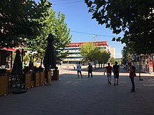
The urban area covers around 345 km² and has almost no elevations. While the agriculturally used blackbird field opens up in the north , the first foothills of the Šar Planina, which are densely forested, rise to the west of the city.
East of the city is Camp Bondsteel , a military base built after the war in Kosovo , which is the largest US base in Kosovo and one of the largest outside the USA.
history
Ferizaj is one of the youngest cities in Kosovo. It owes its rise to the construction of the Mitrovica - Skopje railway line in 1873, when Feriz-Beg Shasivari, who gave the city its name, had the station built on his estate. Hence the name Ferizaj or Ferizovići (thus "Village of Feriz"), around which a rapidly growing settlement developed, at that time still belonging to the Ottoman Empire .
In 1913 the city came to the Kingdom of Serbia as a result of the Balkan Wars and was renamed Uroševac ("City of Uroš"), after the Serbian King Stefan Uroš V. In 1933 the Serbian Orthodox Church of Saint Uroš was completed. In the First World War Urosevac was from Austria-Hungary in World War II by the Kingdom of Italy occupied.
The large mosque of Mulla Veseli in the center and the Church of Saint Uroš are regarded as symbols of the decades of religious tolerance between Albanian Muslims and Serbian Christians . None of these places of worship were damaged or destroyed during the 1999 Kosovo war . However, during the violent unrest against the Serbian population in 2004, the Church of Saint Uroš was attacked by Albanian extremists. Since the mosque and the church are right next to each other, this place is photographed by many tourists as it is a unique architectural, social and religious phenomenon.
population
According to the 2011 census, the town of Ferizaj has 42,628 inhabitants. 39,811 (93.39%) describe themselves as Albanians , 2405 (5.64%) as Roma , Ashkali or Balkan Egyptians , 63 as Gorans , 48 as Bosniaks , 46 as Turks and 14 as Serbs . Another 86 people indicated a different ethnicity.
| census | 1948 | 1953 | 1961 | 1971 | 1981 | 1991 | 2011 |
|---|---|---|---|---|---|---|---|
| Residents | 6685 | 8165 | 11,665 | 22,239 | 37,659 | 57,918 | 42,682 |
Sports
The local football club is KF Ferizaj and currently plays in the highest league, the IPKO Superliga . A well-known club from the city was the former Serbian handball club Borac Uroševac, which had its greatest successes in the 1980s.
sons and daughters of the town
- Svetomir Arsić-Basara (* 1928), sculptor
- Lucjan Avgustini (1963-2016), Roman Catholic bishop
- Mentor Haziri (* 1979), rock and jazz singer
- Labinot "Labi" Tahiri (* 1979), pop singer
- Enis Bytyqi (* 1992), pop folk singer
- Qëndrim Guri (* 1993), racing cyclist
- Mozzik (born 1995), rapper
- Getinjo (born 1990), rapper
- Regard , DJ
Web links
- Website of the Ferizaj municipality (Albanian, Serbian, English and Turkish)
- Ferizaj / Uroševac September 2009 . OSCE (PDF; 295 kB)
- Ferizaj24 (news portal)
Individual evidence
- ↑ Ethnic composition of Kosovo 2011. In: pop-stat.mashke.org. Retrieved January 10, 2018 .
- ↑ Kosovo censuses. In: pop-stat.mashke.org. Retrieved June 10, 2018 .


