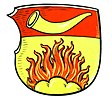
Friend (Aachen)
|
friend
City of Aachen
|
|
|---|---|
| Coordinates: 50 ° 45 ′ 6 ″ N , 6 ° 10 ′ 35 ″ E | |
| Height : | approx. 260 m |
| Postal code : | 52078 |
| Area code : | 0241 |
Freund is a small town in the eastern Aachen district of Brand on the L 220. It belongs to the parish of St. Donatus . On January 1, 1972, Freund and Brand were reclassified from what was then the Aachen district to the city of Aachen. The term 'friend' is derived from Vröng , an old term for benefice , goods and lands of spiritual lords, who drew their livelihood from it.
Brand is seamlessly connected to the west of Freund, and the Stolberg district of Büsbach is to the east of Freund . In the north is the Brander Forest , which mostly serves as a training area for the Aachen barracks. In the south lies the Krauthausen district, which is also part of the Brand district . The Inde runs in a semicircular arc east of Freund and Brander Wald .
Web links
Individual evidence
- ↑ St_Donatus of October 2, 2010
- ^ Federal Statistical Office (ed.): Historical municipality directory for the Federal Republic of Germany. Name, border and key number changes in municipalities, counties and administrative districts from May 27, 1970 to December 31, 1982 . W. Kohlhammer, Stuttgart / Mainz 1983, ISBN 3-17-003263-1 , p. 305 .
- ^ Eilendorfer field names from the Peter Packbier collection , accessed on February 27, 2018.

