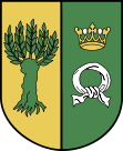
Gmina Rokietnica
| Gmina Rokietnica | ||
|---|---|---|

|
|
|
| Basic data | ||
| State : | Poland | |
| Voivodeship : | Greater Poland | |
| Powiat : | Poznański | |
| Geographic location : | 52 ° 31 ' N , 16 ° 45' E | |
| Residents : | see Gmina | |
| Postal code : | 62-090 | |
| Telephone code : | (+48) 61 | |
| License plate : | POZ, PZ | |
| Economy and Transport | ||
| Rail route : | Poznan – Szczecin | |
| Next international airport : | Poznań-Ławica | |
| Gmina | ||
| Gminatype: | Rural community | |
| Gmina structure: | 10 school offices | |
| Surface: | 79.31 km² | |
| Residents: | 18,225 (Jun. 30, 2019) |
|
| Population density : | 230 inhabitants / km² | |
| Community number ( GUS ): | 3021132 | |
| Administration (as of 2006) | ||
| Wójt : | Bartosz Derech | |
| Address: | ul. Golęcińska 1 62-090 Rokietnica |
|
| Website : | www.rokietnica.pl | |
The Gmina Rokietnica is a rural municipality in the Powiat Poznański of the Greater Poland Voivodeship in Poland . Your seat is the village of the same name ( German Rokietnice ) with about 6650 inhabitants.
geography
The municipality is centrally located in the voivodeship. It borders in the south on the independent capital of the voivodeship Poznan with the seat of the Powiat. The other neighboring municipalities are the municipalities: Tarnowo Podgórne in the southwest, Kaźmierz in the west, Szamotuły in the northwest, Oborniki in the north and Suchy Las in the east.
history
In the summer of 2014 and 2015 the women's tennis tournaments Powiat Poznański Open 2014 and 2015 took place in the village of Sobota .
structure
The rural community (gmina wiejska) Rokietnica with 18,225 inhabitants (as of June 30, 2019) includes the village itself and 15 other villages with a total of ten school boards (sołectwa):
- Rokietnica
- Kiekrz-Pawłowice
- Kobylniki
- Krzyszkowo
- Mrowino-Cerekwica
- Napachanie-Dalekie
- Przybroda
- Sobota-Bytkowo
- Starzyny-Rogierówko
- Żydowo-Rostvorovo
The 16 villages (German names until 1945) of the municipality are:
- Rokietnica ( Rokietnice , 1939–1943 Rokstedt , 1943–1945 Rokstätt (district of Posen) )
- Bytkowo ( Büttkau )
- Cerekwica ( Riemannsfelde )
- Dalekie ( Grundheim Vorwerk )
- Kiekrz ( Ketsch , 1943–1945 Ketsch (Kr. Posen) )
- Kobylniki ( Stutendorf )
- Krzyszkowo ( Friedrichssieg )
- Mrowino ( Rautendorf , 1943–1943 Joachimsfeld )
- Napachanie ( Grundheim )
- Pawłowice ( Paulsfelde )
- Przybroda ( Röhrfeld )
- Rogierówko ( Eckenau )
- Rostvorovo
- Sobota ( sun field )
- Starzyny
- Żydowo ( Hut Valley )
The districts are Gajówka Sobota, Huby and Zmysłowo.
Web links
- Community website (Polish)
- Order on change of place names in Reichsgau Wartheland in the ordinance sheet of the Reich governor in Warthegau from May 18, 1943 (PDF; 1.79 MB)
- District Rokstätt (Kr. Posen) in the Reichsgau Wartheland
Footnotes
- ↑ population. Size and Structure by Territorial Division. As of June 30, 2019. Główny Urząd Statystyczny (GUS) (PDF files; 0.99 MiB), accessed December 24, 2019 .
- ↑ rokietnica.pl: Sołtysi i Rady Sołeckie. (Polish, accessed June 11, 2020)
- ^ A b Rolf Jehke: District Rokstätt (Kr. Posen). In: Territorial changes in Germany and German administered areas 1874 - 1945. Retrieved on January 23, 2011 .
- ↑ a b c d e Cf. Forum Ahnenforschung - German place names in the Wartheland
- ↑ a b c d e f g h i j No. 62: Order about the change of place names in the Reichsgau Wartheland . In: Ordinance sheet of the Reich governor in the Warthegau . No. 12 . Poznan May 18, 1943, p. 85–111 ( gross-wartenberg.de [PDF; 1.8 MB ; accessed on January 23, 2011]).


