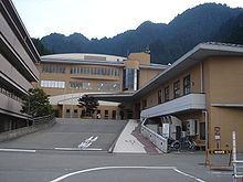
Gujō
| Gujō-shi 郡 上市 |
||
|---|---|---|
| Geographical location in Japan | ||
|
|
||
| Region : | Chūbu | |
| Prefecture : | Gifu | |
| Coordinates : | 35 ° 45 ' N , 136 ° 58' E | |
| Basic data | ||
| Surface: | 1,030.79 km² | |
| Residents : | 39,582 (June 1, 2019) |
|
| Population density : | 38 inhabitants per km² | |
| Community key : | 21219-9 | |
| Symbols | ||
| Flag / coat of arms: | ||
| Tree : | maple | |
| Flower : | Kobushi magnolia | |
| town hall | ||
| Address : |
Gujō City Hall 228 Shimatani, Hachiman-chō Gujō -shi Gifu 501-4297 |
|
| Website URL: | http://www.city.gujo.gifu.jp | |
| Location Gujōs in Gifu Prefecture | ||
Gujō ( Japanese 郡 上市 , - shi ) is a city in the Japanese prefecture of Gifu .
history
On March 1, 2004, the city of Gujō from the three communities Hachiman (八 幡 町, -chō), Yamato (大 和 町, -chō) and Shirotori (白鳥 町, -chō) and the four villages Takasu (高 鷲 村, -mura ), Minami (美 並 村, -mura), Meihō (明 宝 村, -mura) and Wara (和 良 村, -mura) of Gujō County .
geography
Gujō is north of Nagoya and Gifu , and south of Takayama .
The Nagara River flows through the city from north to south.
Attractions
In Gujō lying castle Gujō-Hachiman .
traffic
The city is connected to the Tokai-Hokuriku Highway and the 156, 158, 256 and 472 national roads . The station is on the Nagatetsu etsuminan line .
Neighboring cities and communities
Gujō borders on Takayama , Mino , Gero , Seki and undno .
Web links
Commons : Gujō - collection of images, videos and audio files


