Ōgaki
| Ōgaki-shi 大 垣 市 |
||
|---|---|---|
| Geographical location in Japan | ||
|
|
||
| Region : | Chūbu | |
| Prefecture : | Gifu | |
| Coordinates : | 35 ° 22 ' N , 136 ° 37' E | |
| Basic data | ||
| Surface: | 206.52 km² | |
| Residents : | 158,911 (June 1, 2019) |
|
| Population density : | 769 inhabitants per km² | |
| Community key : | 21202-4 | |
| Symbols | ||
| Flag / coat of arms: | ||
| Tree : | Camphor tree | |
| Flower : | Rhododendron indicum | |
| town hall | ||
| Address : |
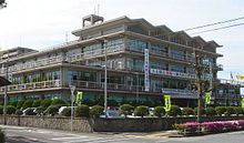
Ōgaki City Hall 2 - 29 Marunouchi Ōgaki -shi Gifu 503-8601 |
|
| Website URL: | http://www.city.ogaki.lg.jp | |
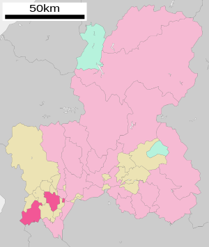
| Location Ōgakis in Gifu Prefecture | ||
Ōgaki ( Japanese 大 垣 市 , - shi ) is a city in the Japanese prefecture of Gifu .
geography
Ōgaki is west of Gifu .
The Nagara River flows through the city from northeast to southeast.
history
With the construction of Ōgaki Castle in 1535 by Miyagawa Yasusada on the instructions of Shogun Ashikaga Yoshiharu , Ōgaki became a castle town . It was conquered by Oda Nobunaga in 1546 . After the defeat of Oda Nobutaka , Toyotomi Hideyoshi gave the castle to Ikeda Nobuteru . After that, the castle became the residence of the Itō in 1590 , the Ishikawa in 1600 , the Hisamatsu in 1616 , the Okabe in 1624 , the Hisamatsu again in 1633 and finally the Toda from 1634 to 1868 with an income of 100,000 Koku .
Ōgaki was promoted to city on April 1, 1918.
traffic
- Street:
- National road 21
- Nakasendo
- Train:
- JR Tōkaidō Main Line , Ōgaki Station, to Tokyo or Kobe
Attractions
- Ōgaki Castle
- Matsuo Basho Museum
sons and daughters of the town
- Nanjō Bun'yū (1849–1927), Buddhist scholar and religious scholar
- Jin Hiratsuka (* 1999), soccer player
- Hiroshi Tanahashi (born 1976), wrestler
Town twinning
Neighboring cities and communities
Web links
Commons : Ōgaki - collection of images, videos and audio files


