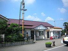
Kani (Gifu)
| Kani-shi 可 児 市 |
||
|---|---|---|
|
|
||
| Geographical location in Japan | ||
| Region : | Chūbu | |
| Prefecture : | Gifu | |
| Coordinates : | 35 ° 26 ' N , 137 ° 4' E | |
| Basic data | ||
| Surface: | 87.60 km² | |
| Residents : | 100,031 (June 1, 2019) |
|
| Population density : | 1142 inhabitants per km² | |
| Community key : | 21214-8 | |
| Symbols | ||
| Flag / coat of arms: | ||
| Tree : | Japanese black pine | |
| Flower : | Rhododendron indicum , rose | |
| town hall | ||
| Address : |
Kani City Hall 1 - 1 Hiromi Kani shi Gifu 509-0292 |
|
| Website URL: | http://www.city.kani.lg.jp/ | |
| Location Kanis in Gifu Prefecture | ||
Kani ( Japanese 可 児 市 , -shi ) is a city in the Japanese prefecture of Gifu .
history
Kani received town charter on April 1, 1982 .
geography
Kani is east of Gifu and north of Nagoya . The Kiso River flows through the city from northeast to northwest.
traffic
- Street
- train
- Kani is through the Taita line of JR according Tajimi and Minokamo and by Hiromi line by Meitetsu connected.
Neighboring cities and communities
Kani is surrounded by the parishes of Tajimi , Minokamo , Toki , Yaozu , Mitake, and Inuyama .
Web links
Commons : Kani - collection of images, videos and audio files


