Kakamigahara
| Kakamigahara-shi 各 務 原 市 |
||
|---|---|---|
|
|
||
| Geographical location in Japan | ||
| Region : | Chūbu | |
| Prefecture : | Gifu | |
| Coordinates : | 35 ° 24 ' N , 136 ° 51' E | |
| Basic data | ||
| Surface: | 87.77 km² | |
| Residents : | 144,335 (June 1, 2019) |
|
| Population density : | 1644 inhabitants per km² | |
| Community key : | 21213-0 | |
| Symbols | ||
| Flag / coat of arms: | ||
| Tree : | jaw | |
| Flower : | azalea | |
| town hall | ||
| Address : |
Kakamigahara City Hall 1 - 69 Nakasakura-machi Kakamigahara -shi Gifu 504-8555 |
|
| Website URL: | http://www.city.kakamigahara.lg.jp | |
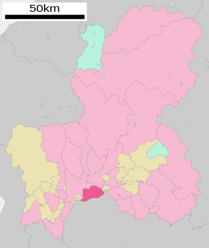
| Location of Kakamigaharas in Gifu Prefecture | ||
Kakamigahara ( Japanese 各 務 原 市 , -shi ) is a city in the Japanese prefecture of Gifu .
history
The city was founded on April 1, 1963 through the merger of the four communities Naka, Inaha, Unuma and Sohara to form the new city of Kakamigahara.
geography
Kakamigahara is east of Gifu and north of Nagoya .
The Kiso River flows through the city from southeast to southwest.
traffic
- Street:
- Tōkai-Hokuriku Highway : to Ichinomiya and Oyabe
- National road 21: to Mizunami and Maibara
- Train:
- JR Takayama Main Line : to Gifu and Toyama
Facilities
Gifu Air Base, a military airfield of the Japanese Air Self-Defense Forces , which opened in 1917, is located in Kakamigahara . It was used by the Americans from 1945 to 1958. To the north of the airfield is an aircraft factory owned by Kawasaki Heavy Industries , to the south of which is the Kakamigahara Aviation Museum.
sons and daughters of the town
- Mutō Kabun (1926–2009), politician
Town twinning
Neighboring cities and communities
- Gifu Prefecture
- Aichi prefecture
Web links
Commons : Kakamigahara - collection of images, videos and audio files


