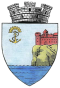
Hârșova
|
Hârșova Hırsova Harsovo / Хърсово |
||||
|
||||
| Basic data | ||||
|---|---|---|---|---|
| State : |
|
|||
| Historical region : | Dobruja | |||
| Circle : | Constanța | |||
| Coordinates : | 44 ° 41 ' N , 27 ° 57' E | |||
| Time zone : | EET ( UTC +2) | |||
| Height : | 20 m | |||
| Area : | 109.02 km² | |||
| Residents : | 9,642 (October 20, 2011) | |||
| Population density : | 88 inhabitants per km² | |||
| Postal code : | 905400 | |||
| Telephone code : | (+40) 02 41 | |||
| License plate : | CT | |||
| Structure and administration (as of 2016) | ||||
| Community type : | city | |||
| Structure : | 1 District / cadastral municipality: Vadu Oii | |||
| Mayor : | Viorel Ionescu ( ALDE ) | |||
| Postal address : | Str. 1 Decembrie 1918, no. 1 loc. Hârșova, jud. Constanța, RO-905400 |
|||
| Website : | ||||
Hârșova ( Bulgarian Хърсово / Harsowo , Russian Гирсово / Girsowo , Turkish Hırsova ) is a town in Constanța County in Romania .
location
Hârșova is located in the west of the Dobrudscha ( Dobrogea ) on the right bank of the Danube, which flows northwest here . The district capital Constanța is located about 80 kilometers southeast of Hârșova.
history
The place has probably been inhabited continuously since the Neolithic . Archaeological finds also date from the Iron and Bronze Ages . In the last century BC Greeks settled in the region. In the 1st century AD the Romans conquered the area. Because of its strategically important location on a Danube crossing, they built Carsium Castle on a hill above the river . After the division of the Roman Empire in 395, Carsium became part of the Eastern Roman Empire . In the 7th century the Bulgarians invaded ; 300 years later the Byzantines returned and restored the fortifications on the Danube, including Carsium. In the 11th century they lost the Dobruja again to the Bulgarians before the region was incorporated into the Ottoman Empire in 1410 .
The Turks took over the fortifications and expanded them. As a result, the city experienced an upswing. After the Russo-Ottoman War (1828–1829) , the Russians destroyed the fortress and large parts of the city. Hârșova lost its importance and came to Romania as a result of the Berlin Congress in 1878. After the Second World War, the settlement of industrial companies began on a modest scale. In the last years of communist rule, some of the old monuments fell into disrepair or were destroyed.
The origin of the current name of the city is unclear. The suffix is of Slavic origin. The root word could be a rudiment of the ancient name Carsium; Turkish origins are also discussed.
The most important branches of the economy are agriculture, food processing and tourism.
population
In 1930 about 600 of the 3500 inhabitants were Turks , the rest of the Romanians . Since the end of the Second World War, the population has increased from 3726 in 1948 to 10,394 in 1992. In 2002, 10,097 people lived in Hârșova, including 8987 Romanians, 983 Turks, 76 Roma , 31 Russians or Lipovans and 12 Hungarians . 9674 lived in the actual city, 423 in the incorporated village of Vadu Oii .
traffic
Hârșova has no rail connection. The European route 60 runs through the city and runs over the Danube bridge at Vadu Oii, which was built between 1966 and 1970. There are bus connections to Constanța.
The city is on the Danube Cycle Path , an international long-distance cycle route .
Attractions
- Thermal springs
- Remains of the Roman castle and the Ottoman fortress
- archaeological sites from Roman, Byzantine and Turkish times
sons and daughters of the town
- Vasilică Cristocea (* 1980), Romanian football player
Web links
- Hârșova at ghidulprimariilor.ro
- Drawings of the fortress from 1826, a few years before the destruction (PDF; 2.0 MB)
Individual evidence
- ↑ 2011 census in Romania at citypopulation.de
- ^ RT Claridge: A guide along the Danube. Westley FC, London, 1837, p. 72
- ↑ 2002 census, accessed January 22, 2008


