Hahnenbach (Nahe)
| Hahnenbach | ||
|
Hahnenbachtal |
||
| Data | ||
| Water code | EN : 2542 | |
| location | Hunsrück , Rhineland-Palatinate | |
| River system | Rhine | |
| Drain over | Nahe → Rhine → North Sea | |
| origin | Confluence of Idarbach and Kyrbach bei Hausen 49 ° 52 ′ 23 ″ N , 7 ° 23 ′ 0 ″ E |
|
| Source height | approx. 294 m above sea level NHN | |
| muzzle | In Kirn in the Nahe coordinates: 49 ° 47 '4 " N , 7 ° 27' 43" E 49 ° 47 '4 " N , 7 ° 27' 43" E |
|
| Mouth height | approx. 190 m above sea level NHN | |
| Height difference | approx. 104 m | |
| Bottom slope | approx. 2.7 ‰ | |
| length | 38 km (with Idarbach ) | |
| Catchment area | 267.878 km² | |
| Medium-sized cities | Kirn | |
|
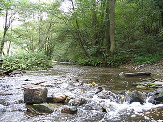
Hahnenbach near the ruins of the Götzenau grinding mill |
||
|
Driving in the 1970s |
||
The Hahnenbach is an almost 20 km long left or northern tributary of the Nahe in Rhineland-Palatinate , Germany . The water body 2542 ( Idarbach and Hahnenbach ) has a length of almost 38 km. Together with the 23 km long Kyrbach (its left, northern and longest source river), the Hahnenbach is 43 km long.
course
The Hahnenbach arises in the district of Birkenfeld bei Hausen , which is located in the Hunsrück between the Idarwald in the west and the Lützelsoon in the east, through the confluence of the Kyrbach , which rises at Kappel at a height of about 500 m. B. Kehrbach) changes, and the Idarbach .
In the upper section between Hausen and Rudolfshaus the Hahnenbach flows through a deeply cut, very scenic valley that can only be reached on foot. Several disused slate pits are located in this section of the valley as well as the Hellkirch or the Blickersau desert . The ruins of Schmidtburg , formerly the largest castle complex in the Rhineland, rise above a bend in the river . Directly opposite it is the reconstructed Celtic settlement of Altburg on the other side of the brook .
In the lower section between Rudolfshaus and Kirn , the Hunsrück Slate and Castle Road runs parallel to the Hahnenbach, which flows through the villages of Hahnenbach and Kallenfels one after the other . The mouth of the Hahnenbach is in the center of Kirn.
Navigability
The course of the river Kyrbach – Hahnenbach is a well-known kayak water. Its upper course to Hausen does not present any particular difficulties. Between Hausen and Kirn there is challenging white water with WW III- . The Kyrburg cataract can be found at the entrance to Kirn . The Kyrbach – Hahnenbach is best navigable in winter and after heavy rainfall.
Flora and fauna
The Hahnenbach flows through extensively used valley meadows, on the bank there are mainly willows and alders that are hardly used economically today. In the Schmidtburg area, the valley becomes narrower, with oak and hornbeam- wooded slopes directly adjacent to the stream. Gray herons and mallards are the most common water birds in the Bachtal. Even kingfishers are often spotted on the river bank.
Touristic
There are numerous tourist offers between Hausen and Kirn. From Bundenbach , Rudolfshaus or Schneppenbach , the Schmidtburg , the visitor mine, the Altburg and the Hahnenbachtal water adventure trail can be reached quickly on foot or by mountain bike. On the eastern heights, the Lützelsoon cycle path runs parallel to the stream. Since 2010, a section of the Soonwaldsteig premium hiking trail has also led through the Hahnenbachtal.
Individual evidence
- ↑ a b Topographic map 1: 25,000
- ↑ a b GeoExplorer of the Rhineland-Palatinate Water Management Authority ( information )
literature
- Uwe Anhäuser: The legendary Hunsrück. Rhein-Mosel-Verlag, Alf / Mosel 1995, ISBN 3-929745-23-2 .
- Uwe Anhäuser: Schinderhannes and his gang. Rhein-Mosel-Verlag, Alf / Mosel 2003, ISBN 3-89801-014-7 .


