Hart (Odenwald)
| Hard
Hard, Hardt
|
||
|---|---|---|
|
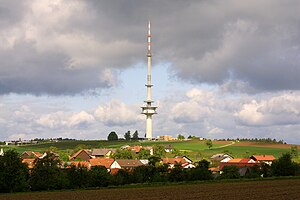
View from the neighboring Reisenberg westwards over Reisenbach to the Hart with the telecommunications tower |
||
| height | 580.8 m above sea level NHN | |
| location | at Reisenbach ; Neckar-Odenwald district , Odenwald district ; Baden-Württemberg , Hessen ( Germany ) | |
| Mountains | Odenwald | |
| Dominance | 3.3 km → Markgrafenwald | |
| Notch height | 73 m ↓ Bergsattel with the Neckarweg east of the L 524 between Elzbach and Reisenbach near Unterscheidental | |
| Coordinates | 49 ° 30 '23 " N , 9 ° 6' 50" E | |
|
|
||
| particularities | Telecommunication tower Reisenbach | |
The Hart , also called the Hard and Hardt , in the Odenwald is 580.8 m above sea level. NHN high mountain in the district of Reisenbach in the municipality of Mudau in the Neckar-Odenwald district in Baden-Württemberg ; its northern flank lies in the Hessian Odenwaldkreis , reaching up to the high elevations . It is one of the highest mountains in the Odenwald and after the Katzenbuckel and the Markgrafenwald the third highest mountain in the Neckar-Odenwald district. As the only one of the ten highest Odenwald peaks, it is predominantly unforested, but is used for agriculture. The Reisenbach telecommunications tower is on the mountain .
geography
location
The Hart rises with a peak in the Neckartal-Odenwald Nature Park , and its northern flank extends up to the high elevations in the Bergstrasse-Odenwald Nature Park . Its summit is 530 m south-southeast of the Hessian border, 800 m east-south-east of the Mudau district of Reisenbach (Baden-Württemberg) and 4.2 km south-east of the Oberzenter district of Kailbach (Hesse).
A ridge stretches from the Hart summit to the Köpfchen ( 571 m ) located about 1000 m to the west and to the Salzlackenkopf ( 576 m ) located about 1.6 km to the northwest , two side peaks of the Hart. To the south the landscape leads to Hartsporn Scheidberg 850 m away (approx. 560 m ). To the east, beyond Reisenbach, the Reisenberg rises 1.4 km away ( 567.8 m ).
On the steeply sloping and wooded north slope of the Hart rises, beyond the state border, the southern source stream of the Galmbach , which joins the main source stream coming from the east near the forester's house Eduardsthal . A nameless, northeastern tributary of the Reisenbach flowing south of the mountain rises on the southeast flank .
Natural allocation
The Hart lies in the natural spatial main unit group Odenwald, Spessart and Südrhön (No. 14) and in the main unit Sandstein-Odenwald (144) on the border of the sub-units Central Sandstone Ooden Forest (144.6) - with the natural area Südlicher ertalter Sandstein Ooden Forest (144.60) - in the west and a breath of winter (144.5) in the east.
Protected areas
Except for the bergfußnahe southeast, south and south-west edge of the hard-rich around the spur Scheidberg parts of the protected landscape Reisenbachtal ( CDDA -No 323 791;. 1988 reported; 3.4458 square kilometers large) and the fauna Habitats -region Odenwald Eberbach (FFH no. 6520-341; 33.58 km²). Parts of the southern Odenwald bird sanctuary (VSG no. 6420-450; 89.3981 km²) and, within the framework of the Galmbach, parts of the FFH area Euterbach and Itterbach with side streams (FFH no. 6420-350; 51.42 ha ).
Telecommunication tower Reisenbach
The Reisenbach telecommunications tower has been on the Hart since 1972, about 100 m east-northeast of the mountain summit . The originally 173 m high telecommunication tower is currently 149.65 m high after removing a cylinder attachment. The tower is used for directional radio and the distribution of television and radio programs.
Individual evidence
- ↑ a b Card TK 1: 25,000 . In: Landesgeschichtliches Informationssystem Hessen (LAGIS).
- ↑ Topographic map Mudau-Schlossau (p. 6420), M 1: 25,000, published by the State Office for Geoinformation and Rural Development Baden-Württemberg
- ↑ Hiking map of the Odenwald Nature Park, Bergstrasse and Neckar Valley , with hiking trails of the Odenwald Club, Bl. RV 14, M = 1: 100,000, published by Reise- und Verkehrsverlag Stuttgart (RV; geographical-cartographic institute and map publisher)
-
↑ Josef Schmithüsen : Geographical land survey: The natural space units on sheet 161 Karlsruhe. Bundesanstalt für Landeskunde, Bad Godesberg 1952. → Online map (PDF; 5.1 MB)
The natural area of the southern part of the sandstone forest (144.60) is in the neighboring Otto Klausing: Geographical survey: The natural units on sheet 151 Darmstadt. Bundesanstalt für Landeskunde, Bad Godesberg 1967. → Online map (PDF; 4.3 MB) accidentally marked with the number 144.00 . - ↑ Map services of the Federal Agency for Nature Conservation ( information )

