Heubach (Kinzig)
| Heubach | ||
|
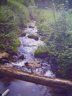
The Heubach roughly in the middle of the valley |
||
| Data | ||
| Water code | DE : 234312 | |
| location | Baden-Wuerttemberg , Germany | |
| River system | Rhine | |
| Drain over | Kinzig → Rhine → North Sea | |
| source | in the Black Forest south of the salt lick 48 ° 20 ′ 46 ″ N , 8 ° 18 ′ 8 ″ E |
|
| Source height | 760 m above sea level NN | |
| muzzle | in Schiltach in the Kinzig coordinates: 48 ° 17 ′ 27 ″ N , 8 ° 19 ′ 50 ″ E 48 ° 17 ′ 27 ″ N , 8 ° 19 ′ 50 ″ E |
|
| Mouth height | 320 m above sea level NN | |
| Height difference | 440 m | |
| Bottom slope | approx. 63 ‰ | |
| length | approx. 7 km | |
The Heubach (near Schiltach) is a small right tributary of the Kinzig , sometimes with a steep gradient . It is located in Baden-Württemberg in the districts of Ortenaukreis and Rottweil . As Heubach (Haibich, popularly called), however, the whole valley is also referred to (Heubachtal). It's about seven kilometers long.
course
The source is 760 m south of the salt lick . The water flows through the Hinter-Heubach, a former scattered woodcutter settlement that belongs to the Schenkenzell district of Kaltbrunn . The brook flows in a southerly direction through the narrow valley past several individual houses, former mills and farmsteads, where it meets the Kinzigtal district on the right , a district of Wolfach , and Schenkenzell on the left. In the front part of the valley, the stream finally comes into the district and town of Schiltach and thus finally to its destination. The confluence with the Kinzig is reached in Schiltach at the train station.
history
Rafting in the Heubachtal
In the days of rafting, the Heubach was an important raft route, even if it is hard to imagine today, given the narrowness and slope of the valley. The water was dammed at the raft pond in the rear Heubach, in order to then find the way down to the Kinzig with the raftsmen. In the most notorious section, the so-called hell , the name corresponded to the danger, many a raftsman was killed. The Black Forest painter Wilhelm Hasemann captured the journey of the raftsmen through hell in pictures.
Mining in the Heubachtal
The St. Anton pit was located in the Heubach Valley . Here were silver and cobalt mined. The miners came from Tyrol . The surname Mantel in the valley comes from these miners. A geoscientific observatory of the Universities of Karlsruhe and Stuttgart has been located in the former pit since 1972 . Changes and deformations of the earth's body are recorded here, e.g. B. earthquake measurements , air pressure fluctuations , broadband variations of the earth's magnetic field .
Hiking trails
A section of the Hansjakobweg I hiking trail leads through the valley .


