Honghuagang
| Hónghuāgǎng Qū 红花岗区 Honghuagang |
||
|---|---|---|
|
|
||
| Coordinates | 27 ° 39 ′ N , 106 ° 54 ′ E | |
| Basic data | ||
| Country | People's Republic of China | |
| Guizhou | ||
| District-free city | Zunyi | |
| ISO 3166-2 | CN-GZ | |
| surface | 476 km² | |
| Residents | 617,100 (2017) | |
| density | 1,296.4 Ew. / km² | |
| Website | www.zyhhg.gov.cn | |
|
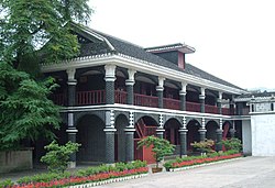
Site of the Zunyi Conference in Honghuagang
|
||
Honghuagang ( Chinese 红花岗区 , Pinyin Hónghuāgǎng Qū ) is a municipality in the prefecture -level city of Zunyi in the Chinese province of Guizhou . It occupies large parts of the urban center of Zunyi, administers a territory of 476.29 square kilometers and had a resident population of 617,100 at the end of 2018.
geography
Honghuagang is located southeast of the Dalou Shan Mountains , its relief slopes from northwest to southeast. The most important river is the Xiang Jiang , which crosses the Honghuagang area for a length of 12.5 kilometers and belongs to the catchment area of the Yangtze River .
Honghuagang's climate is subtropical with an average annual temperature of 15 ° C. Honghuagang receives an annual average rainfall of 1099 millimeters.
population
The 2000 population census showed a total population of 691,694 people in 200,864 households, of which 358,839 men and 332,855 women. The same population census found that 156,838 people under the age of 14, 499,914 people between the ages of 15 and 64, and 34,942 people over the age of 65 lived in Name-de.
At the end of 2012, Honghuagang had a total population of around 510,000 people. In addition to the Han , Honghuagang also had national minorities such as Miao , Gelao and Tujia . Almost 82% of the population are counted among the urban population.
Administrative structure
Honghuagang consists of nine large municipalities and 14 street districts at the municipality level as of 2018 . These are:
- Street district Laocheng (老城 街道), Wanli Lu (万里 路 街道), Zhonghua Lu (中华 路 街道), Yinghong (迎 红 街道), Yan'an Lu (延安 路 街道), Zhoushui Qiao (舟 水 桥 街道), Zhongshan Lu (中 山路 街道), Beijing Lu (北京 路 街道), Changzheng (长征 街道), Liyi (礼仪 街道), Nanguan (南 关 街道), Zhongzhuang (忠 庄 街道), Xinpu (新 蒲 街道), Xinzhong (新 中 街道)
- Large communities Qiangkou (巷口 镇), Hailong (海龙 镇), Shenxi (深 溪镇), Jinding (金鼎 山镇), Xinzhou (新 舟 镇), Xiazi (虾子 镇), Sandu (三 渡镇), Yongle (永乐 镇), Laba (喇叭 镇)
At the village level, the above-mentioned administrative units are made up of 74 communities and 40 villages . The headquarters of the Honghuagang Government are located in the Zhongzhuang Street District.
With a government reform in December 2003, two large parishes and three street districts were separated from the Honghuagang District and placed under the Huichuan District .
Economy and Transport
In Honghuagang there are deposits of manganese , sulfur , iron ore and limestone for the production of cement .
The Lanzhou-Haikou highway , the Hangzhou-Ruili highway , the national roads 210 , 326 and 205 provincial highway running through the territory of Honghuagang. Since the beginning of 2018, Honghuagang has been connected to the high-speed network of the Chinese railway with the high-speed line Chongqing – Guiyang .
Culture
Honghuagang is home to some monuments to the Long March and the Zunyi Conference .
Individual evidence
- ↑ a b c d 红花岗区 概况.遵义 红花岗区 人民政府 主办, January 2, 2019, accessed August 11, 2019 (Chinese).
- ↑ a b c d e f g 红花岗区 概况 地图.行政 区划 网站, February 13, 2015, accessed on August 11, 2019 (Chinese).
- ↑ 贵州 省 乡 、 镇 、 街道 人口. (No longer available online.) State Bureau of Statistics of the People's Republic of China , archived from the original on August 8, 2019 ; accessed on August 11, 2019 (Chinese).
- ↑ a b 红花岗区. State Statistics Office of the People's Republic of China , accessed August 11, 2019 (Chinese).
- ↑ 红花岗区 历史 沿革.行政 区划 网站, February 13, 2015, accessed August 11, 2019 (Chinese).

