International Geography Olympiad
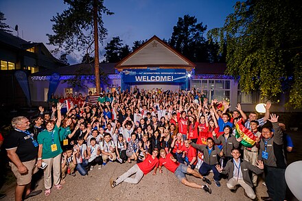
The International Geography Olympiad ( iGeo ) is an international school competition for 16 to 19 year olds. The pupils who represent their respective country in the competition have participated particularly successfully in previous national geography Olympics or comparable qualifications. iGeo tests the skills of the participants in relation to spatial patterns and processes . The test consists of three parts: a written exam, a multimedia test and extensive geographical fieldwork , which requires good observation and comprehension, so that a cartographic representation can emerge from it after a geographical analysis . The program also includes a poster presentation by the individual teams, a cultural exchange and opportunities for the students, their competitors and the host country to get to know and to explore the venue.
The International Geography Olympiad is organized by the International Geographical Union (IGU), which prepares the tasks with reference to the local organizer and the international participants.
history
During the congress of the International Geographical Union (IGU) in Prague in 1994 , the congress participants from Poland and the Netherlands submitted a proposal for an international geographic competition or an International Geography Olympiad for schoolchildren between the ages of 15 and 19. The idea was received with great approval, so that two years later the first International Geography Olympiad was held in The Hague . However, initially only five countries took part in the competition. By 2008 the participation had grown to 24 countries. The most popular iGeo competition to date took place in Beijing in August 2016 with participants from a total of 45 countries. In addition, representatives from Canada and Kyrgyzstan were present as official observers in order to get an idea of the competition and to successfully take part in future international competitions. After the first International Geography Olympiad in 1996, the competition was initially held every two years. However, as it became more and more popular, it was decided, like the other major international science Olympiads, to hold it every year from 2012 onwards.
procedure
The international competition usually lasts four to five days, depending on the program, up to seven days. Each participating country is represented by four students. During the Olympics, Olympians take part in a series of practical and theoretical tests that test their geographic skills. There is also a stimulating program with cultural events and excursions to geographically interesting areas, businesses and cities. The official language of iGeo is English .
Qualification and preparation
The prerequisite for participation is that you are between 16 and 19 years old by June 30 of the year in which the Olympics take place, have attended a technical or general high school or have not yet been enrolled at a college or university. Participating students must be able to complete the assignments written in English. Non-native speakers receive support in the form of dictionaries, translations of selected geographical terms and additional processing time for the longer tests. In order to take part in the International Geography Olympiad, one must first qualify at the national level. This happens differently in every country: In Germany, for example, one must have successfully participated in the Diercke iGeo competition (formerly Janus iGeo Competition Germany ). Here, too, the assignment and processing takes place in English. An extra qualification has been set up for Switzerland . To represent Japan at iGeo, students must achieve a high total score in the national championship competition, with the top four students being selected for participation in the iGeo in the English test section. What they all have in common is that a national competition must first be won and the selection of Olympic participants is made by a national committee and nationally established rules. Often the selected students have to attend a national training camp before the actual Olympics to prepare for the Olympics. Participation in the Olympic competition is limited to two times for each student.
tasks
Students must have cartographic and other geographic skills in order to complete the assignments. Image analysis and the interpretation of diagrams , graphs and statistics are particularly important . The tasks for the written exam and the multimedia test of the competition come from the following categories:
- Climate and climate change
- Environmental disasters and disaster management
- Resources and resource management
- Environmental geography and sustainable development
- Surface forms, landscapes and land use
- Agricultural geography and food issues
- Population and demographic change
- Economic geography and globalization
- Developmental geography and spatial inequality
- Urban geography , urban renewal and urban planning
- Tourism and tourism management
- Cultural geography and regional identities
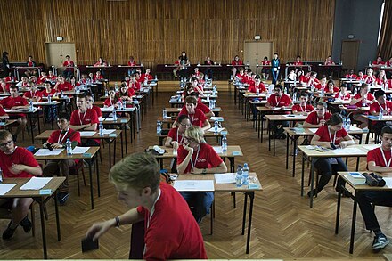
The written test ( English written response test : WRT ) consists of six subjects that are to be processed in 20 to 25 minutes. They deal with geographic and social issues and require up-to-date and applied geographic knowledge. Different materials, such as maps, photos, graphs or statistics, are available for working on each topic or task area. For each subject area there are several different tasks that have to be worked on. The bandwidth of the required answers ranges from bullet points to longer essays. The completion of a matrix or table or the graphical representation of certain facts may also be required. The committee that prepares the test selects the six subject areas from a total of 12 categories. In general, care is taken to ensure that the relationship between physical and human geographic issues is balanced. Participants are expected not only to reflect their theoretical geographical knowledge, but also to apply their knowledge in specific regional contexts and to be able to use their geographical skills.
The multimedia test ( English multimedia quizzes ) consists of 40 parts, on the computer are each depending on the complexity of the available materials in a processing time of one to two minutes to complete. Again, these are questions that are geographically and socially relevant and require up-to-date and applied geographical knowledge and skills. Each task consists of a map and / or a photo, film, visual or satellite image and a short multiple-choice question with four possible answers. In this part of the Olympics, the tasks revolve around topics from all 12 categories. The main aim here is to test basic geographical thinking skills. The multimedia test is therefore not intended to test the candidates' ability to reproduce geographical facts, but to test their skills in geographical analysis in stressful situations. One reason why people move away from geographical knowledge here is that the curricula and educational plans of the participating countries vary greatly.
The geographical fieldwork ( English fieldwork ) consists of three sub-areas:
- Observe and map
- Processing a task in the study area including additional data collection
- Working out a solution to the problem that is visualized using a room plan or map
This part of the International Geography Olympiad is therefore aimed at the practical application of knowledge as well as geographical, precise work in the field and requires teamwork and other social skills. In order to make the requirements for the map to be created and the evaluation criteria transparent, a document with the cartographic guidelines is available.
When completing the tasks, participants are strictly prohibited from using cell phones, tablets or other electronic devices that have not been authorized by the organizer. In addition, it is not allowed to communicate with one another or even to work together during the tests, unless it is expressly permitted, for example when collecting data for field work. Violating the rules leads to the disqualification of the participant.
program
The competition starts after the board meeting of the International Geographical Union with an opening ceremony. The first test, the written response test , takes place on the morning of the following day and takes about three, sometimes four hours. Then there is an excursion on the plan, through which the students should get to know the host region. In the evening the participants get an introduction to field work. However, since the host countries can freely design the additional program and thus the Olympics, there is no general schedule. On the third day of the 13th International Geography Olympiad in China, the first part of the fieldwork was carried out, while in 2014 a one-day excursion day followed the briefing on the fieldwork in Poland . In addition to the tasks of the Olympics and the excursions, various cultural events such as fashion shows or musical performances, sightseeing and a poster presentation by the students are also integrated into the event. These presentations are intended to reflect the theme of the IGU congress. During iGeo 2016, the students were asked to design a poster on the topic of Sustainable Cities , on which they illustrate how a city of their respective home country of their choice deals with ecological, economic and social problems and wants to achieve a sustainable future. The posters are presented during the 90-minute poster presentation. Although it is not part of the Olympic competition and no points are awarded, the team with the best poster will be awarded a prize independently of the Olympics. After the Olympics, the participants will have the opportunity to join a so-called Post-iGeo trip and visit other interesting places in the host country.
Prices
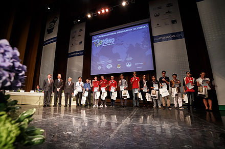
Although the individual participants compete as a team and the performances of the individual nations are evaluated at the end of the Olympics, the focus in the international competition is on the individual students, so that the medals are also awarded to the individual participants by the respective patrons of the Olympics . The final score of a student is calculated from the points achieved in the individual task areas. The written test and the fieldwork each make up 40% of the final result, the multimedia quiz the remaining 20%. The gold, silver and bronze medals are awarded proportionally to the number of participants. In 2014 a total of 12 gold, 24 silver and 36 bronze medals were awarded, while in 2015 the achievements of the students were honored with a total of 13 gold, 27 silver and 40 bronze medals.
aims
The event is not only intended to arouse young people's enthusiasm for the subject of geography and to draw attention to geographic and ecological problems, but at the same time also to improve the quality of geographic education internationally and to increase the social rank and importance of the subject nationally and internationally. The IGU congress, which follows directly on from the International Geography Olympiad, will also bring together research and teaching, as well as science and school, which is hoped to provide a lasting impetus for the further development of schools and teaching. Another goal is to uncover stereotypes through cultural exchange , to refute prejudices and to offer the students another opportunity to network regionally, nationally and internationally.
Venues
The host countries switch from Olympiad to Olympiad.
Previous venues
| No. | year | Host country | city | Number of participating countries |
number of students | Winner (person) | 1st place (country) | 2nd place (country) | 3rd place (country) |
|---|---|---|---|---|---|---|---|---|---|
| 1. | 1996 |
|
The hague | 5 | 20th |
Steven Pattheeuws ( Belgium ) |
|
|
|
| 2. | 1998 |
|
Lisbon | 5 | 20th |
Katarzyna Kwiecińska ( Poland ) |
|
unknown | unknown |
| 3. | 2000 |
|
Seoul | 13 | 52 |
Adam Biliski ( Poland ) |
|
|
|
| 4th | 2002 |
|
Durban | 12 | 48 |
Florin Olteanu ( Romania ) |
|
|
|
| 5. | 2004 |
|
Danzig | 16 | 64 |
Maciej Hermanowicz ( Poland ) |
|
|
unknown |
| 6th | 2006 |
|
Brisbane | 23 | 92 |
Jacek Próchniak ( Poland ) |
|
|
|
| 7th | 2008 |
|
Tunis | 24 | 96 |
Barbu Ion Alexandru ( Romania ) |
|
|
|
| 8th. | 2010 |
|
Taipei | 27 | 108 |
Barbu Ion Alexandru ( Romania ) |
|
|
unknown |
| 9. | 2012 |
|
Cologne | 31 | 124 |
Samuel Chua ( Singapore ) |
|
|
|
| 10. | 2013 |
|
Kyoto | 32 | 128 |
Daniel Wong ( Singapore ) |
|
|
|
| 11. | 2014 |
|
Krakow | 36 | 144 |
James Mullen ( United States ) |
|
|
|
| 12. | 2015 |
|
Tver | 40 | 159 |
Wang Chang-chin ( Chinese Taipei ) |
|
|
|
| 13. | 2016 |
|
Beijing | 45 | 173 |
Wuttipat Kiratipaisarl ( Thailand ) |
|
|
|
| 14th | 2017 |
|
Belgrade | 41 | 160 |
Victor Vescu ( Romania ) |
|
|
|
| 15th | 2018 |
|
Quebec | 43 | 165 |
Alen Kospanov ( Russia ) |
|
|
|
| 16. | 2019 |
|
Hong Kong | 43 | 166 |
Albert Zhang ( United States ) |
|
|
|
| 17th | 2020 |
|
Istanbul | - | - | - (-) | - | - | - |
Future venues
18 2021 in Bandung ( Indonesia )
![]()
Selection, qualification and participation of German participants
Schoolchildren from Germany have been taking part in the iGeo since 2006 and have been able to successfully place themselves several times. The national selection competition takes place every two years at secondary schools in Germany, at which time the participants attend grades 10 to 13 and are between 16 and 19 years old. In its current form, the Diercke iGeo competition is designed as a bilingual exam competition , which is designed for the upper level and takes place in several rounds. Tasks, material and cards are in English and must be answered in English. A knowledge test must also be taken. The state competition takes place at grammar schools, comprehensive schools and community schools with upper level and is initially looking for a school winner. This is reported to a state commissioner, who chooses a state winner from all submissions from his state. For the two-day national competition, all winners from the federal states are expected and a four-person national team is determined. In addition to exams, a multimedia test must be completed and an excursion must also be carried out. The previous international participations of the German team led to three gold, seven silver and seven bronze medals since 2006. The Association of German School Geographers ( VDSG ) organizes the competition together with the Westermann Group .
Web links
-
iGeo homepage
- iGeo 2017
-
Previous Olympiads
- Written exam 2012 (including materials , evaluation scheme )
- Multimedia test 2012 (including solutions )
- Worksheet 1 field work 2016 (including completed tasks )
- Worksheet 2 fieldwork 2016 (including materials )
- IGeo 2014 program
- Film contribution iGeo 2012
- Film contribution iGeo 2015 (compilation)
- Test of the Swiss qualification in 2015
Individual evidence
- ↑ a b Official iGeo homepage
- ↑ What is iGeo
- ↑ Geolymp Switzerland
- ↑ a b c d e handout - iGeo 2016
- ^ Association of German School Geographers eV
- ↑ Article by the Federal Office of Administration about Diercke Wissen ( Memento of the original from August 24, 2017 in the Internet Archive ) Info: The archive link was inserted automatically and has not yet been checked. Please check the original and archive link according to the instructions and then remove this notice.
- ↑ a b c Saxony in the Association of German School Geographers eV ( page no longer available , search in web archives ) Info: The link was automatically marked as defective. Please check the link according to the instructions and then remove this notice.
- ↑ Instructions for the preliminary round
- ^ A b Yoshiyasu Ida: Geography Education in Japan. Springer Verlag, Tokyo 2015, ISBN 978-4-431-54952-9 , p. 147.
- ↑ iGeo 2016 China
- ↑ iGeo guidelines
- ↑ Cartographic guidelines for field work
- ^ State of Saxony media service
- ↑ Program iGeo 2014 Krakow
- ↑ a b idw - Science Information Service
- ^ State of Saxony media service
- ↑ Shuying Leng: The Geographical Sciences during 1986-2015. From the Classics to the Frontiers. Springer Verlag, Singapore 2016, ISBN 978-981-10-1883-1 , p. 43.
- ^ State government of North Rhine-Westphalia - press release
- ↑ Past Geography Olympiads
- ↑ Diercke iGeo | Bilingual competition for geography


