Juergensberg
| Juergensberg | ||
|---|---|---|
|
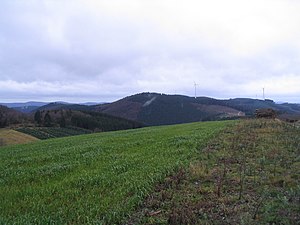
View from the Bracht southwest to the Juergensberg |
||
| height | 619.2 m above sea level NHN | |
| location | at Burbecke ; District of Olpe and Hochsauerlandkreis ; North Rhine-Westphalia ( Germany ) | |
| Mountains | Saalhaus mountains | |
| Dominance | 1.7 km → Hoher Lehnberg | |
| Notch height | 90 m ↓ Wehrscheid | |
| Coordinates | 51 ° 8 '26 " N , 8 ° 7' 59" E | |
|
|
||
The Jürgensberg is 619.2 m above sea level. NHN the highest mountain in the western part of the Saalhauser Mountains . Belonging to the Sauerland , it is located near Burbecke in the Olpe district in North Rhine-Westphalia ; its summit is part of the urban area of Lennestadt (Olpe district).
geography
location
The Jürgensberg rises in the western part of the Saalhauser Berge and belongs to the northwest part of the Sauerland-Rothaargebirge nature park . The summit of the mountain, located in the northeast of the Olpe district in the vicinity of the Hochsauerlandkreis in the areas of Lennestadt and Schmallenberg , is 2.5 km south-south-west of Brenschede (Lennestadt), 3.5 km south-west of Bracht (Schmallenberg), 2.7 km north-north-west of Gleierbrück , 3.1 km north-northeast of Langenei and 1.8 km southeast of Burbecke (all Lennestadt). Hamlets and farms close to the mountain are: Hebbecke (Schmallenberg) in the north-northeast and Stöppel (Lennestadt) in the south-southwest.
The Stuhlmecker Siepen rises on the southern flank of the wooded Jürgensberg , whose water flows into the Lenne through the Gleierbach , which runs southwards and passes the mountain to the east and whose valley leads over to the higher eastern part of the Saalhauser mountains . The Huchslacher Siepen and the Hamecker Siepen (Hameker Siepen) rise on the western flank, each flowing northwestwards, the waters of which head towards the Elspebach through the Burbecke .
The eastern neighboring mountain of the Jürgensberg is the Hohe Lehnberg on the other side of the Gleierbach valley . A trigonometric point ( 618.9 m ) is located a few meters south-southwest of the Jürgensberg summit .
Natural allocation
The Jürgensberg belongs to the natural spatial main unit group Süderbergland (No. 33), in the main unit Südsauerländer Bergland (336 2 ) and in the subunit Südsauerländer Rothaarvorhöhen (336 2 .5) to the natural area Oberlennebergland (336 2 .52).
Protected areas
Located on the southern flank of the mountain Jürgen which was founded in 2005 and 56.13 hectare nature reserve Rümperholz ( CDDA -No. 378273), the east was founded in the 2008 and 12.78 hectare nature reserve Ringesbach- and upper Gleierbachtal (CDDA no. 389875) transforms. Parts of the landscape protection areas Elsper Senke-Lennebergland (type A) (CDDA no. 555555270; designated 2006; 71.9952 km² ) in the south and Rothaargebirge (Hochsauerlandkreis sub-area 1) (CDDA no. 555555133; 1984; 140.3369 km²) in the north.
Hiking and wind power
The Jürgensberg is accessed from the Friedrich-Wilhelm-Grimme-Weg of the Sauerland Mountain Association , which leads past the summit about 180 m to the west. A little southwest of the hilltop, there are four wind turbines on the ridge of the Saalhauser Berge, including on the Hamberg .
Individual evidence
- ↑ a b c Topographical Information Management, Cologne District Government, Department GEObasis NRW ( information )
- ↑ Martin Bürgener: Geographical Land Survey: The natural spatial units on sheet 110 Arnsberg. Federal Institute for Regional Studies, Bad Godesberg 1969. → Online map (PDF; 6.1 MB)
- ↑ Map services of the Federal Agency for Nature Conservation ( information )

