
Kühgundkopf
| Kühgundkopf | ||
|---|---|---|
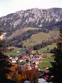
 From Iseler with Tannheimer mountains and Tannheimer valley |
||
| height | 1907 m above sea level NHN | |
| location | Border Bavaria , Germany / Tyrol , Austria | |
| Mountains | Vilsalpseeberge , Allgäu Alps | |
| Dominance | 1.6 km → Bschießer | |
| Notch height | 287 m ↓ notch to the Bschießer | |
| Coordinates | 47 ° 30 '13 " N , 10 ° 25' 53" E | |
|
||
| rock | Main dolomite | |

The Kühgundkopf (in Austrian maps: Wannenjoch ) is a 1907 meter (according to Austrian measurements: 1908 m) high mountain in the Allgäu Alps . The Kühgundspitze (1852 m) is a rock head with a cross in the north-eastern ridge of the mountain that descends into the Tannheimer Tal .
Location and surroundings
It is a local mountain of Oberjoch and, together with the Iseler, forms the northern end of the Rauhhorn train . Both from Oberjoch and from Schattwald lifts pull up against this elongated, slightly rocky ridge in the north. There are ski areas there in winter . The height of the gap on the Kühgundspitze is at least 287 meters, its dominance 1.6 kilometers, with the Bschießer reference mountain in each case .
geology
The Kühgundkopf is a main dolomite summit on a base of Lias spotted marl and Kössen layers (ie alternating fine-leaved marl with dark, dense and well-banked limestone ).
Routes to the summit
- From Oberjoch via the rear Wiedhagalpe (approx. 2.5 hours)
- From Hinterstein (866 m) over the Zipfelsalpe (approx. 3 hours)
- From Schattwald (1072 m) through the Stuibental (approx. 2.5 hours)
- From the Iselerbahn mountain station (Oberjoch) via Iseler and Iselergrat, ridge hike so be careful with children (approx. 1.5 hours)
- From the mountain station of the Wannenjochbahn (Schattwald) (approx. 45 min.)
photos

Kühgundspitze
Oberjoch with Kühgundkopf

Kühgundkopf above the Iselerkar

Kematsried-Moos with Kühgund


literature
- Dieter Seibert: AVF Allgäu Alps . 16th edition. Bergverlag Rudolf Rother, Munich 2004, ISBN 3-7633-1126-2 .
- Thaddäus Steiner : Allgäu mountain names . Kunstverlag Josef Fink, Lindenberg 2007, ISBN 978-3-89870-389-5 .
Web links
References and comments
- ↑ a b Federal Office for Metrology and Surveying Austria: Austrian Map online (Austrian map 1: 50,000) . Retrieved February 26, 2011.
- ↑ Bavarian Surveying Administration : BayernViewer 2.0 ( Memento of the original from December 26, 2015 in the Internet Archive ) Info: The archive link was inserted automatically and has not yet been checked. Please check the original and archive link according to the instructions and then remove this notice. . Retrieved February 26, 2011.
- ^ Thaddäus Steiner: Allgäu mountain names . 2nd Edition. Kunstverlag Josef Fink, Lindenberg 2008, ISBN 978-3-8987-0389-5 (p. 128f).
- ↑ Exact value not known, stated value is a minimum value (can be up to 19 meters higher). It was determined from the distance between the contour lines (20 meters in altitude ) on a topographic map ( scale 1: 25,000).